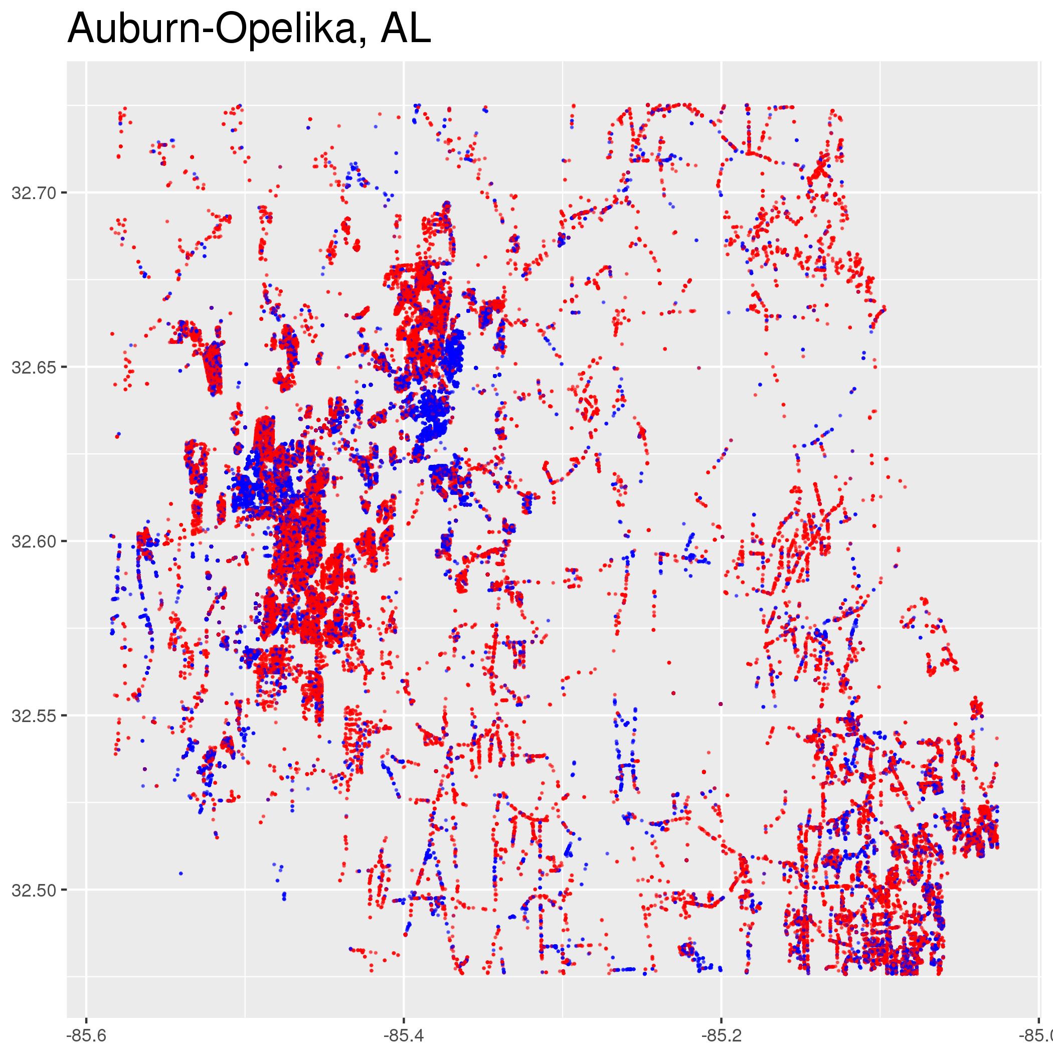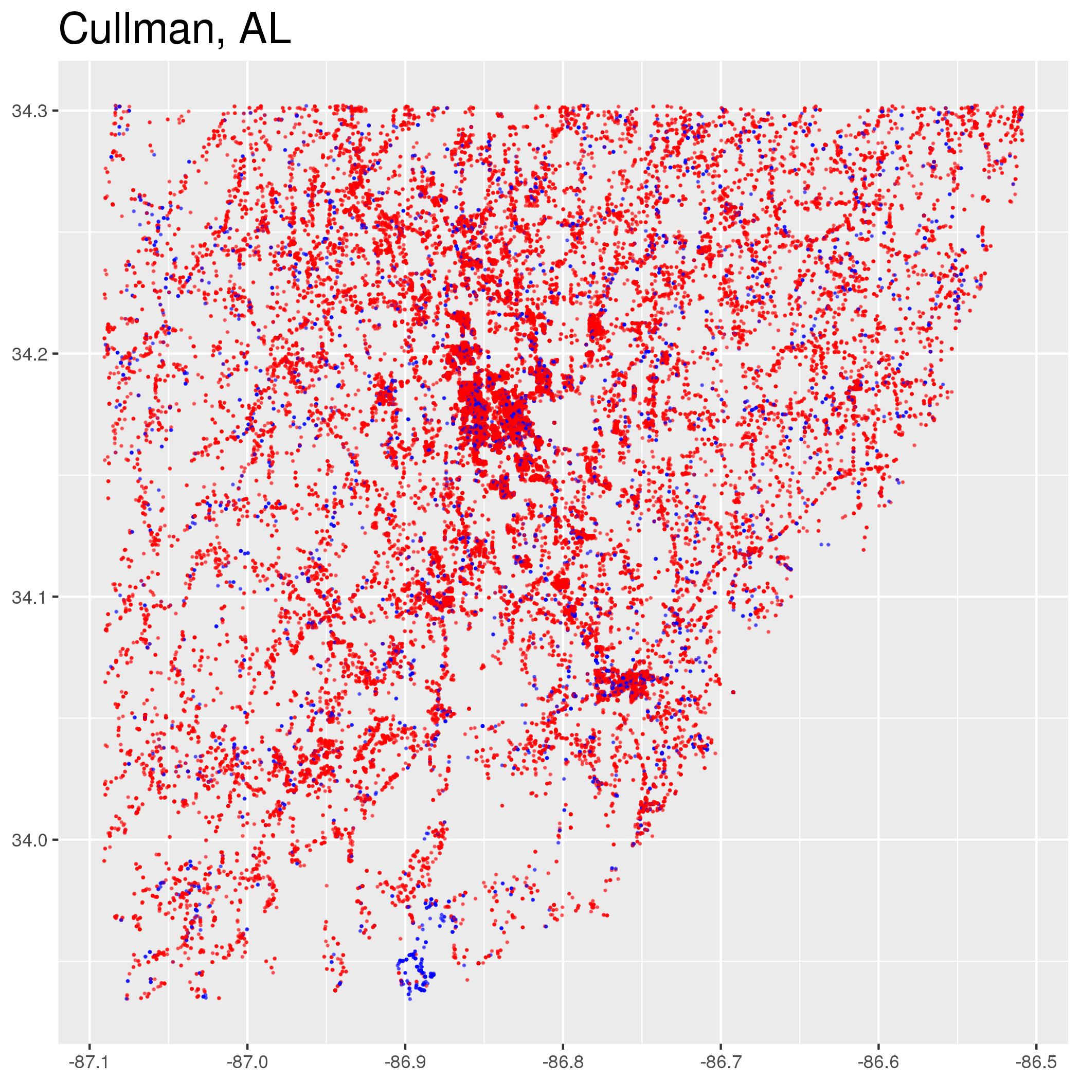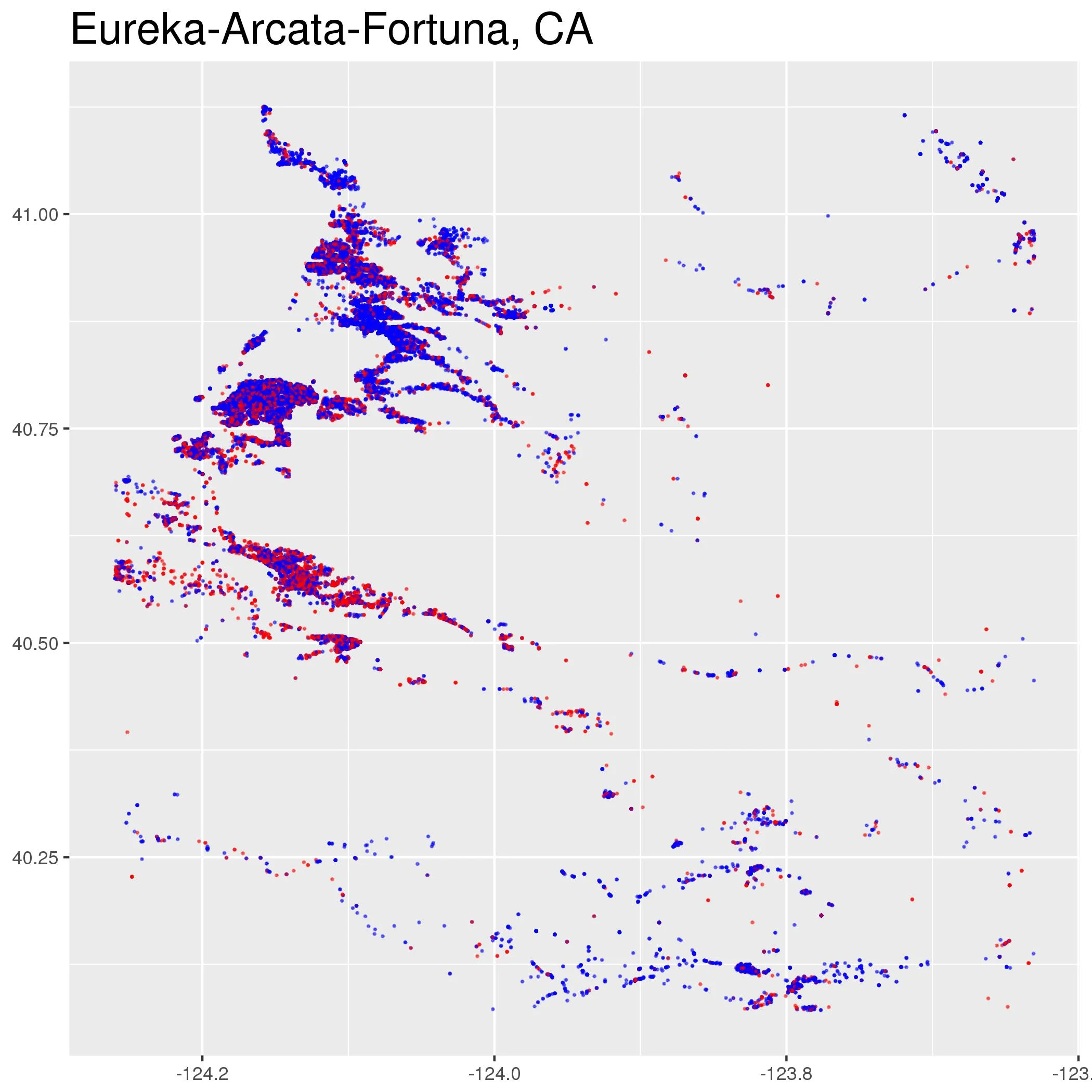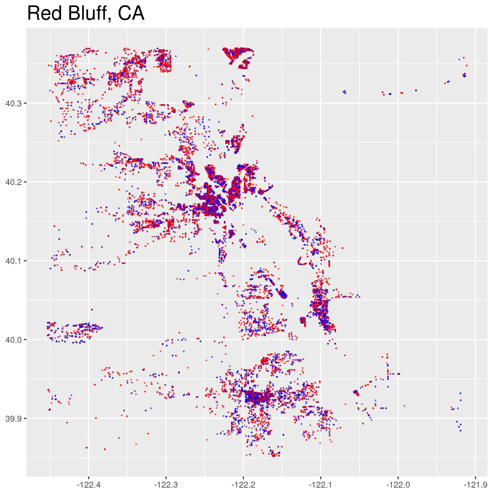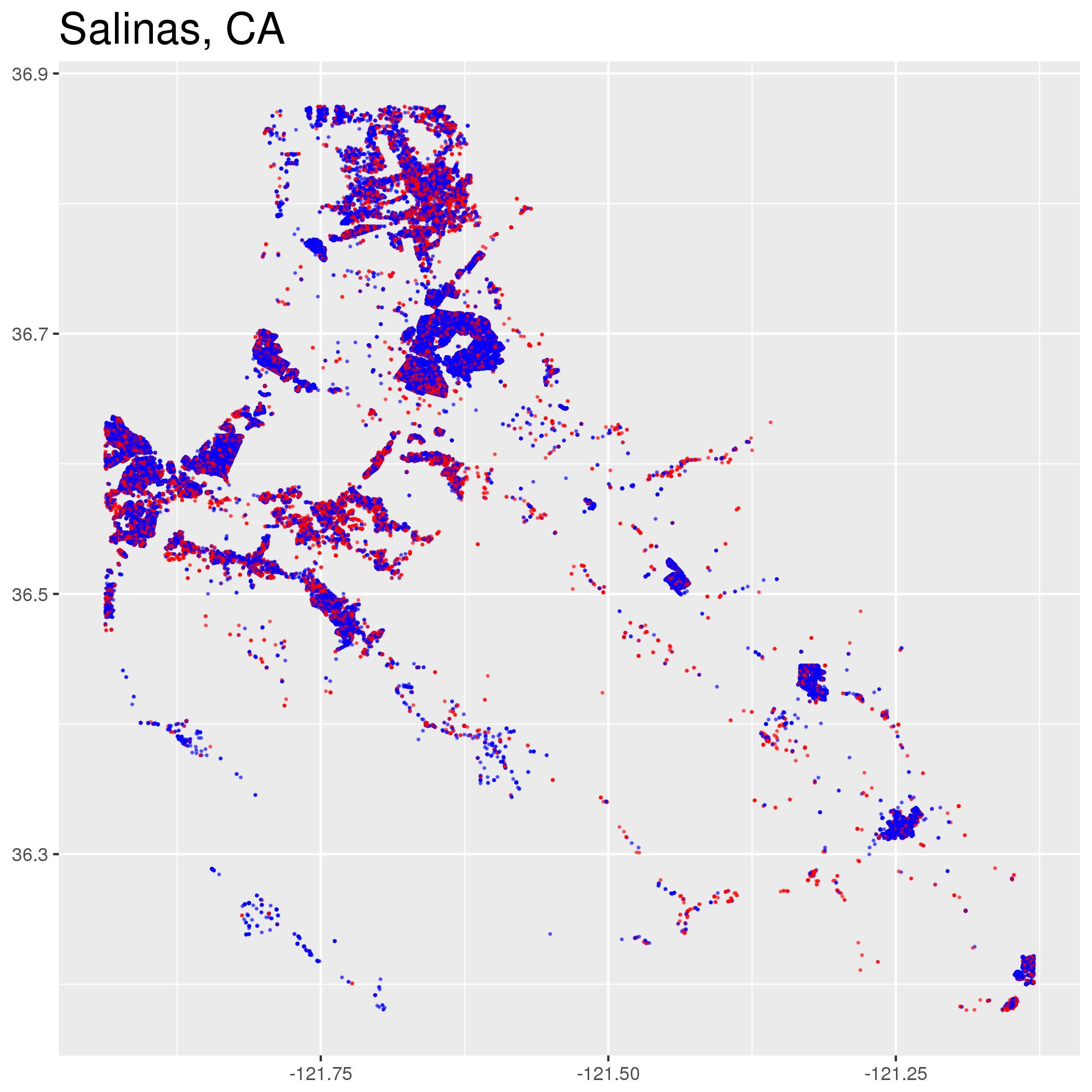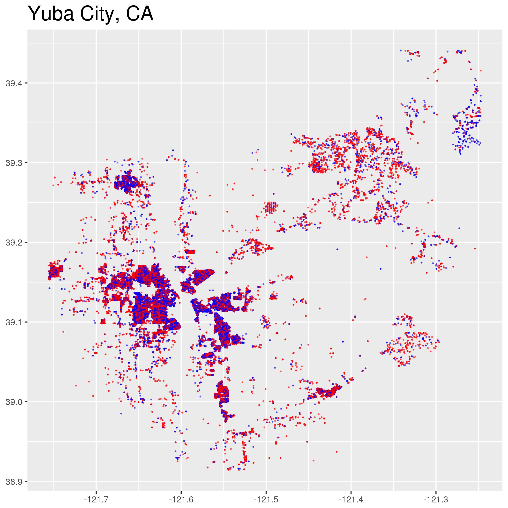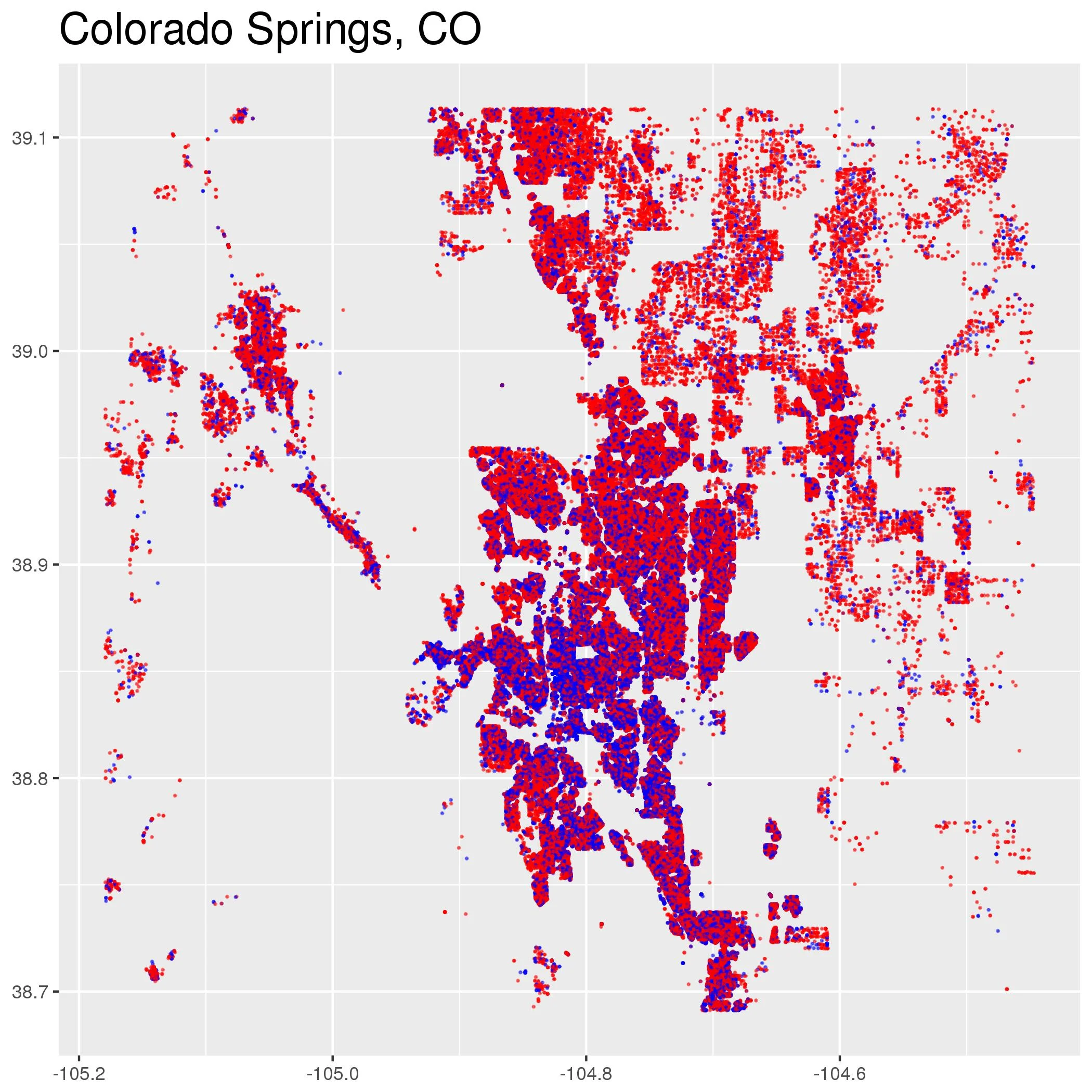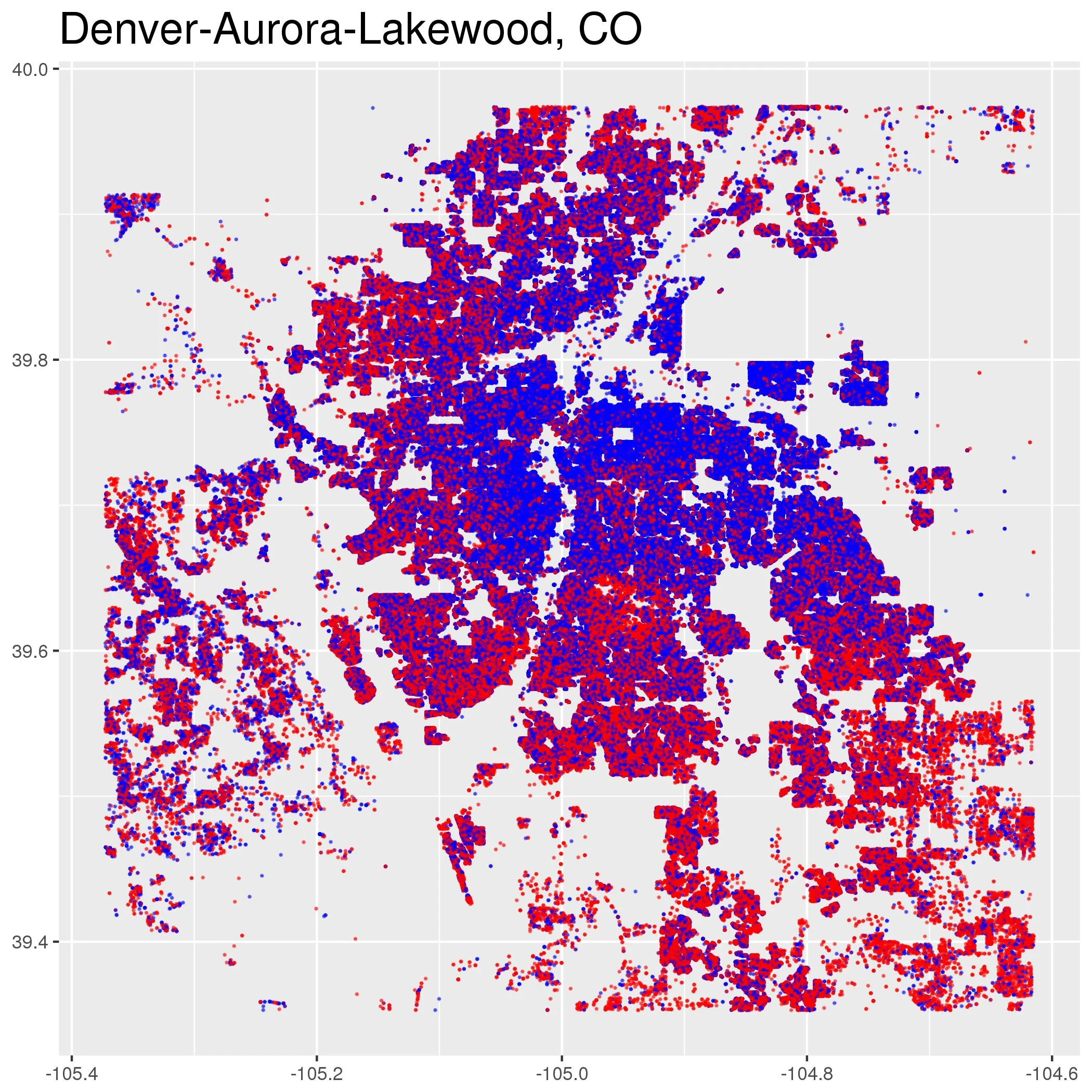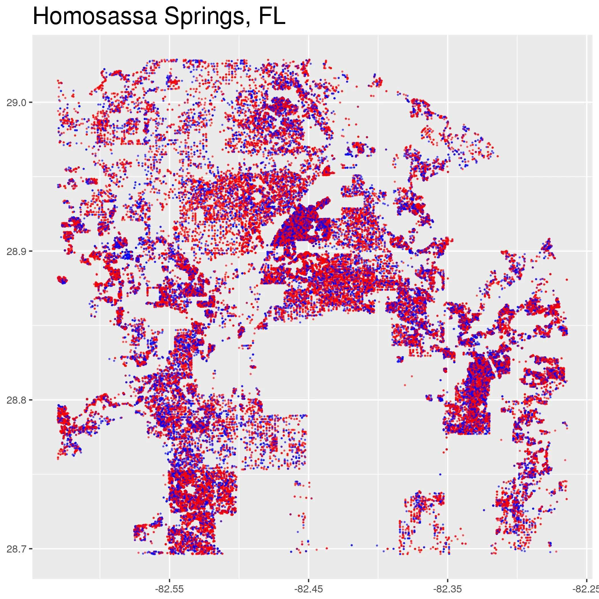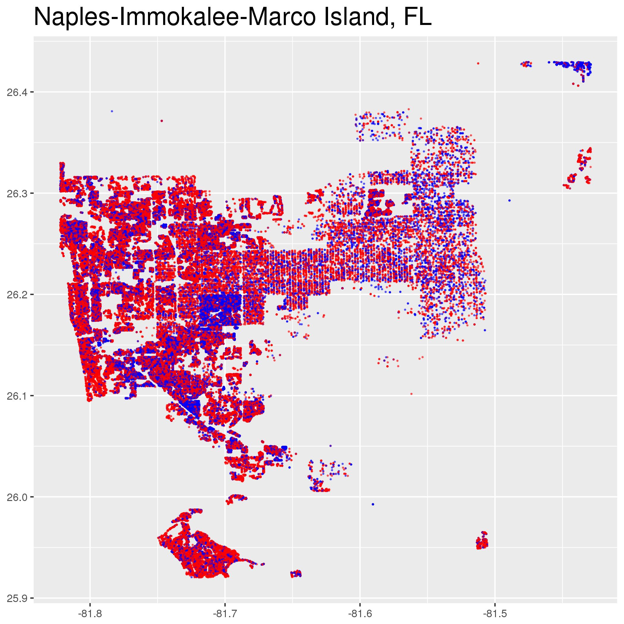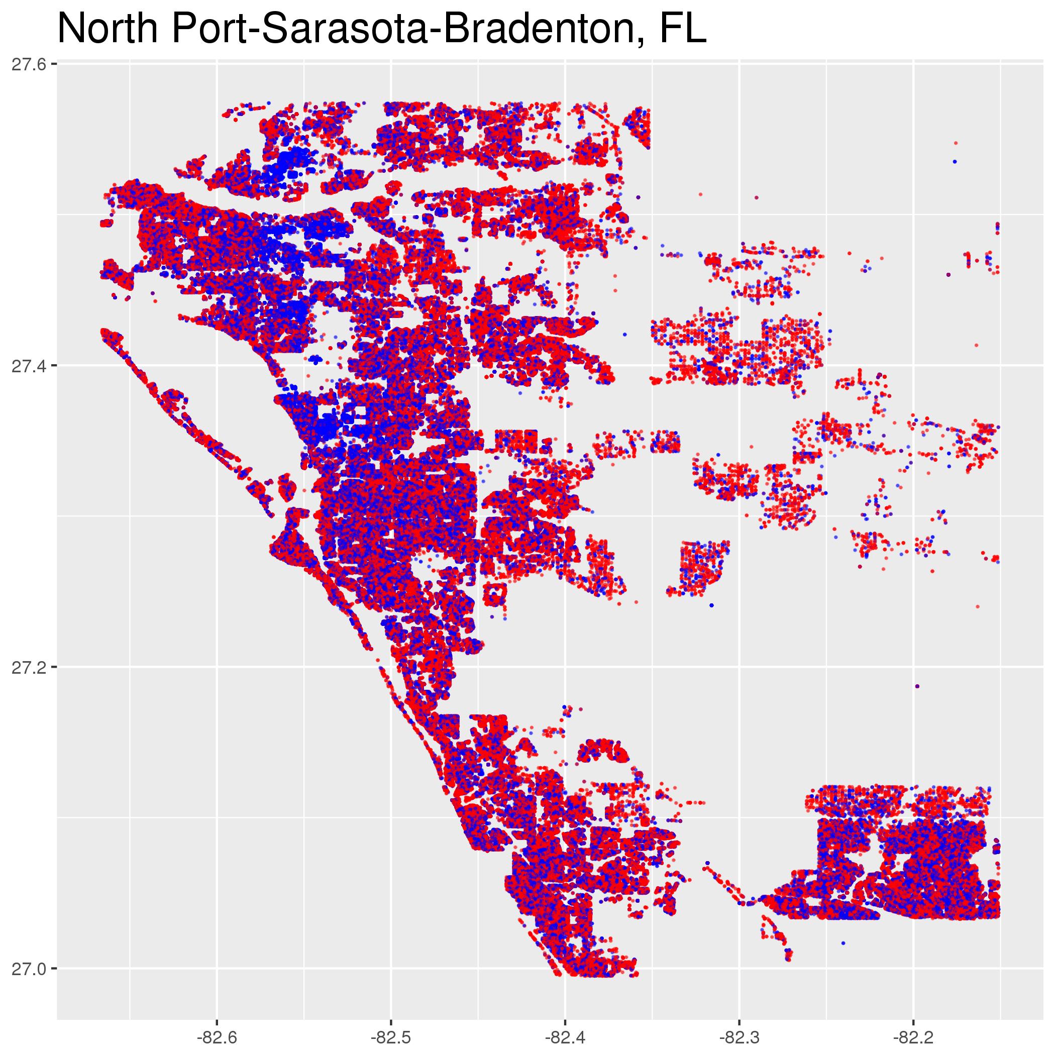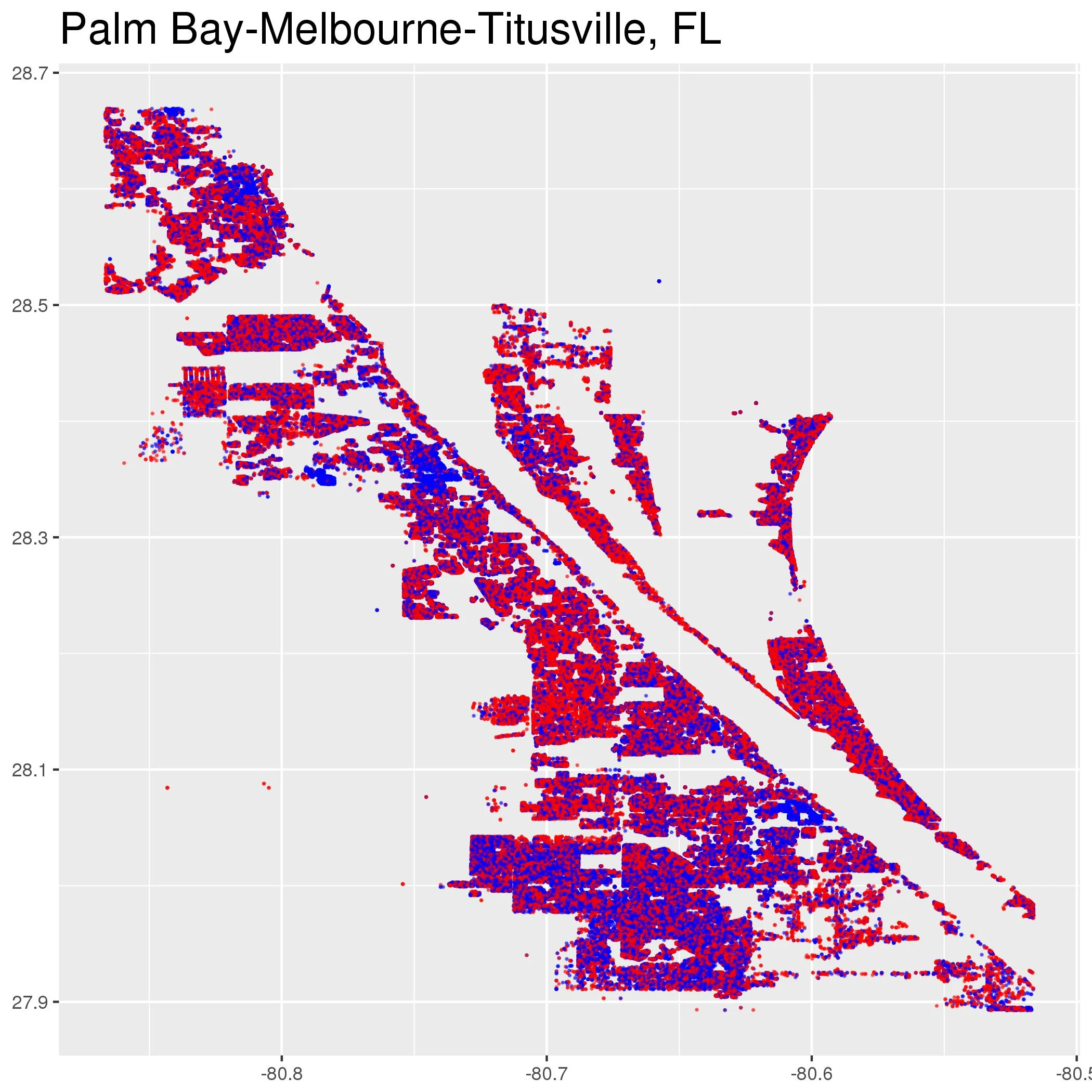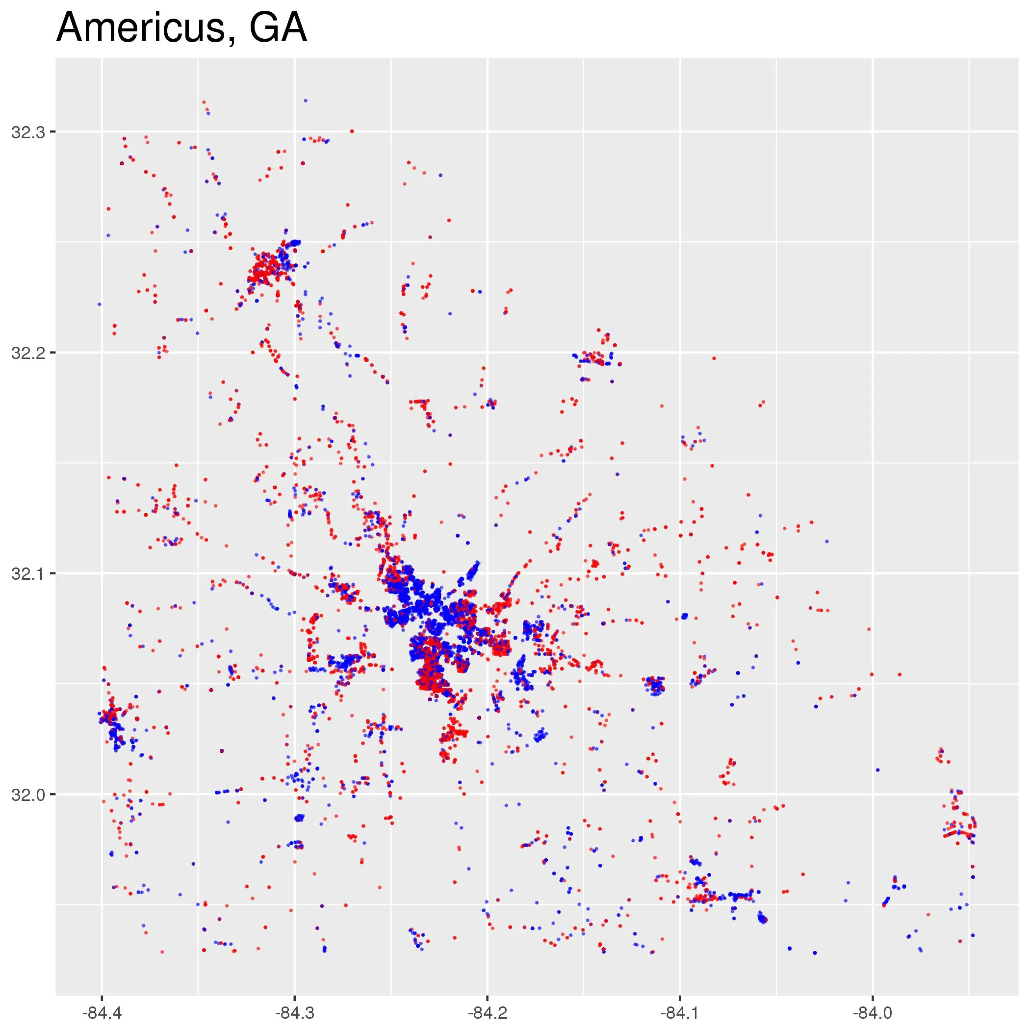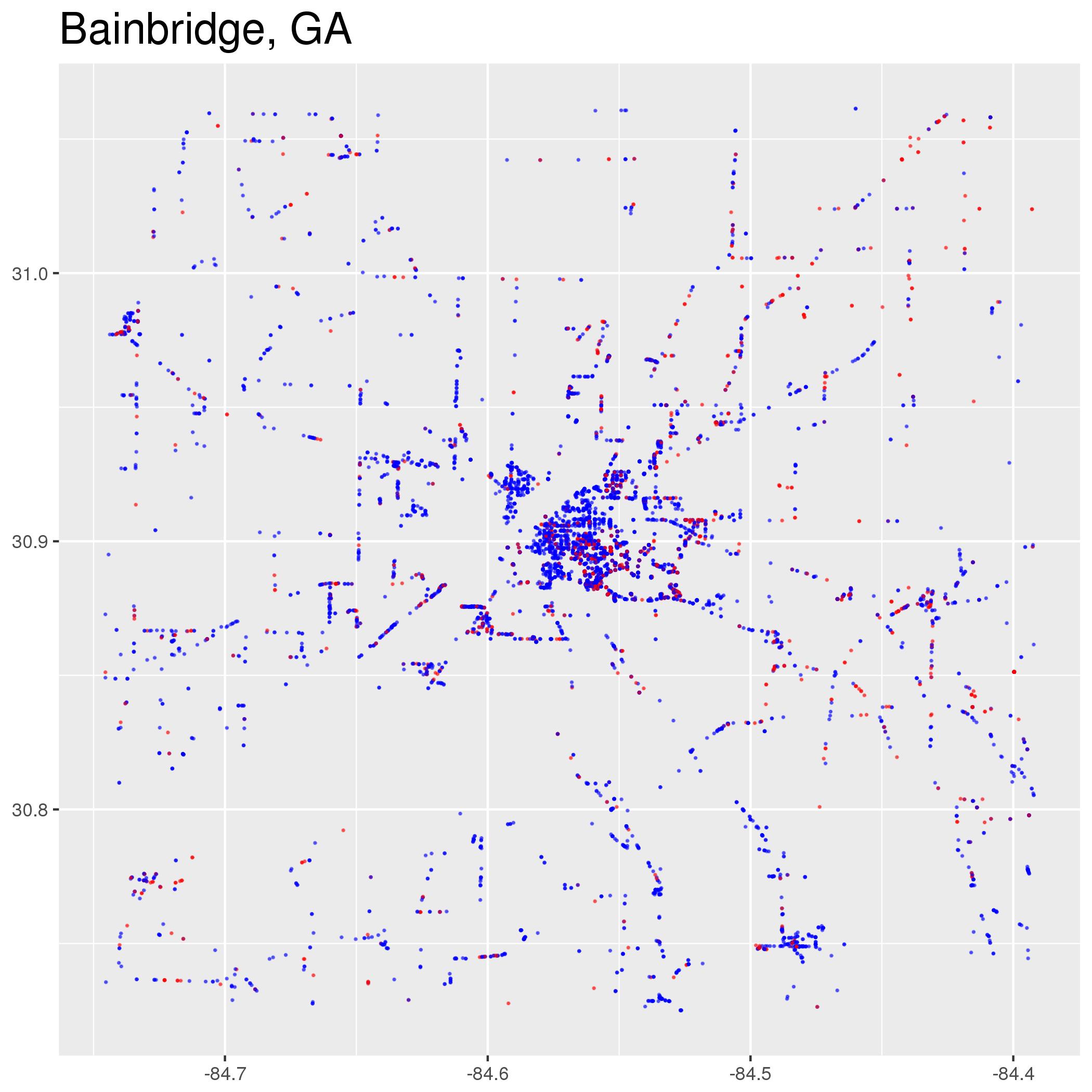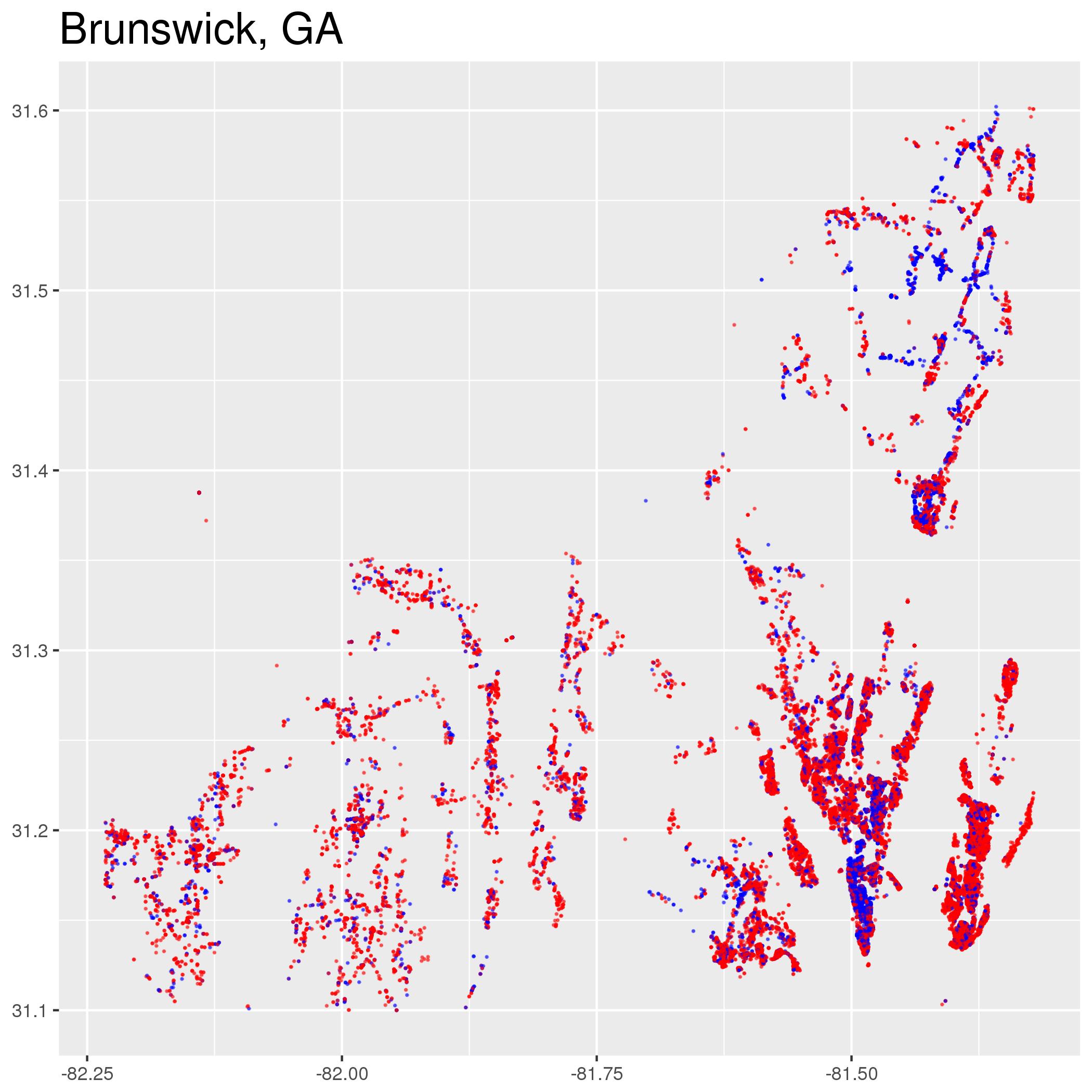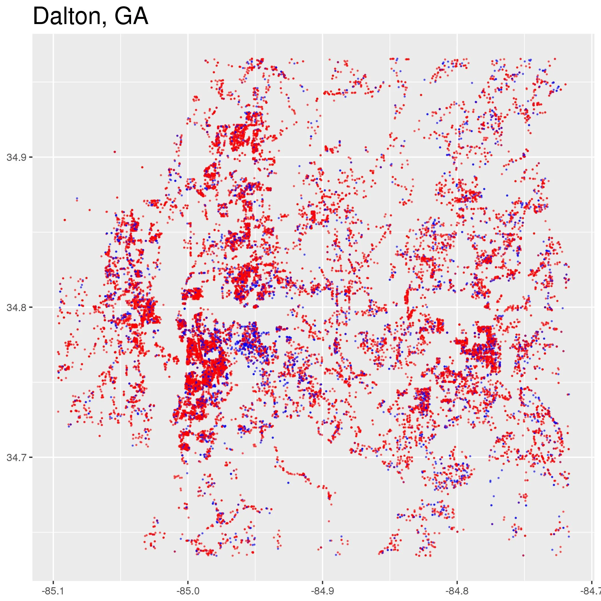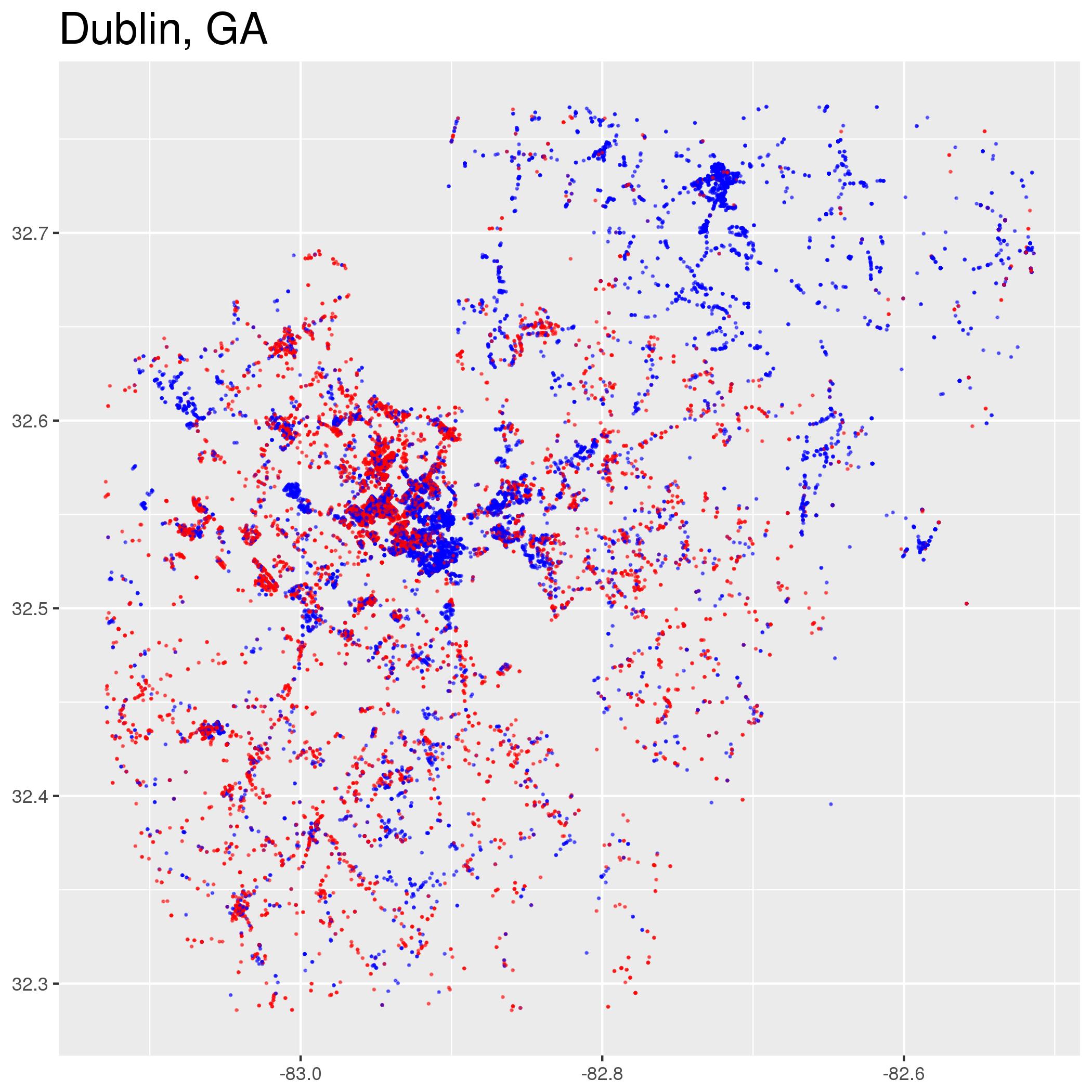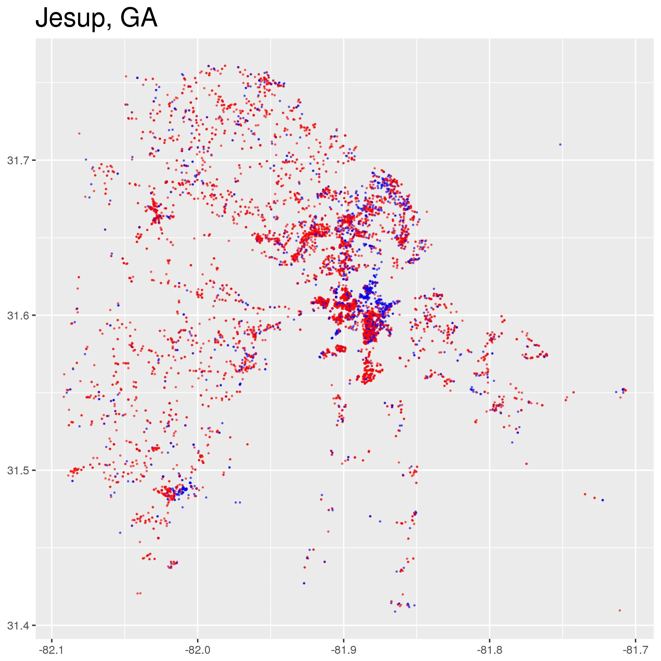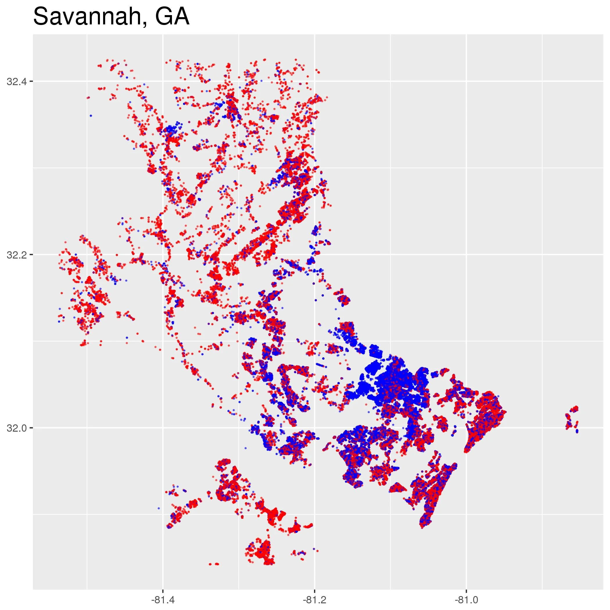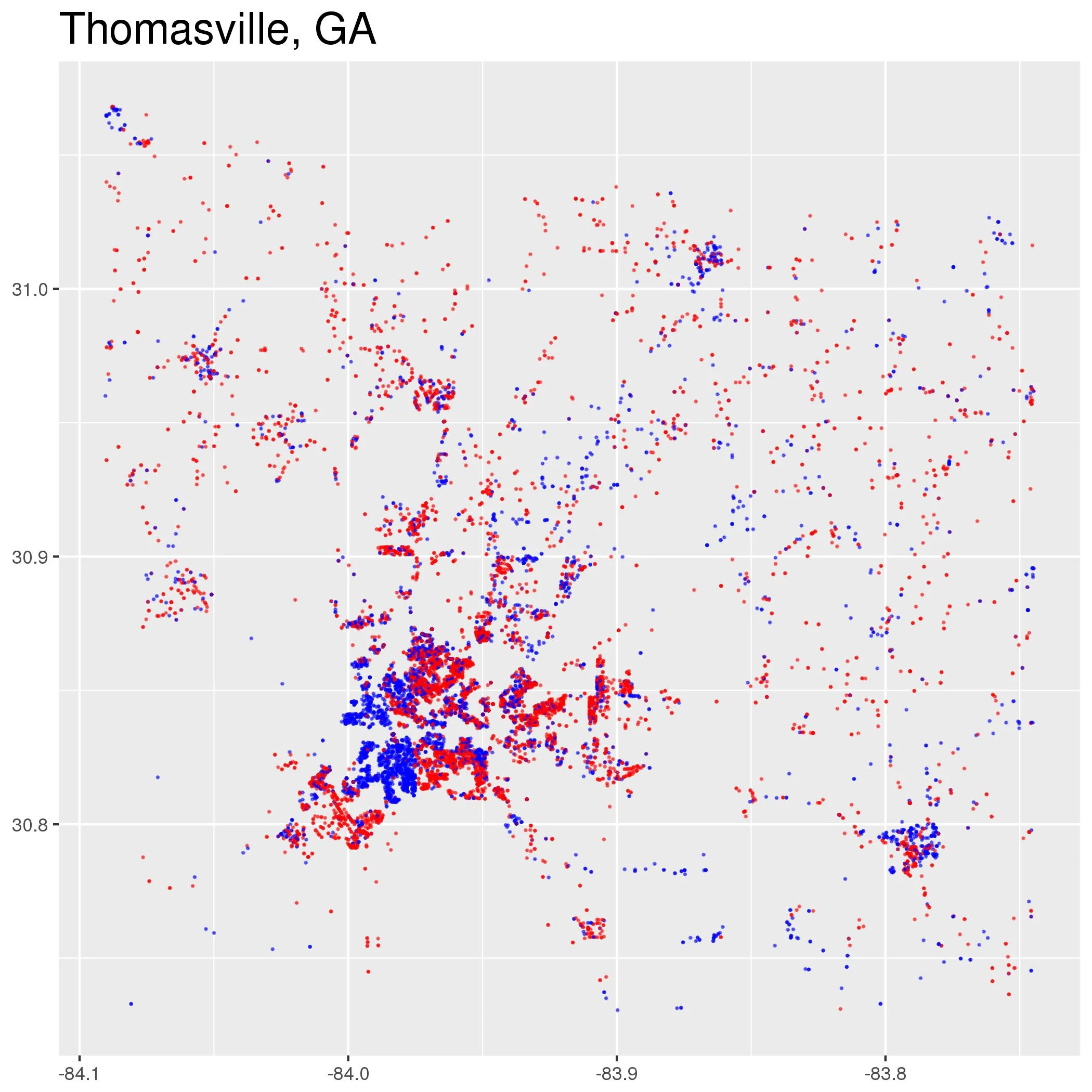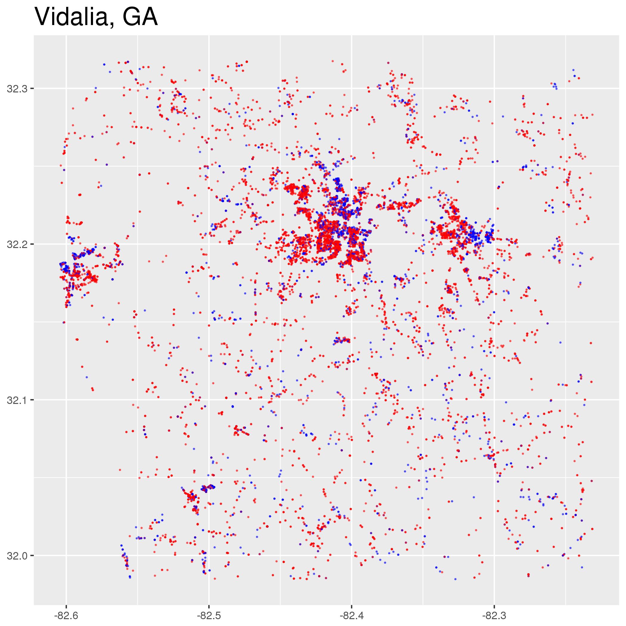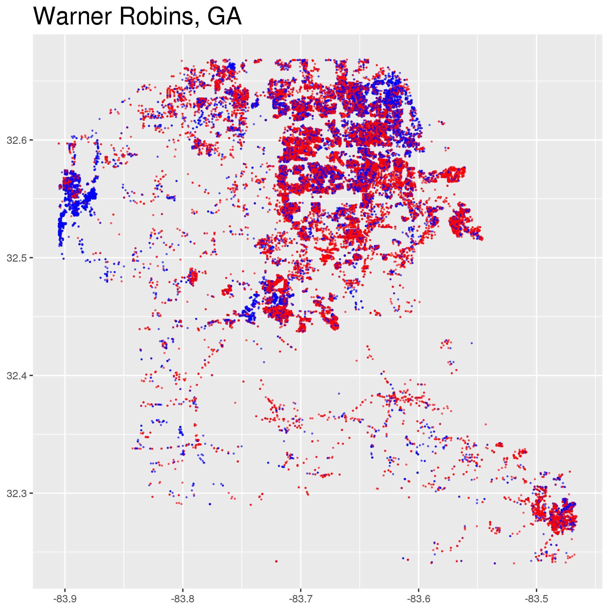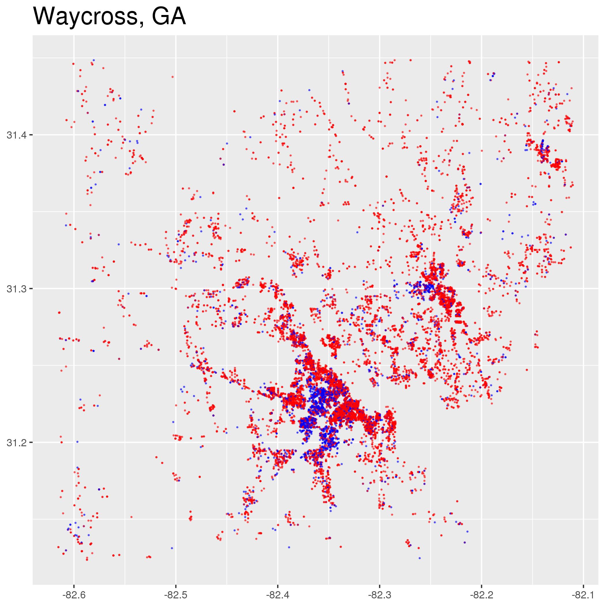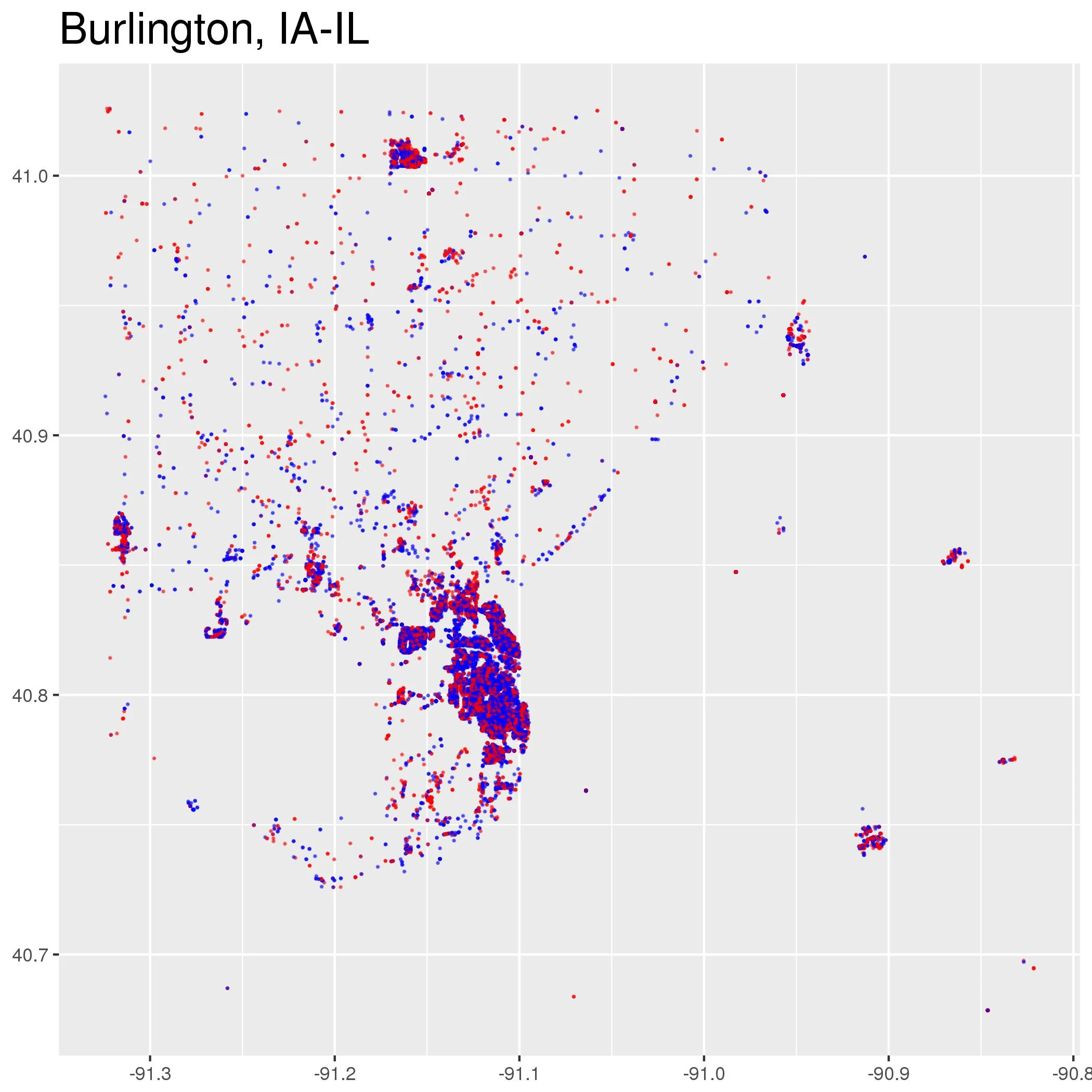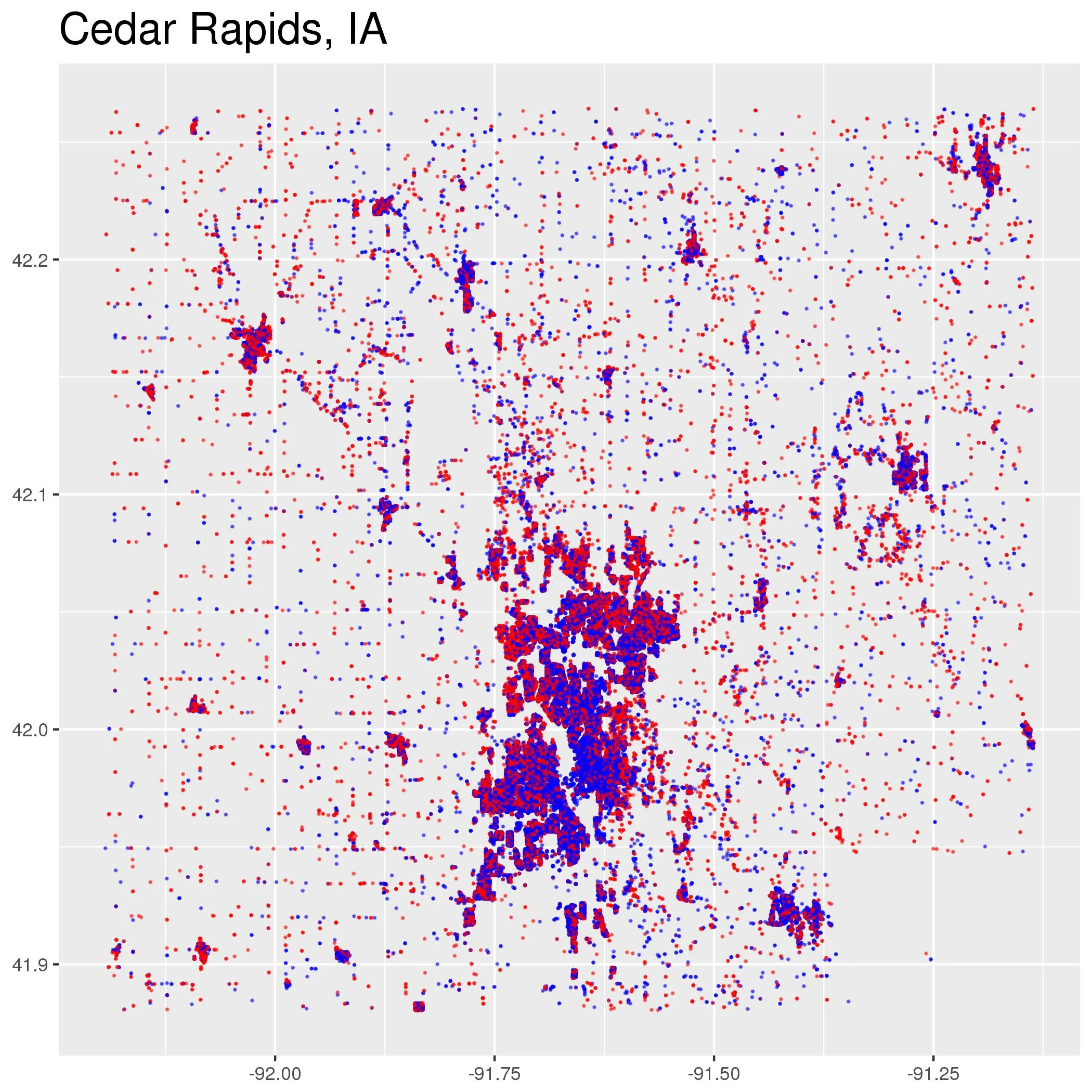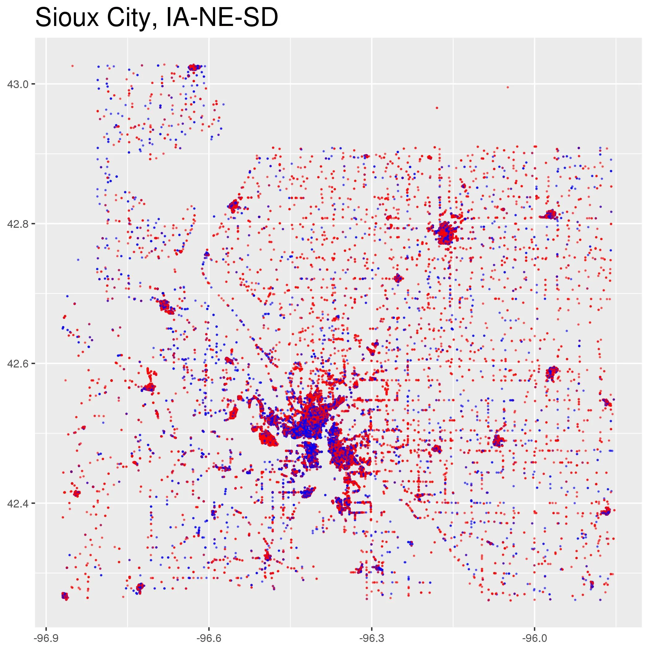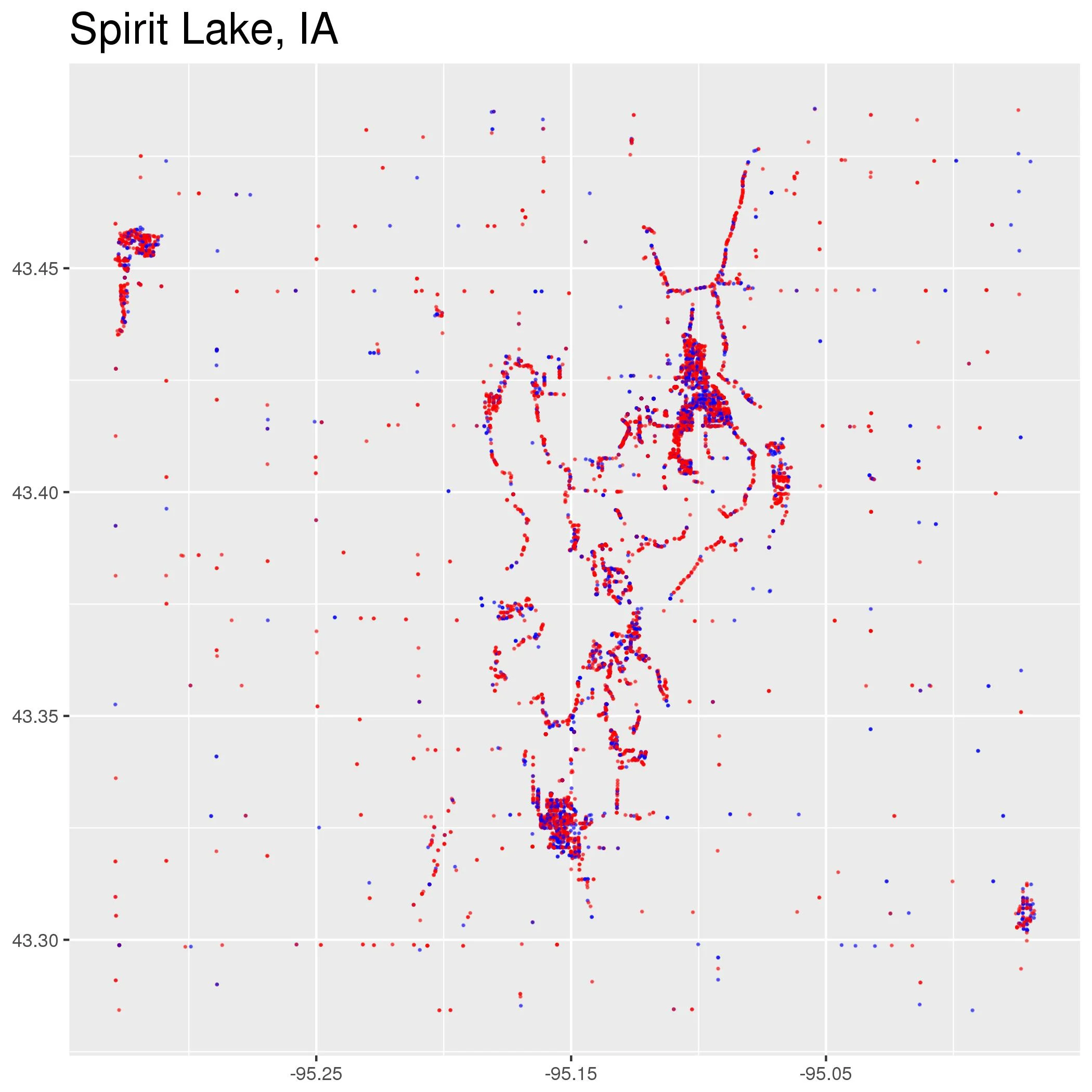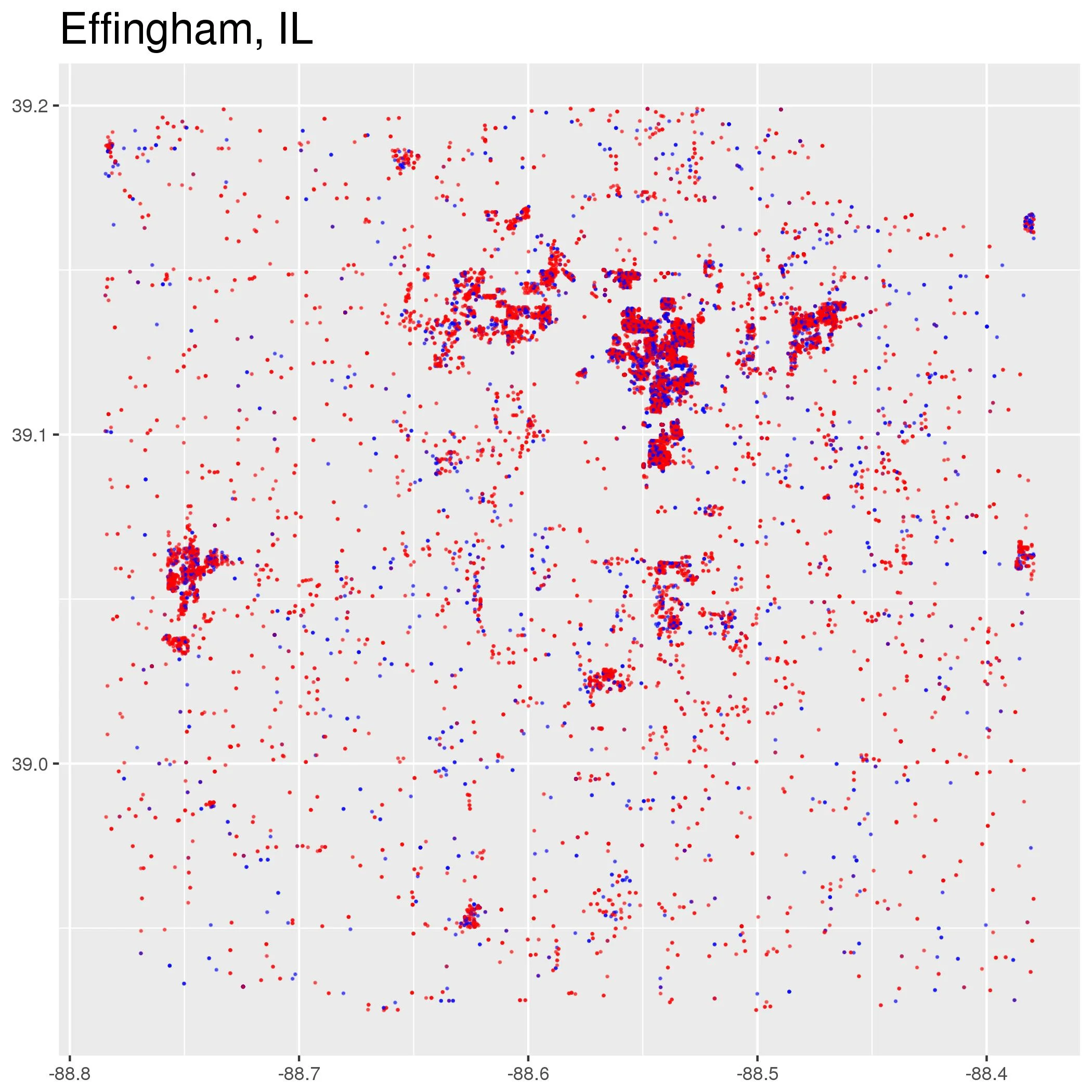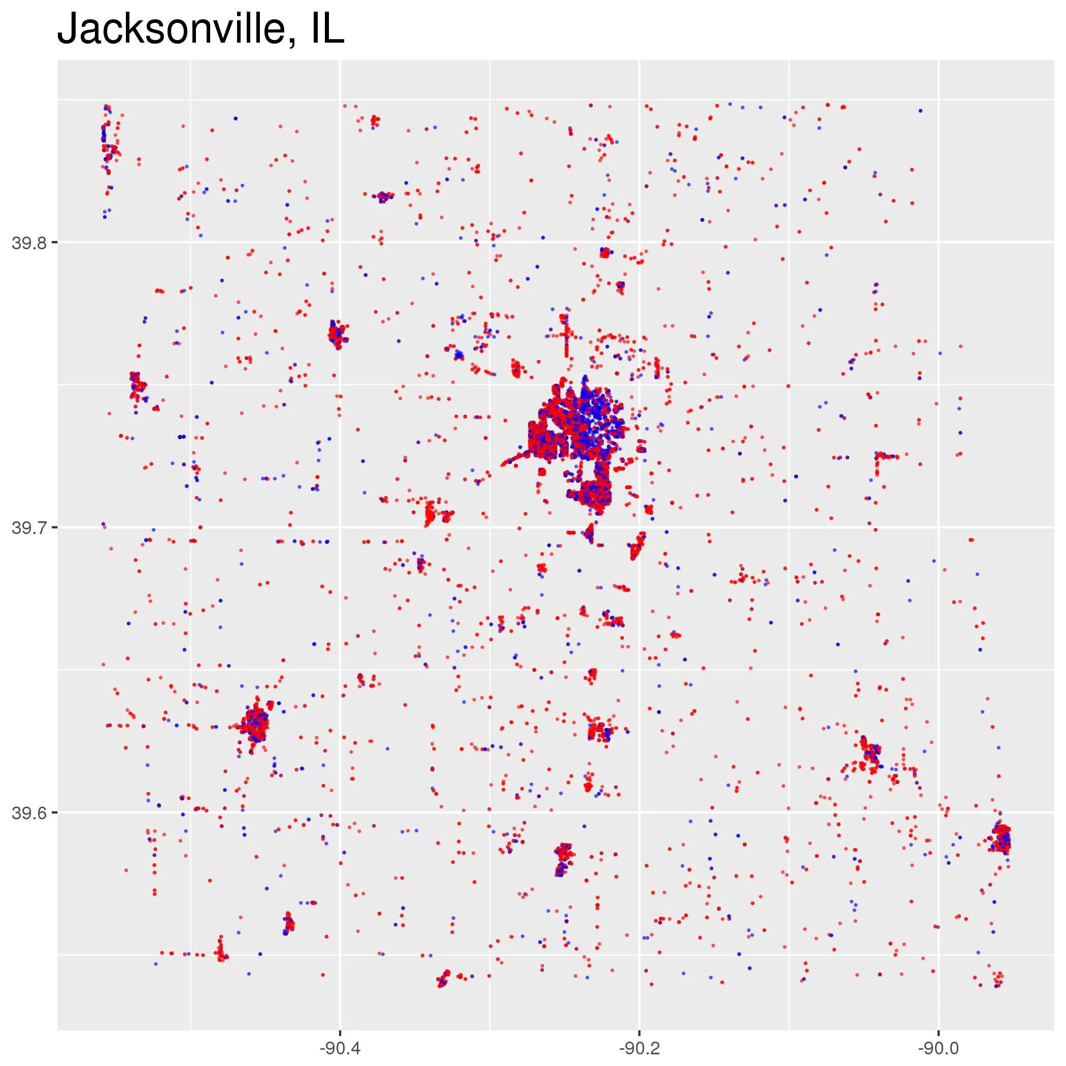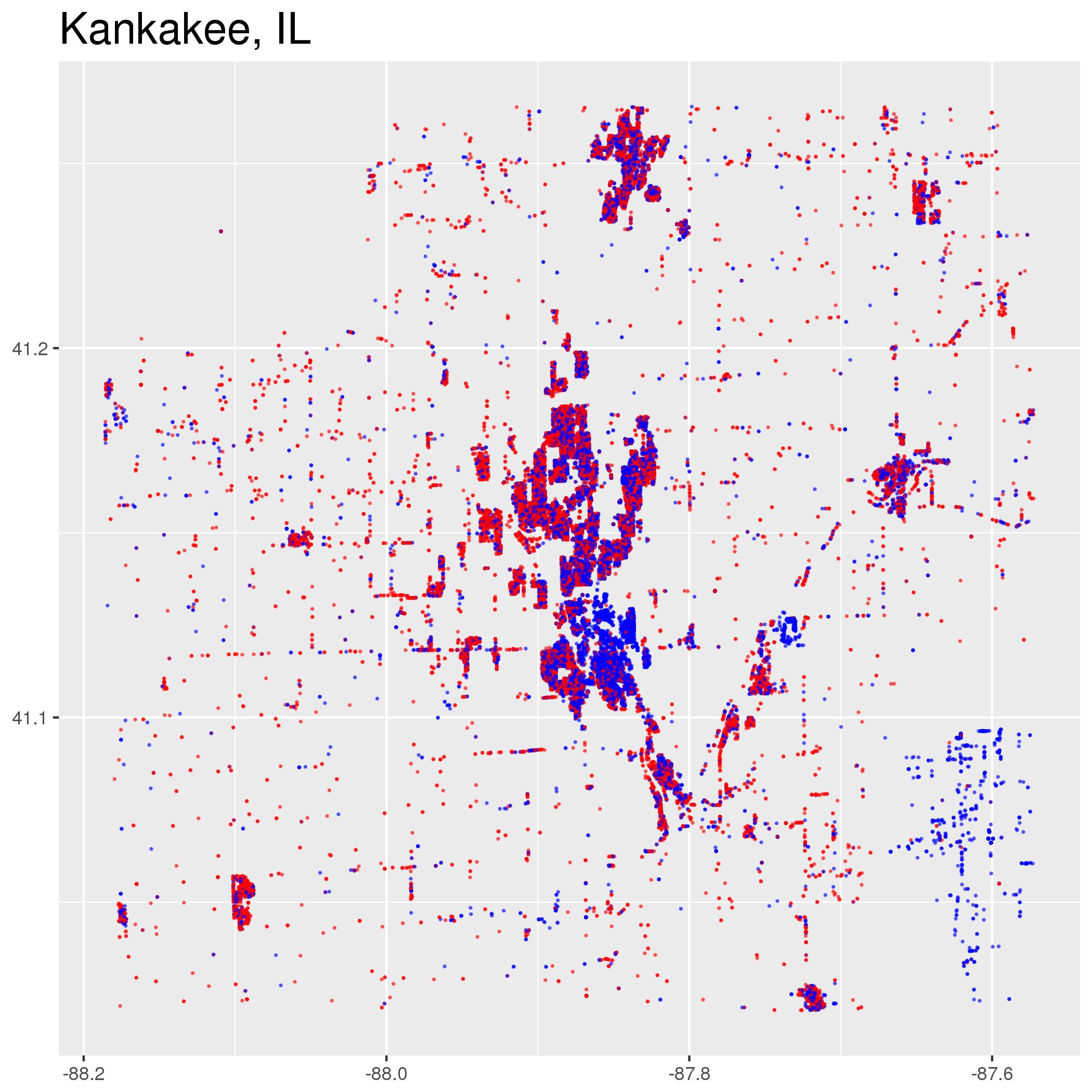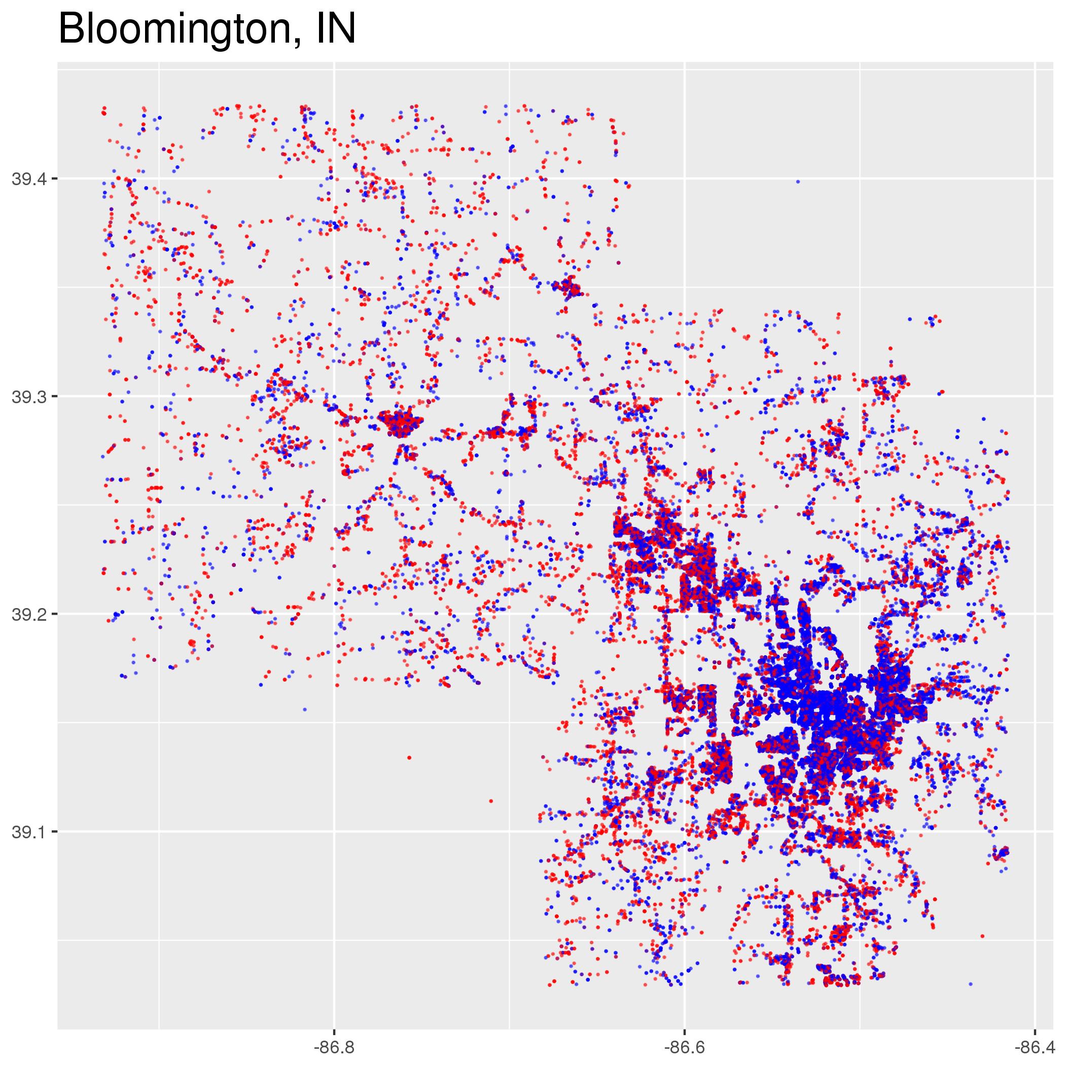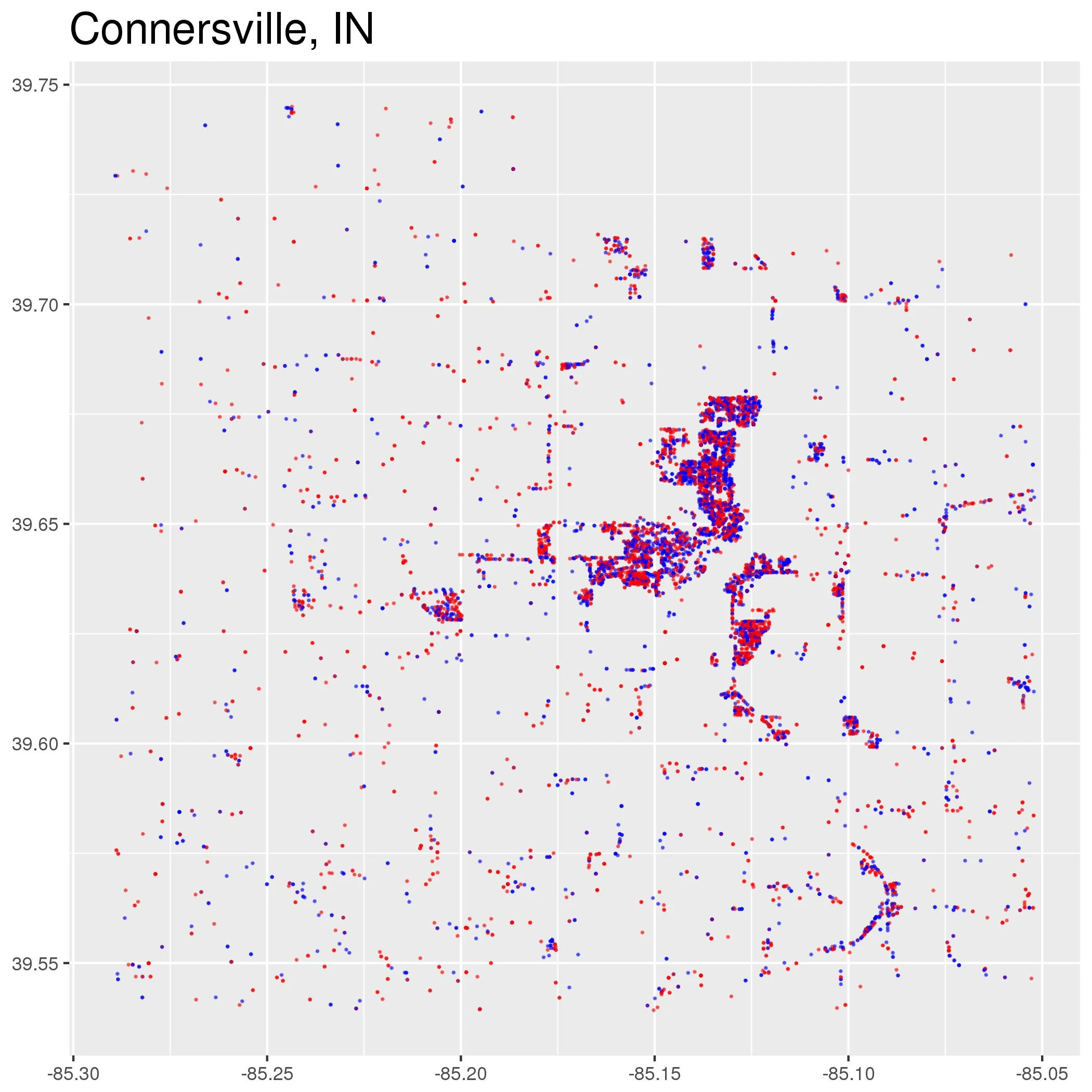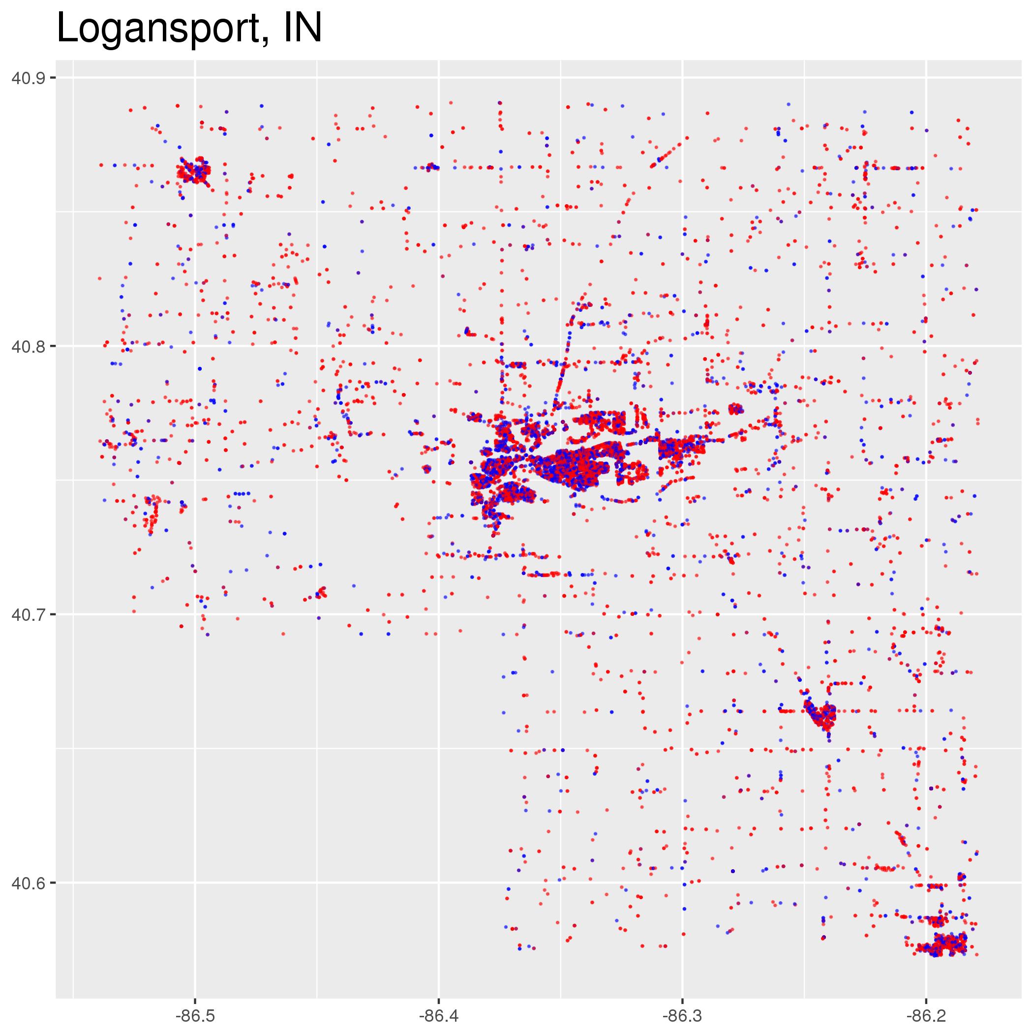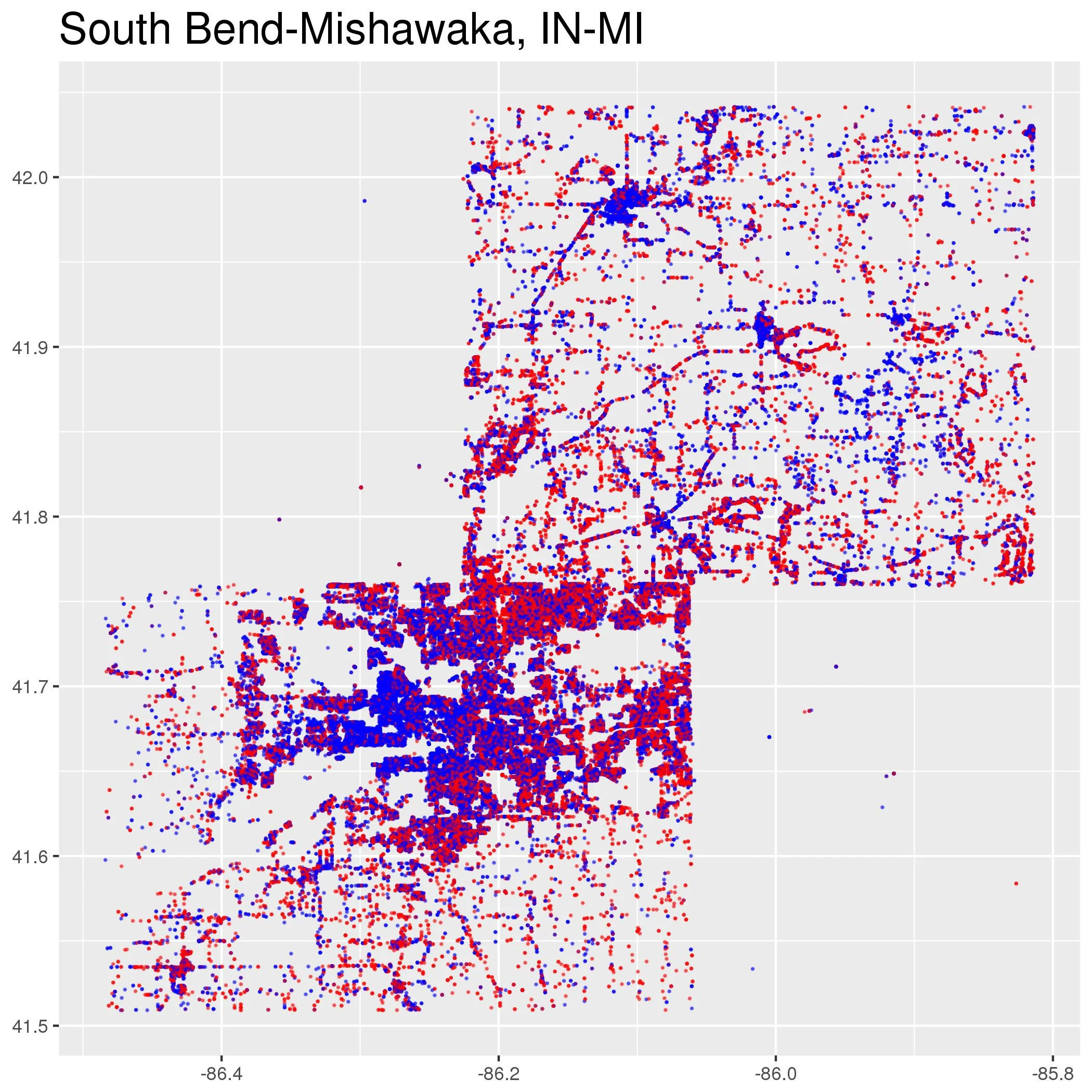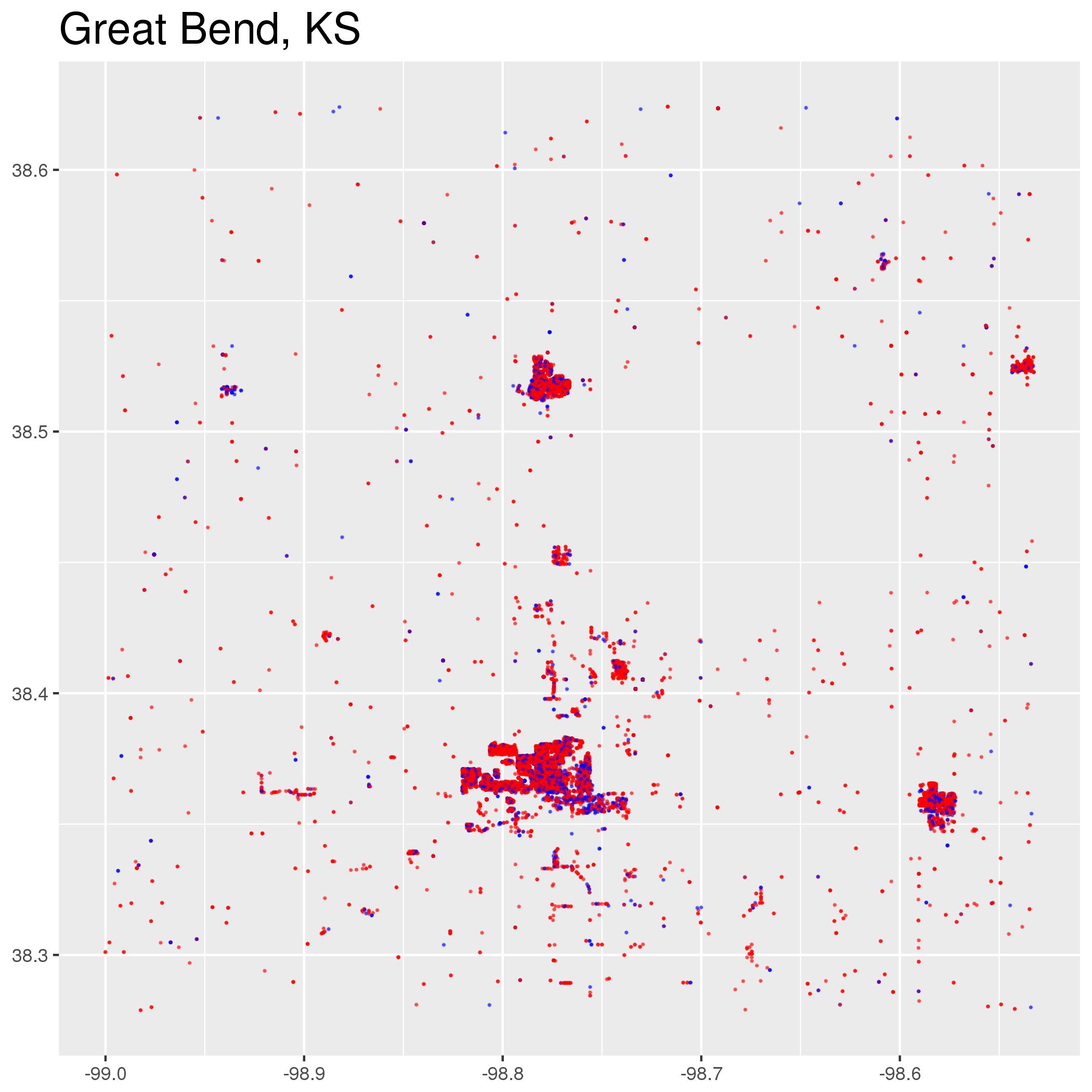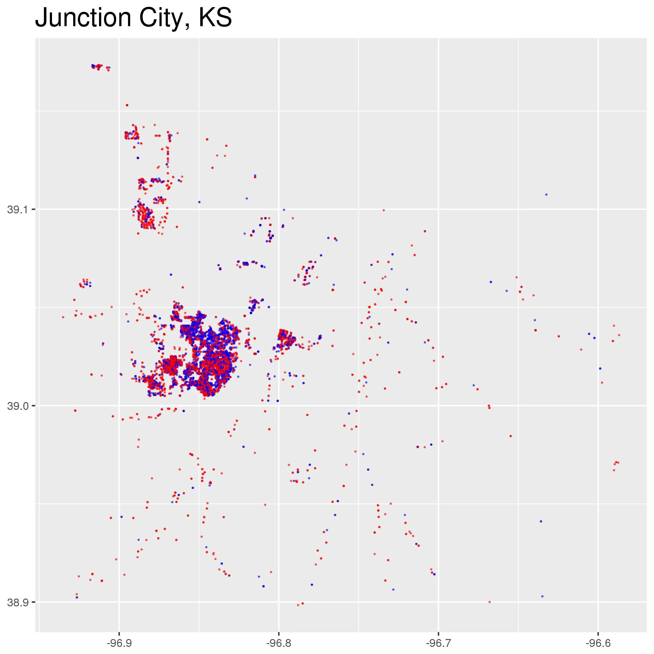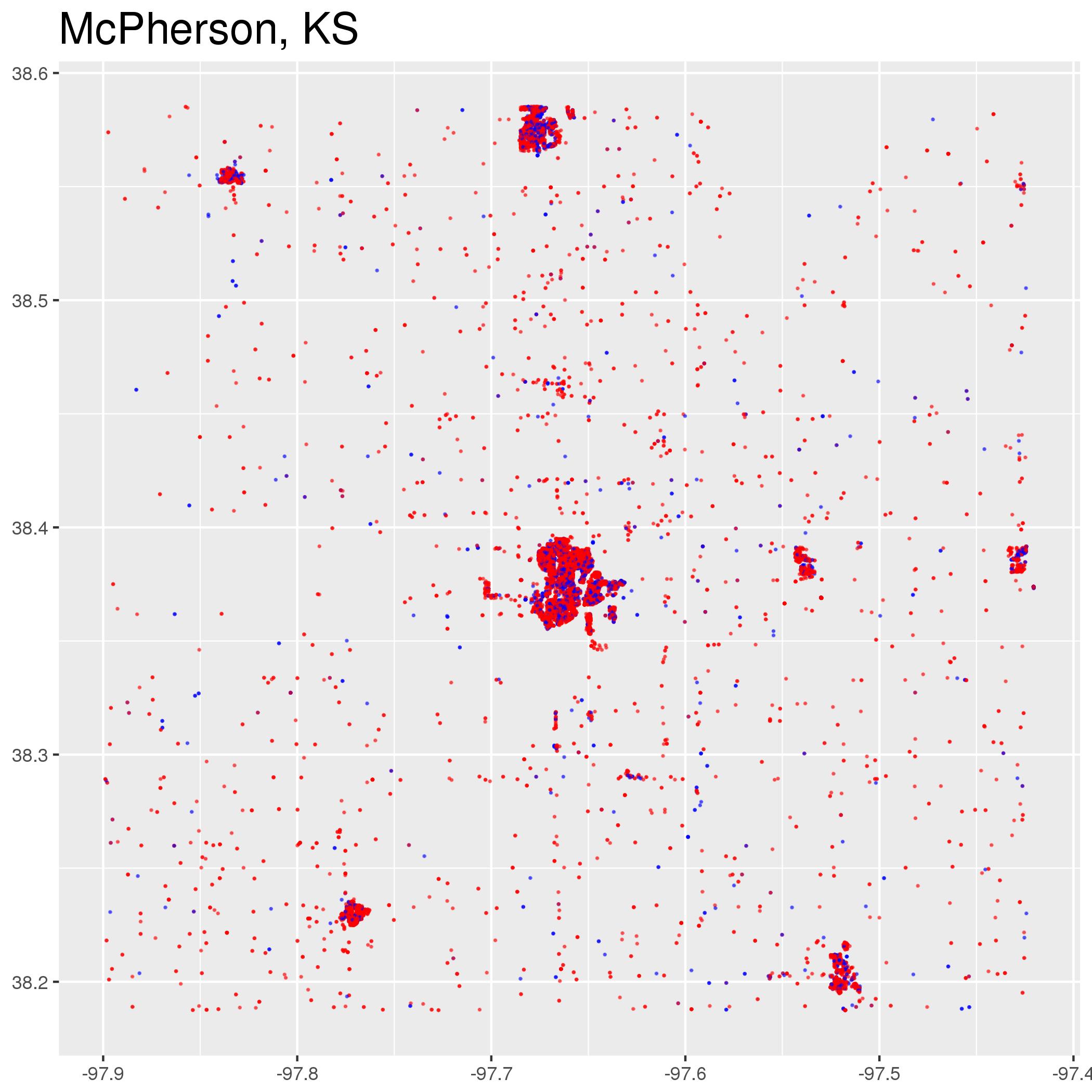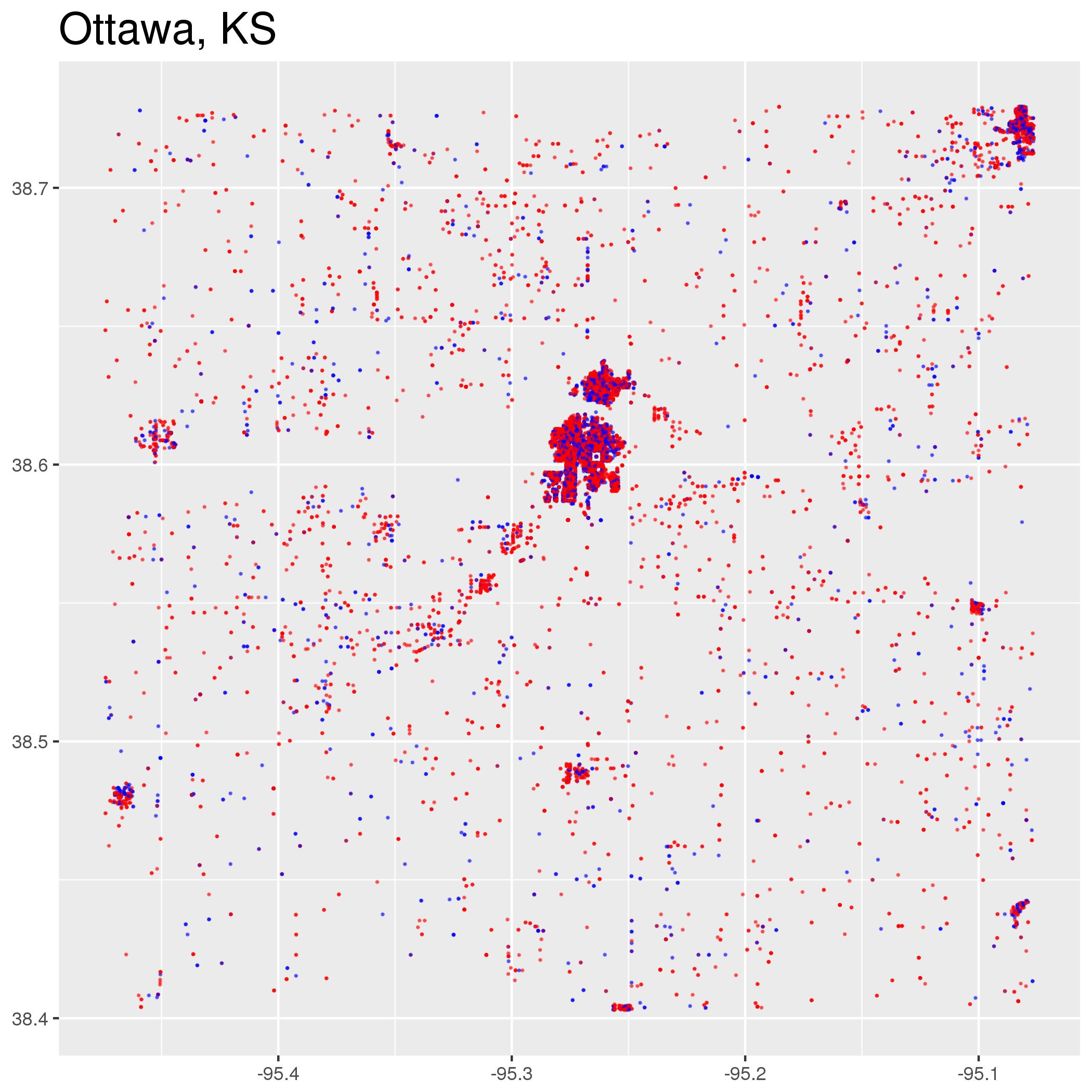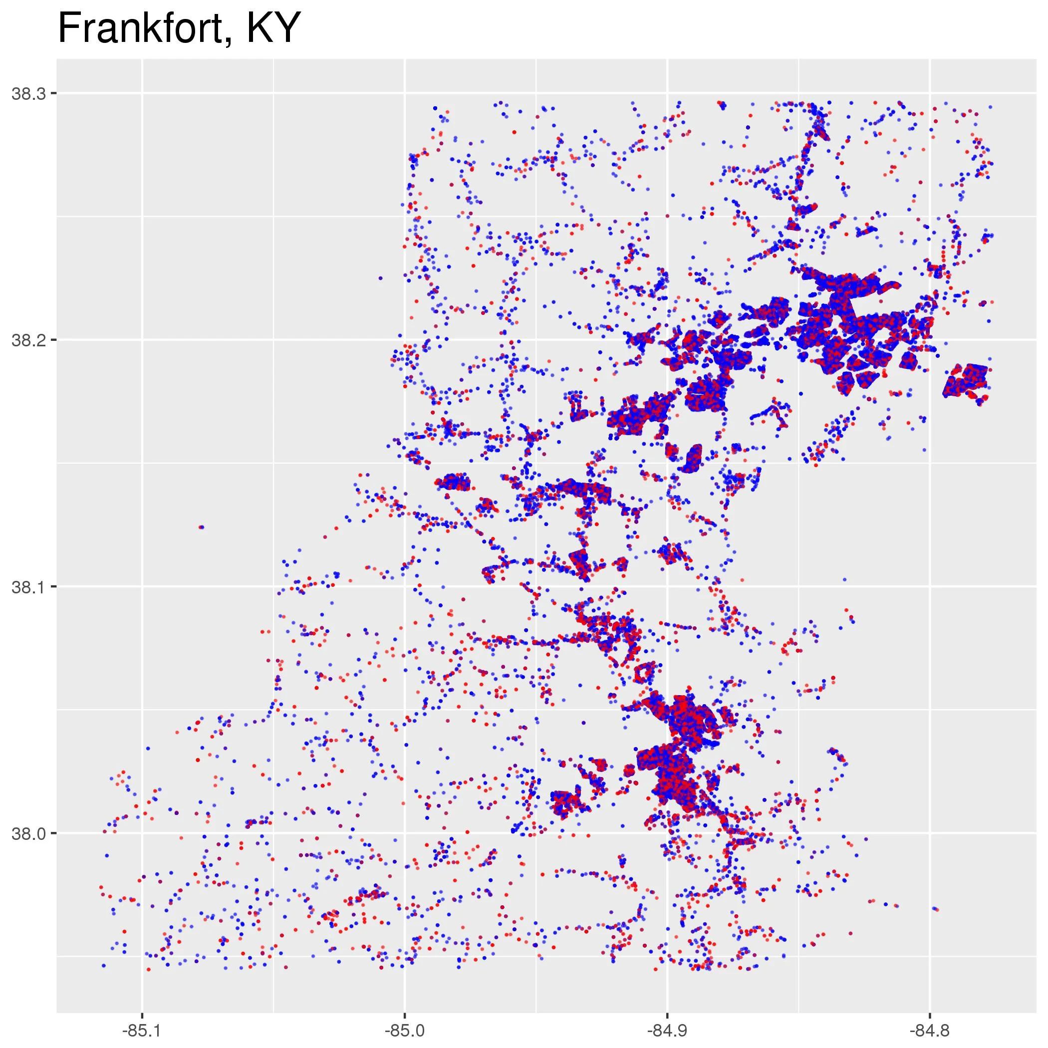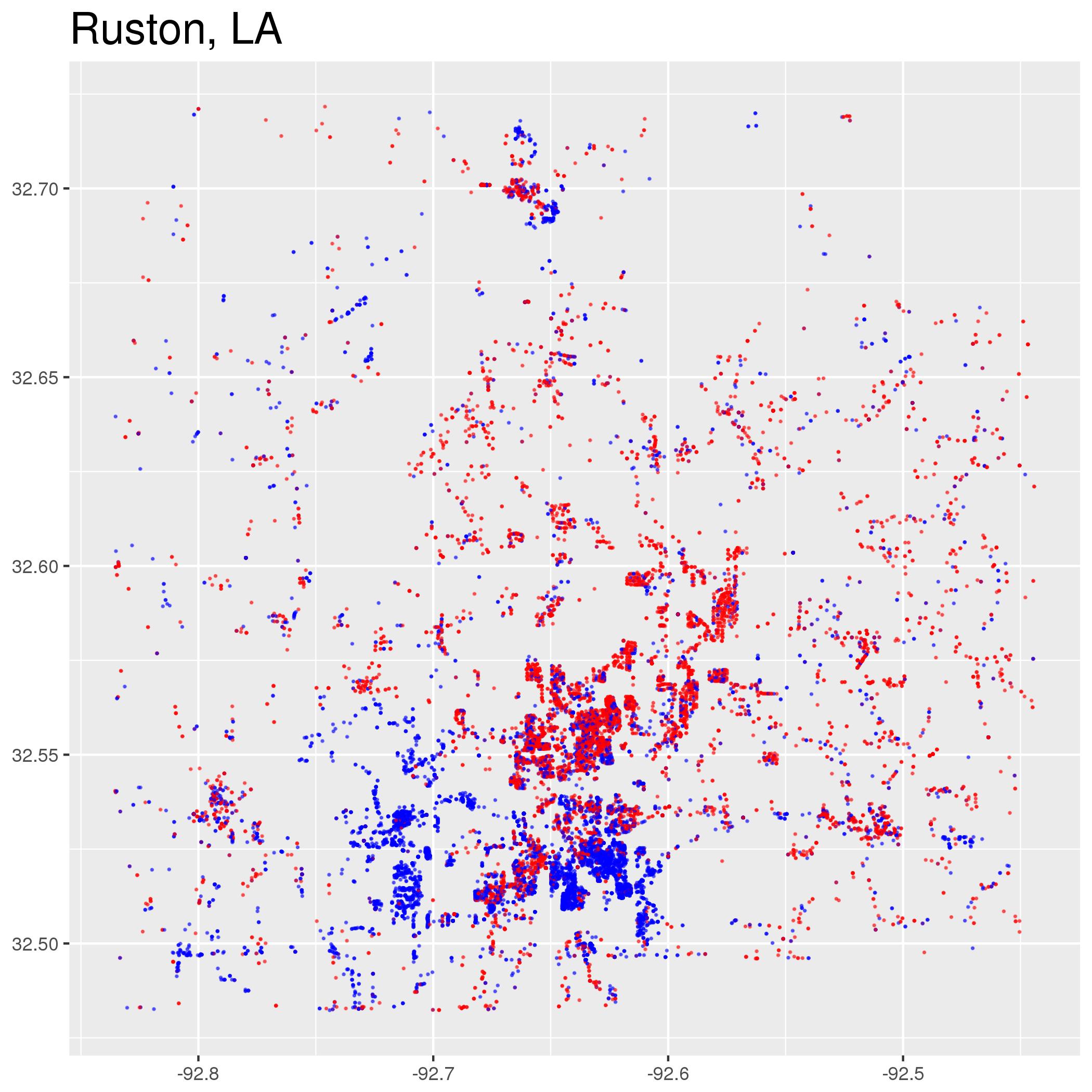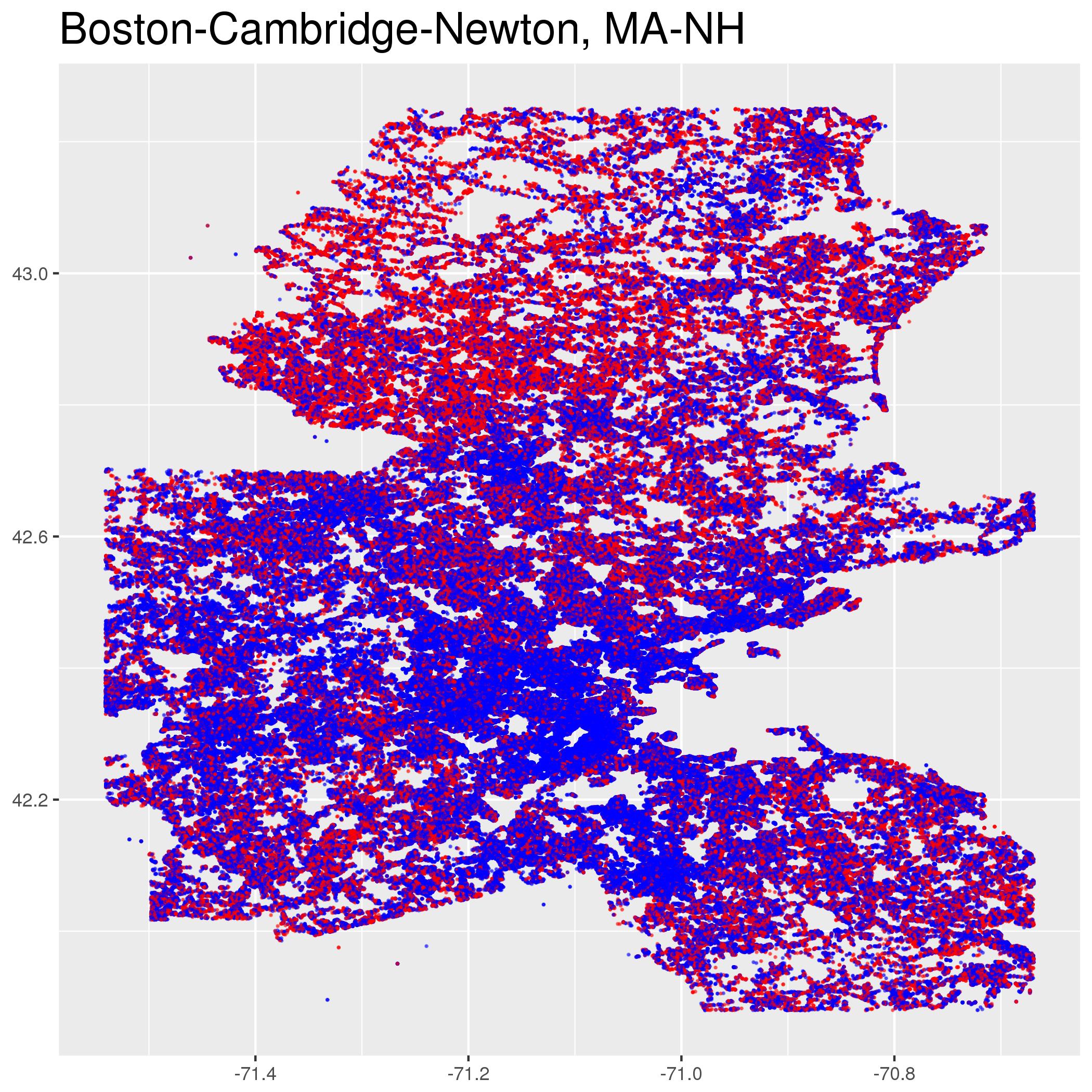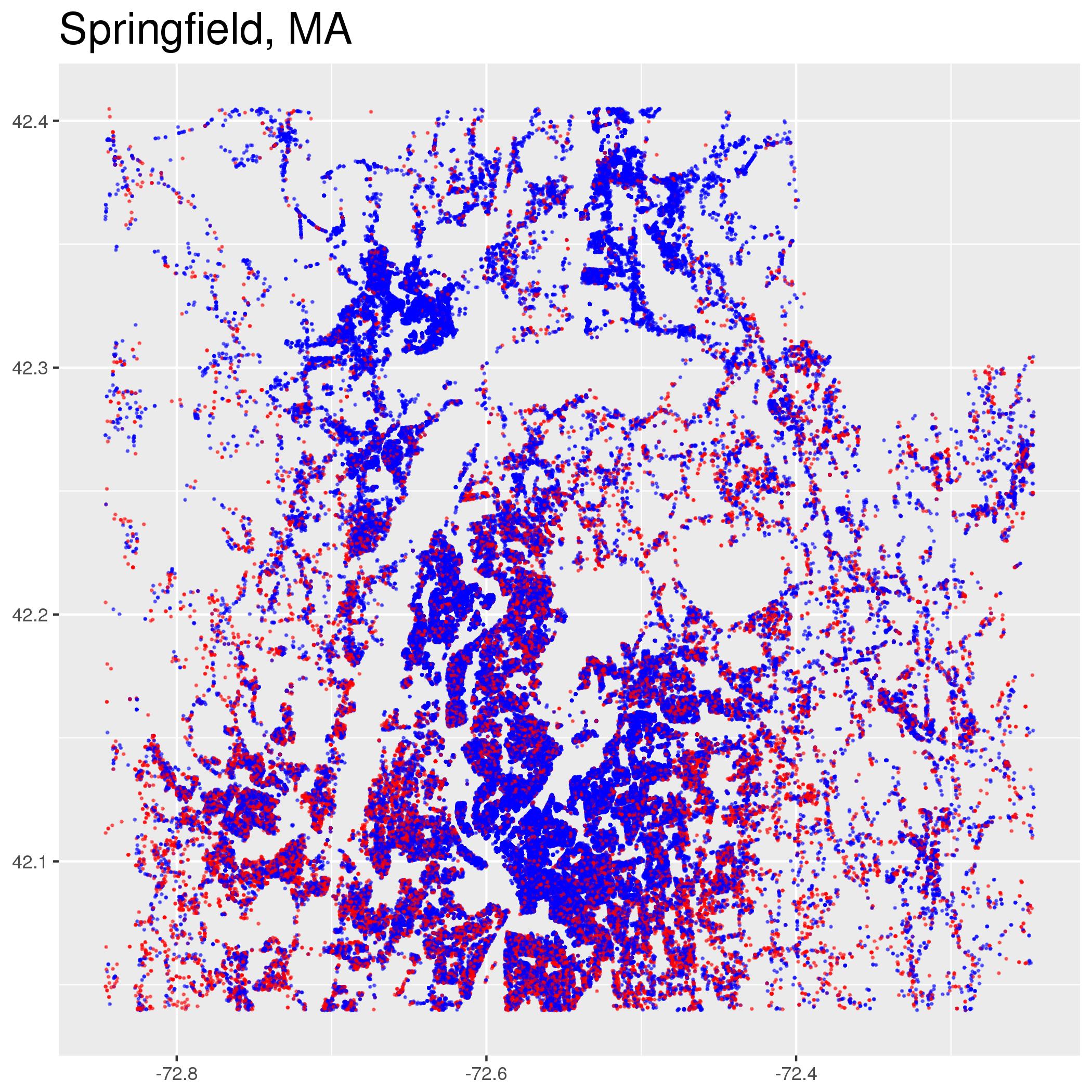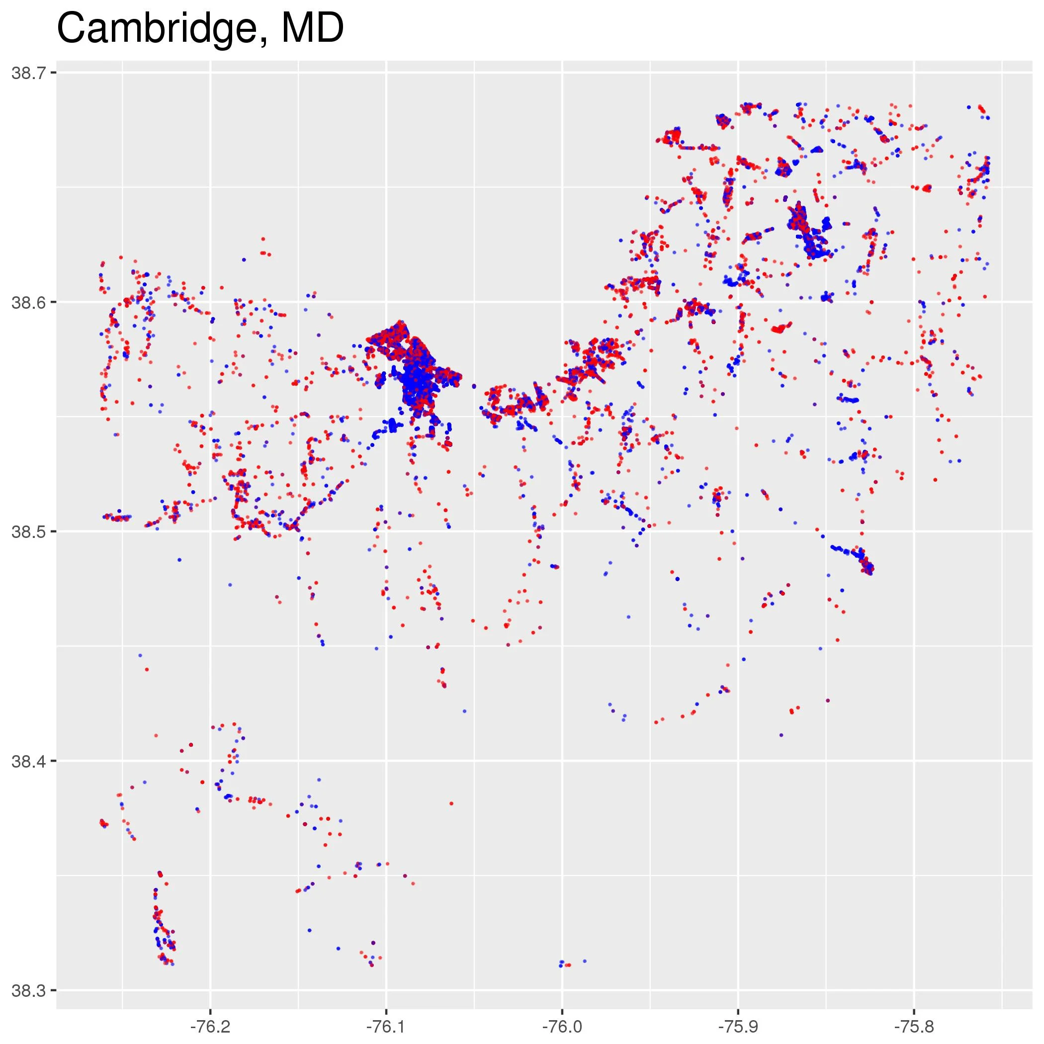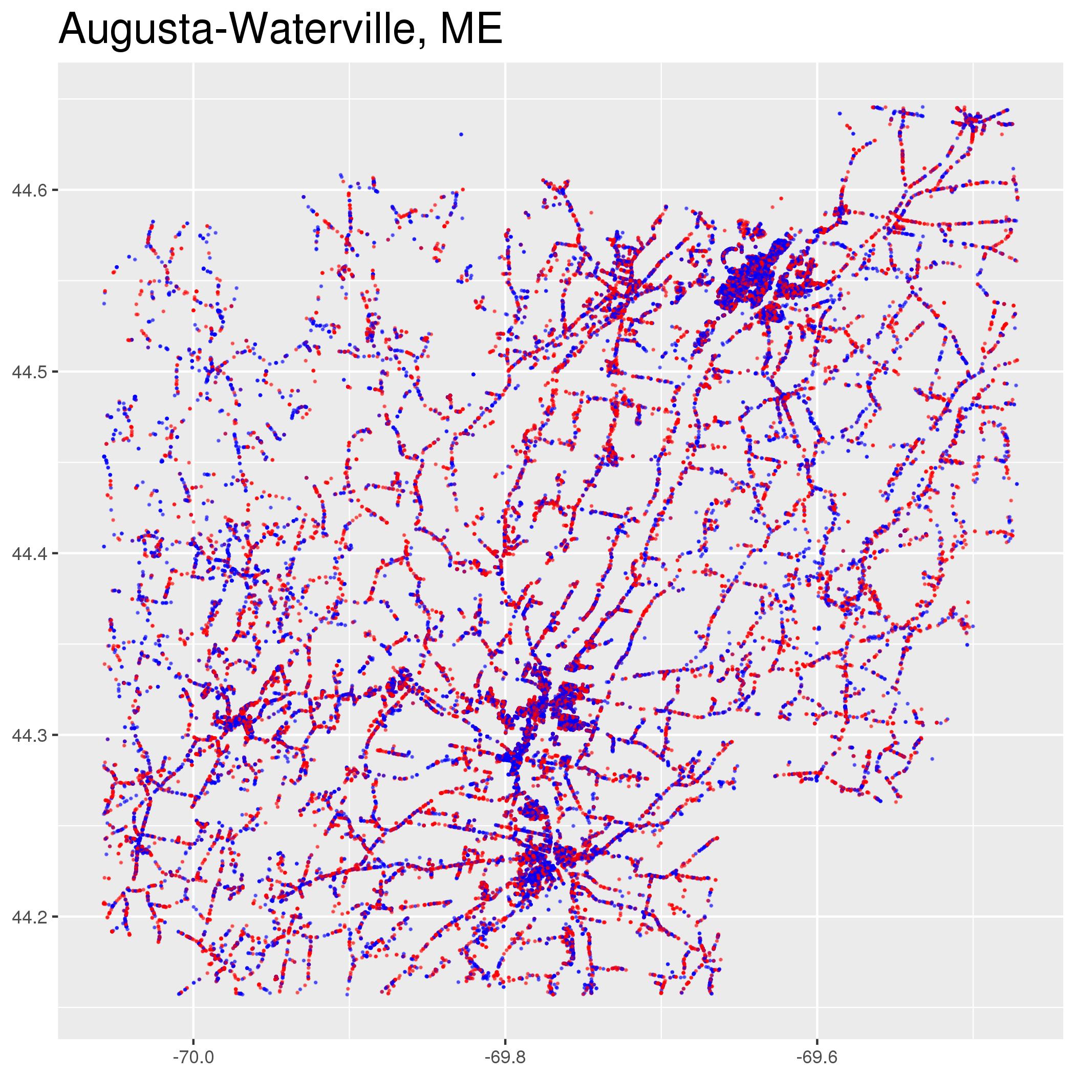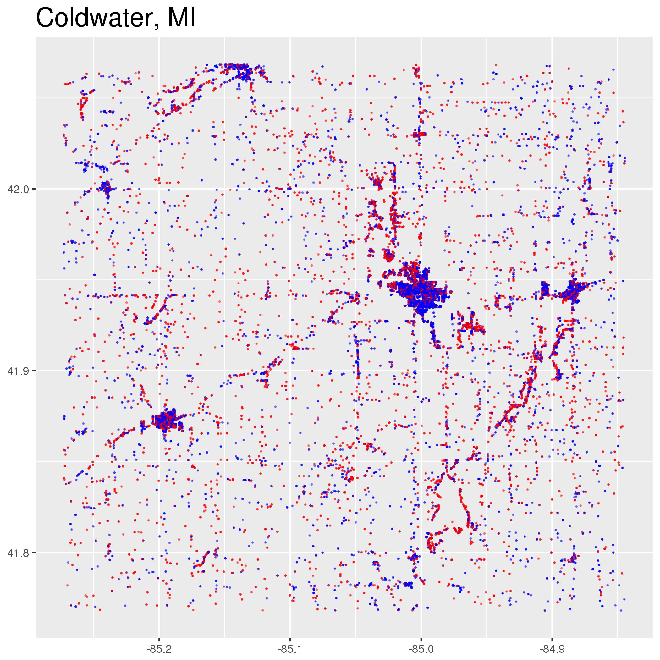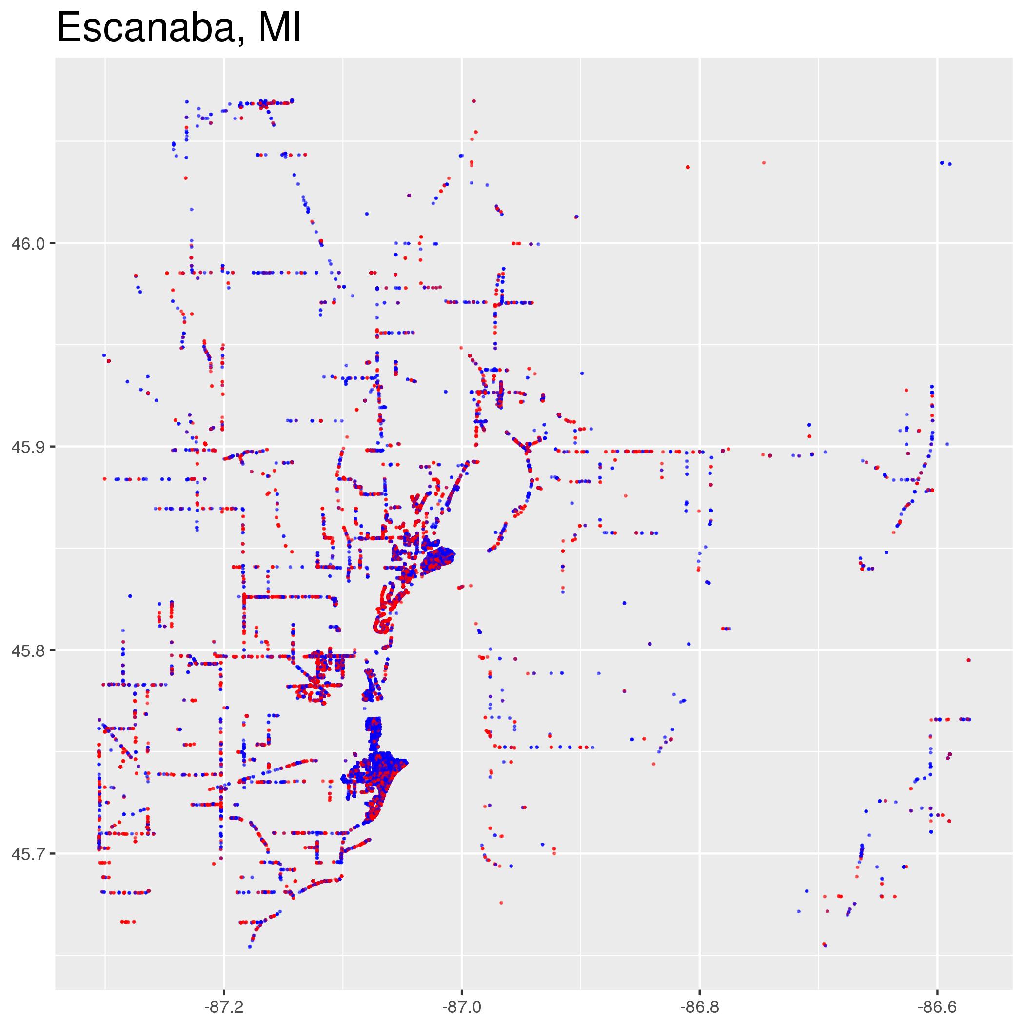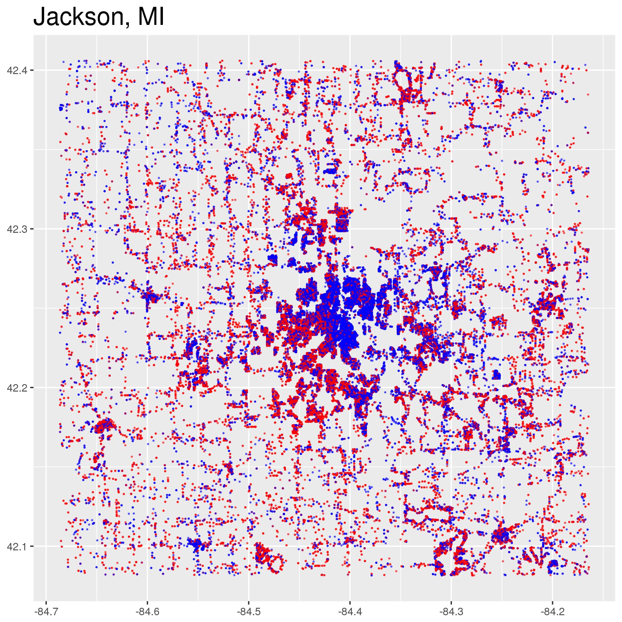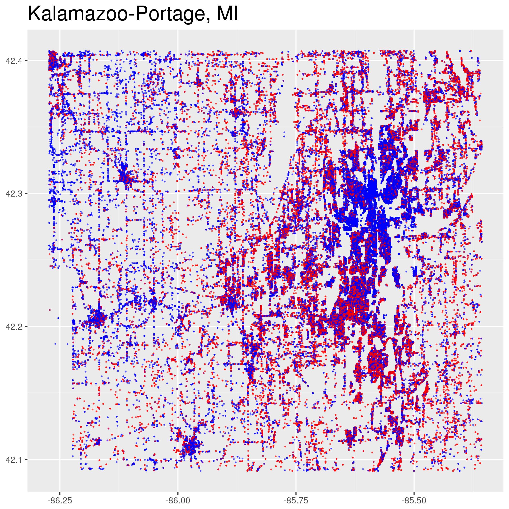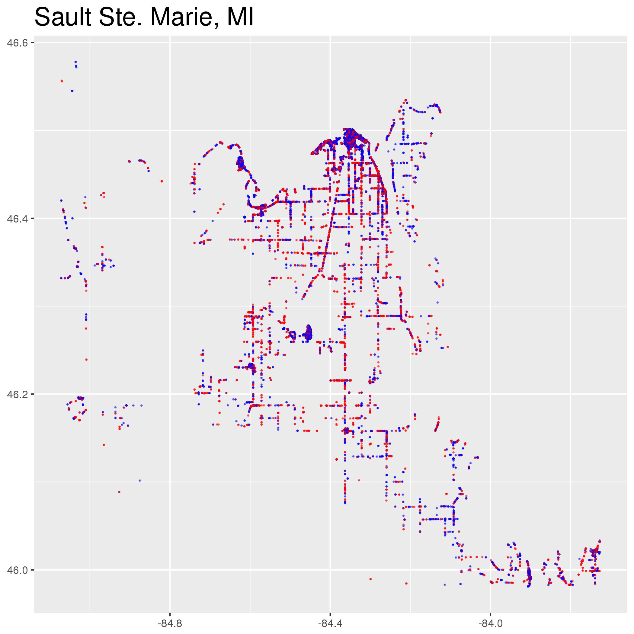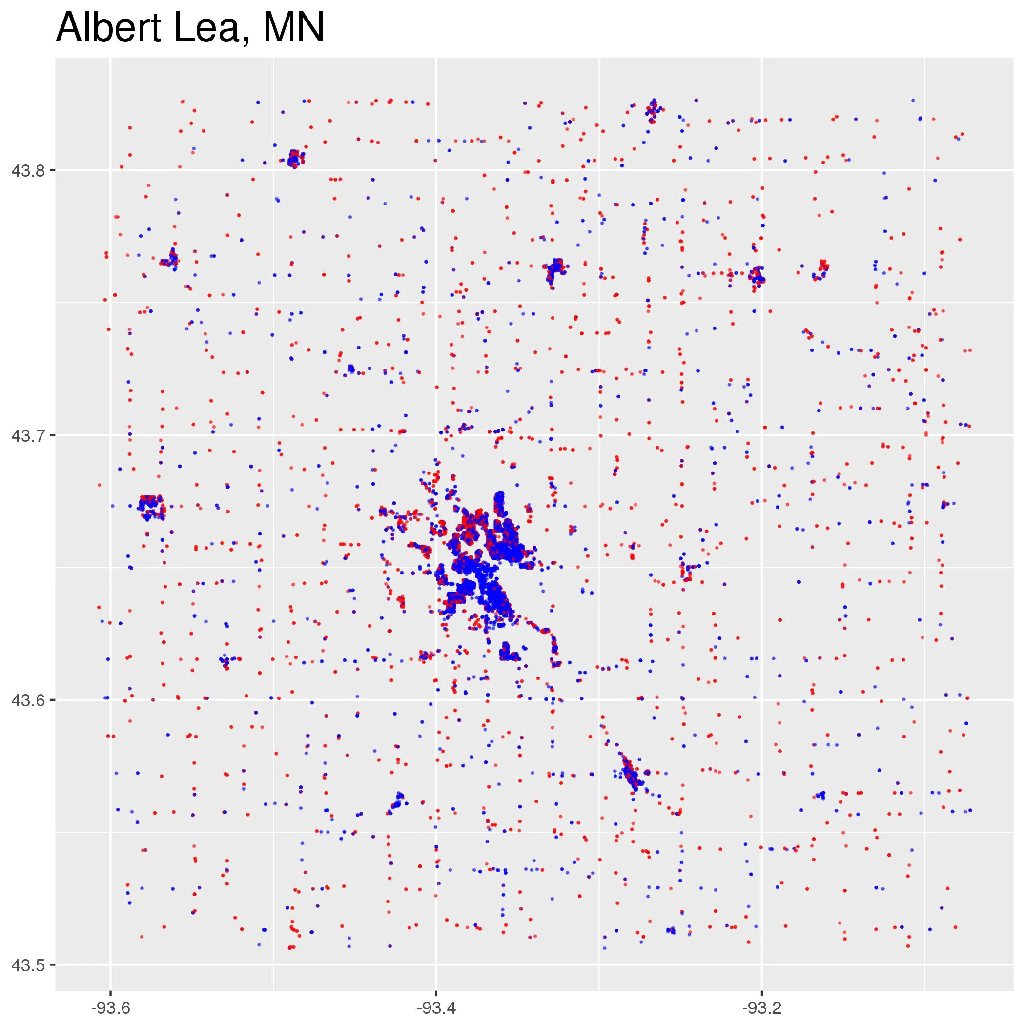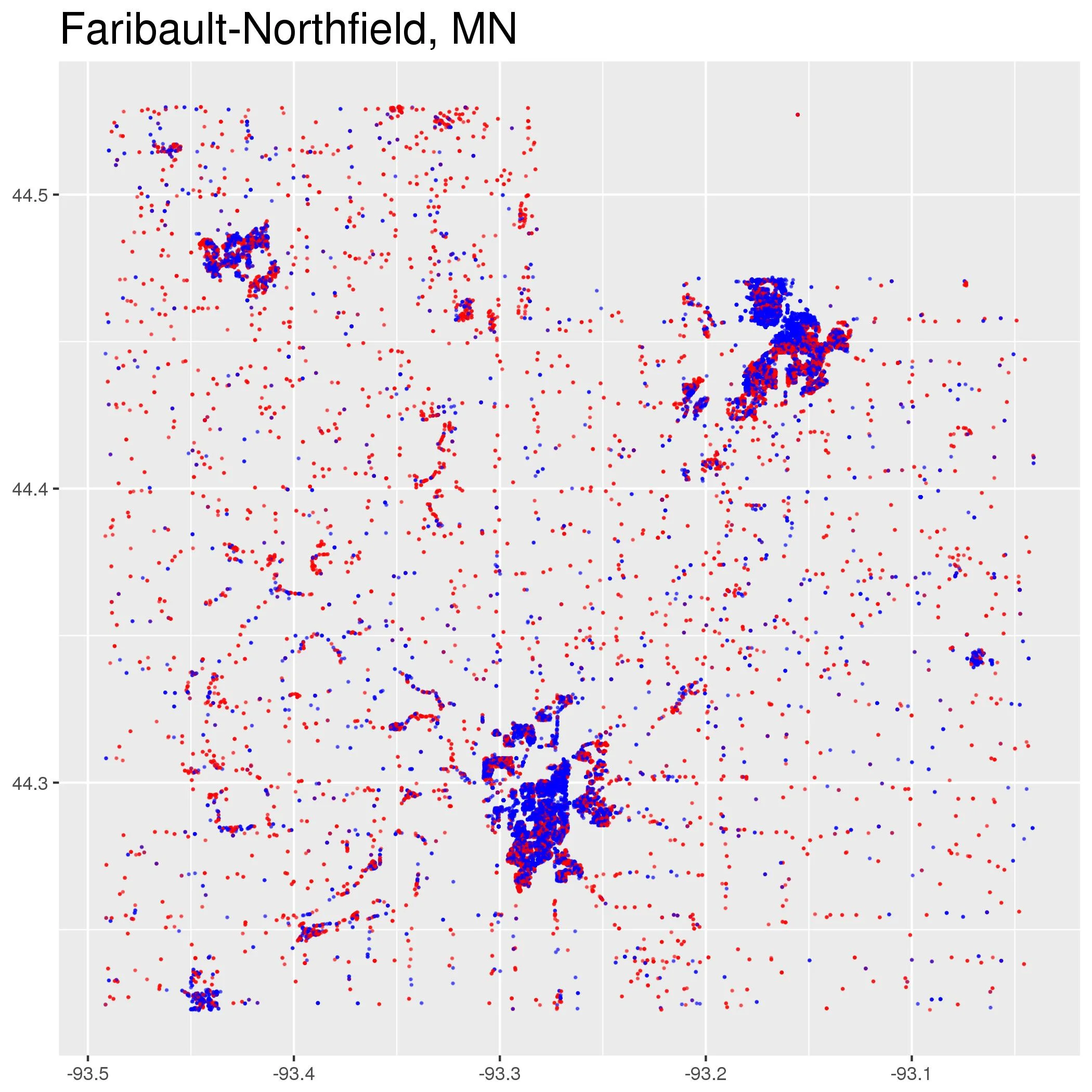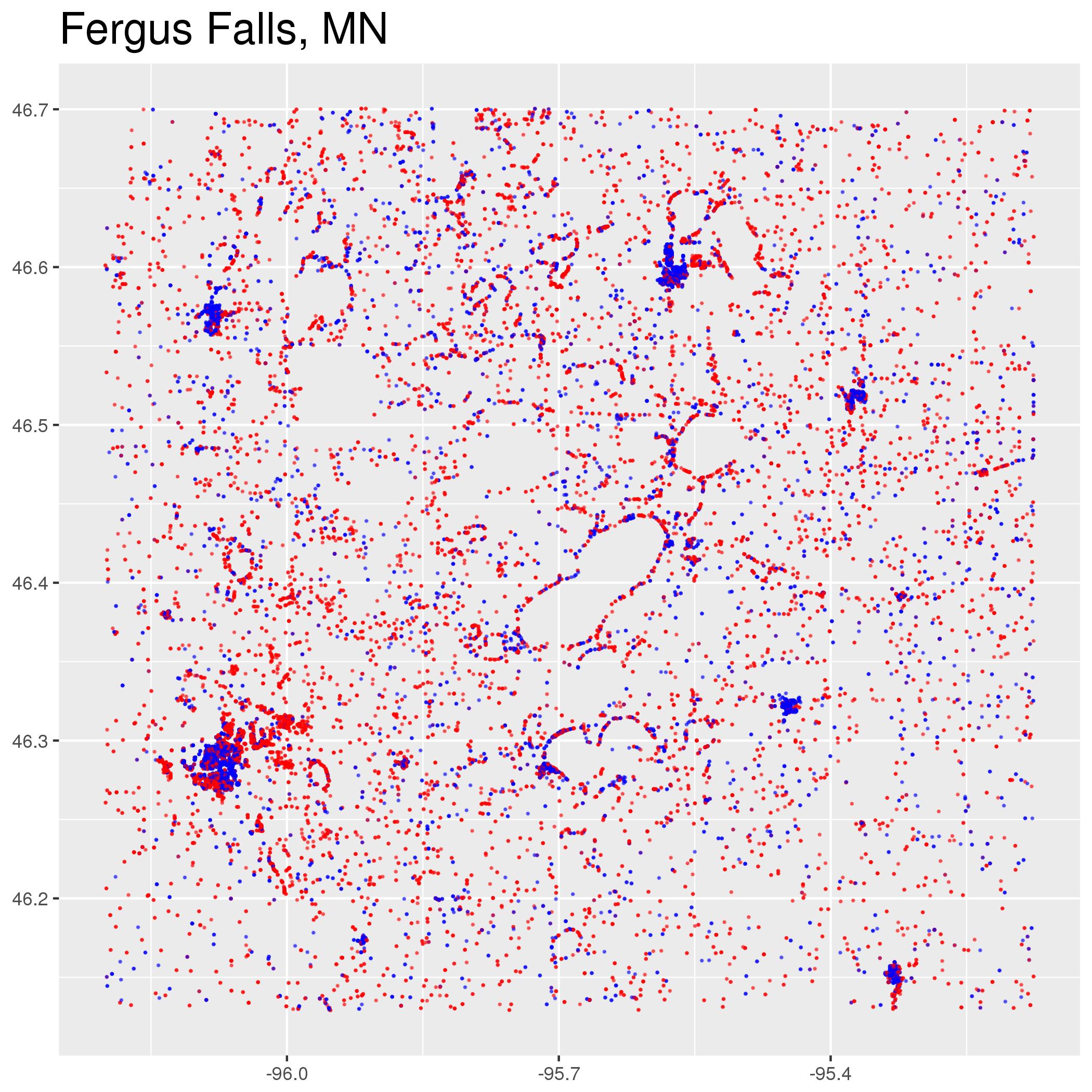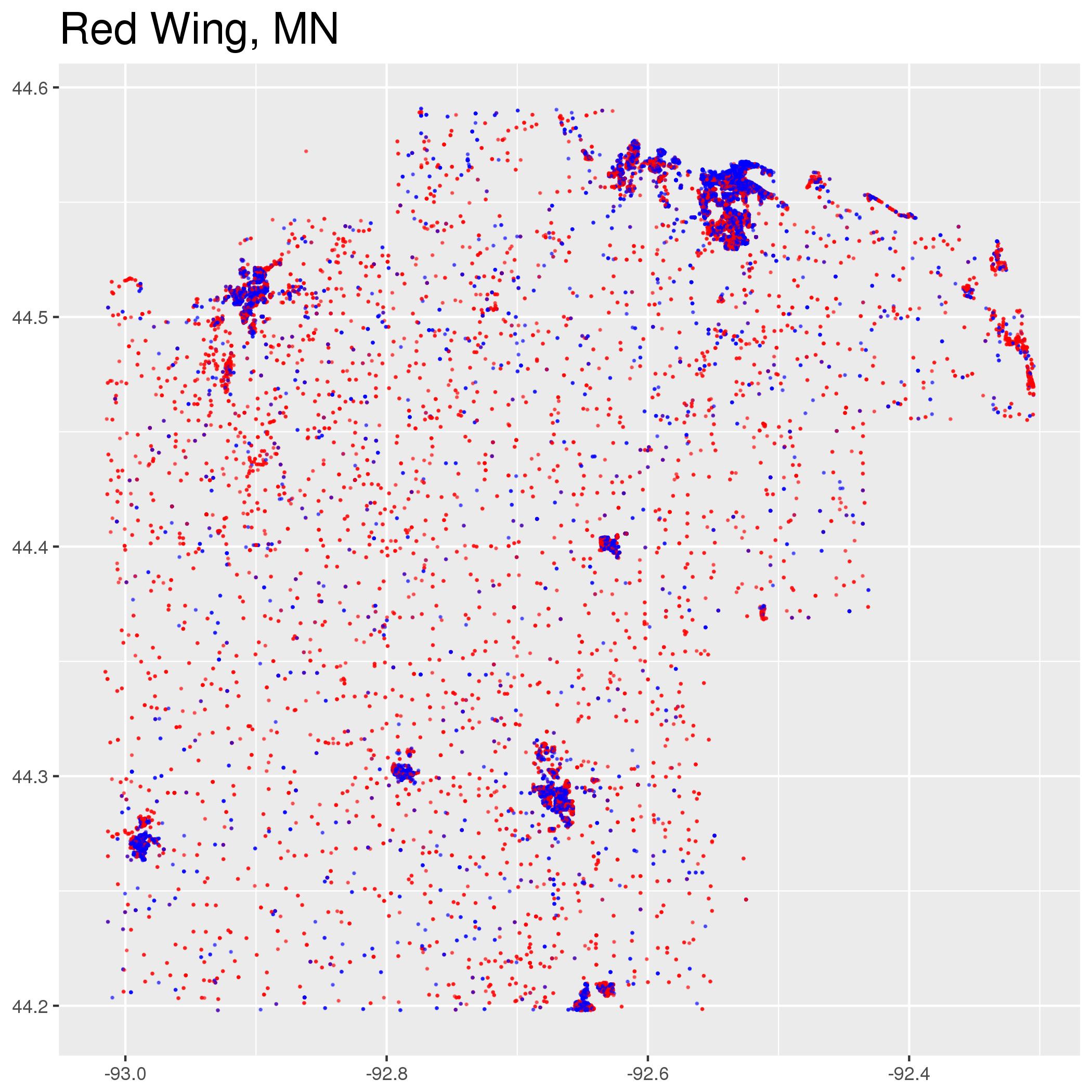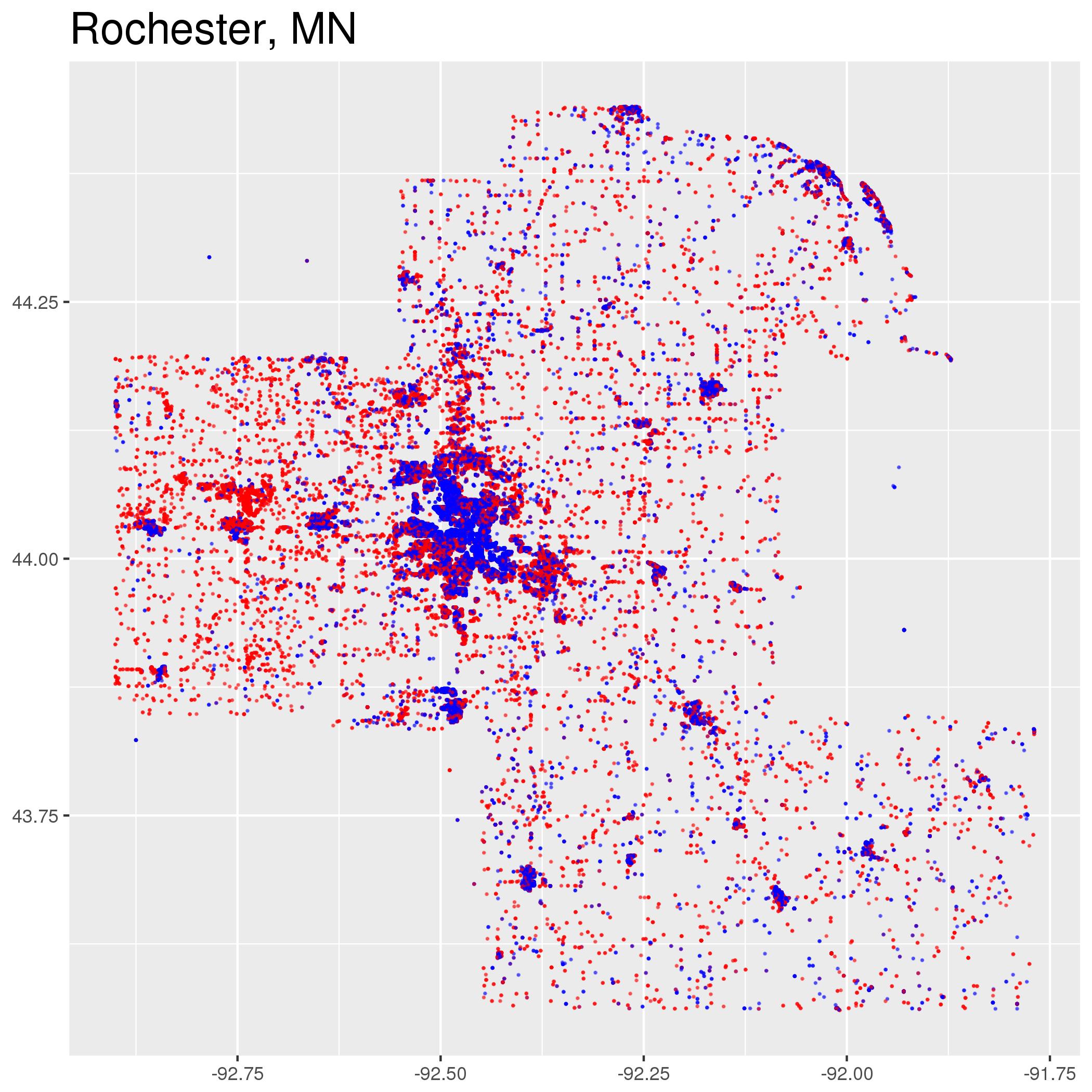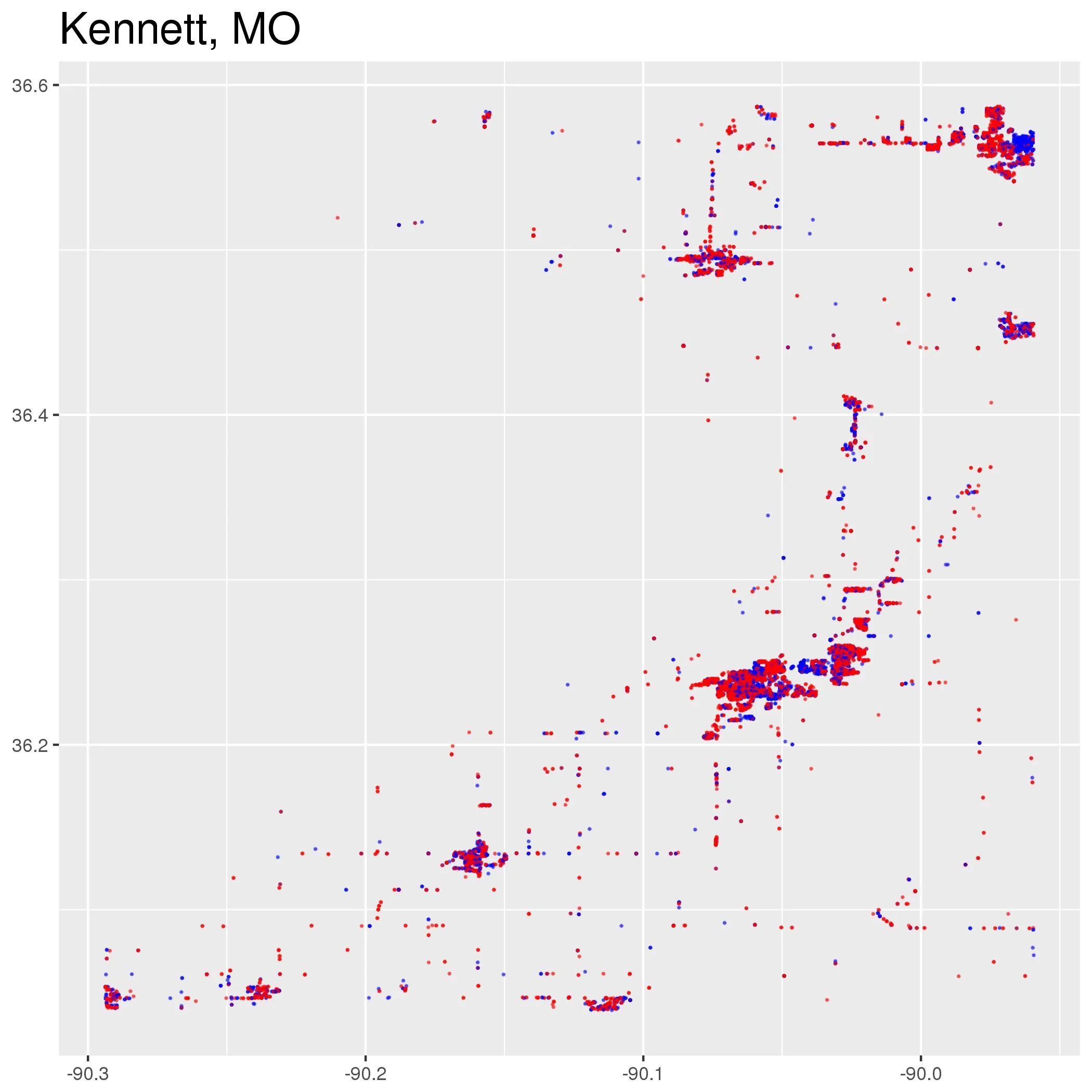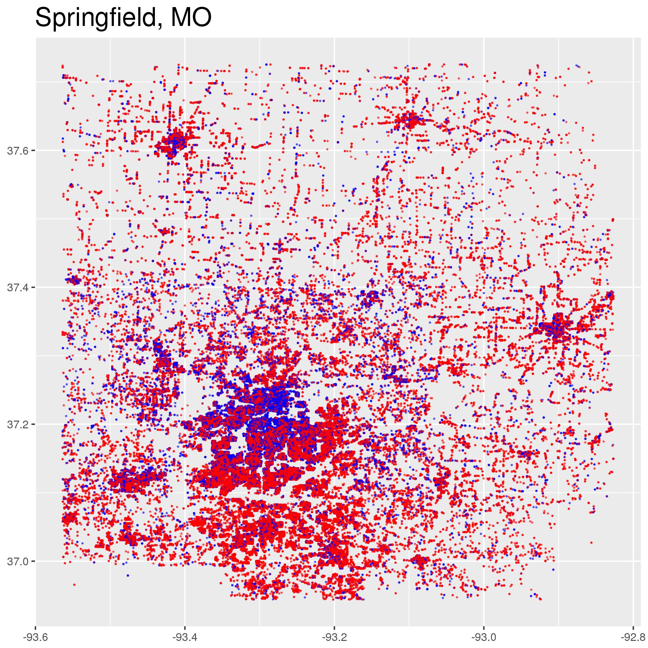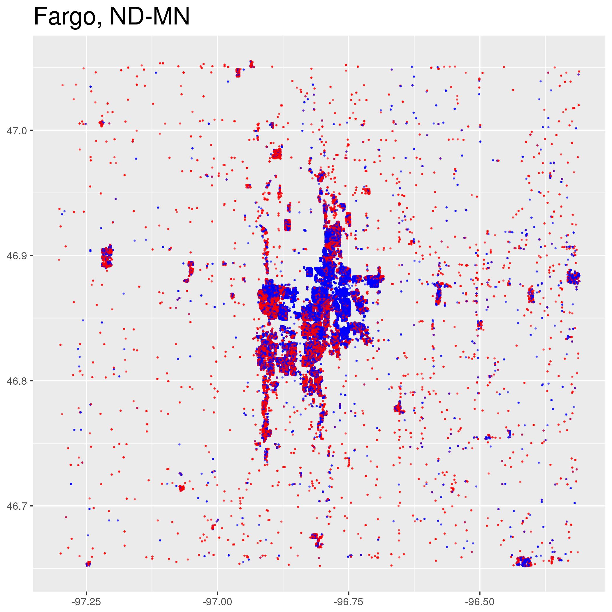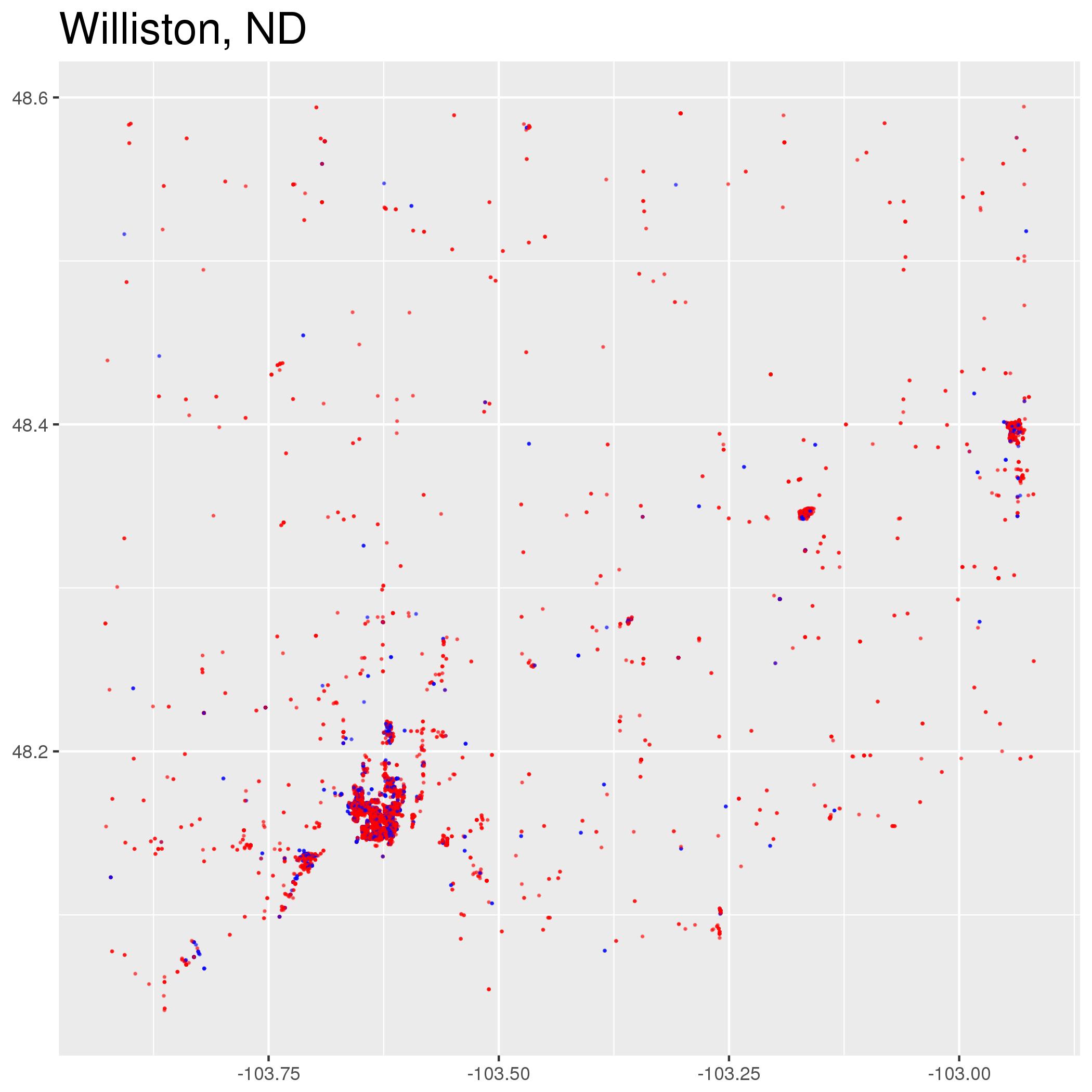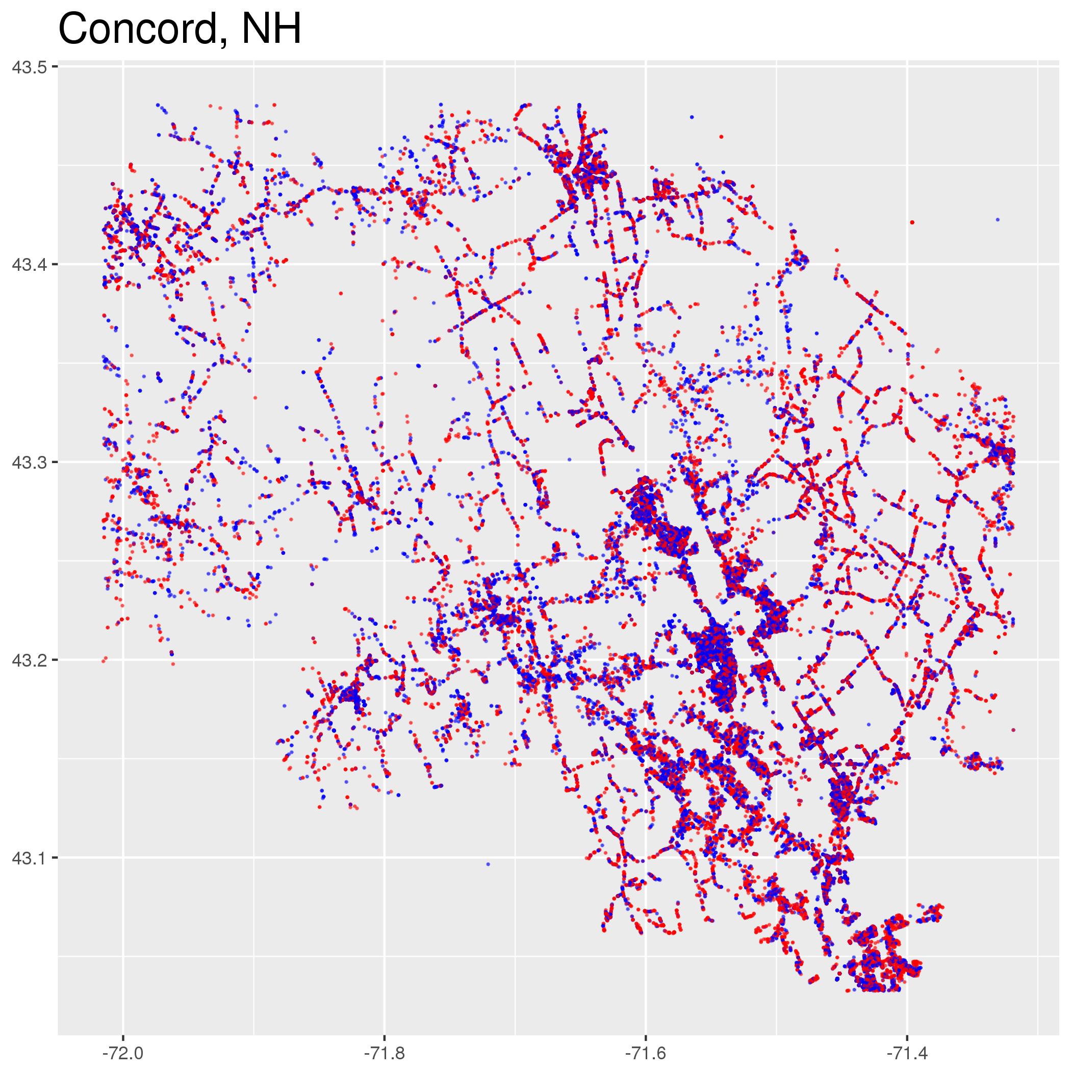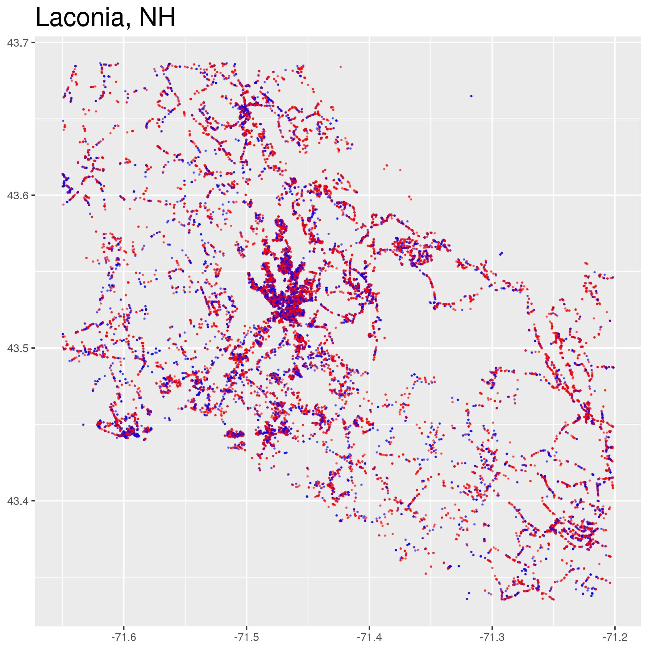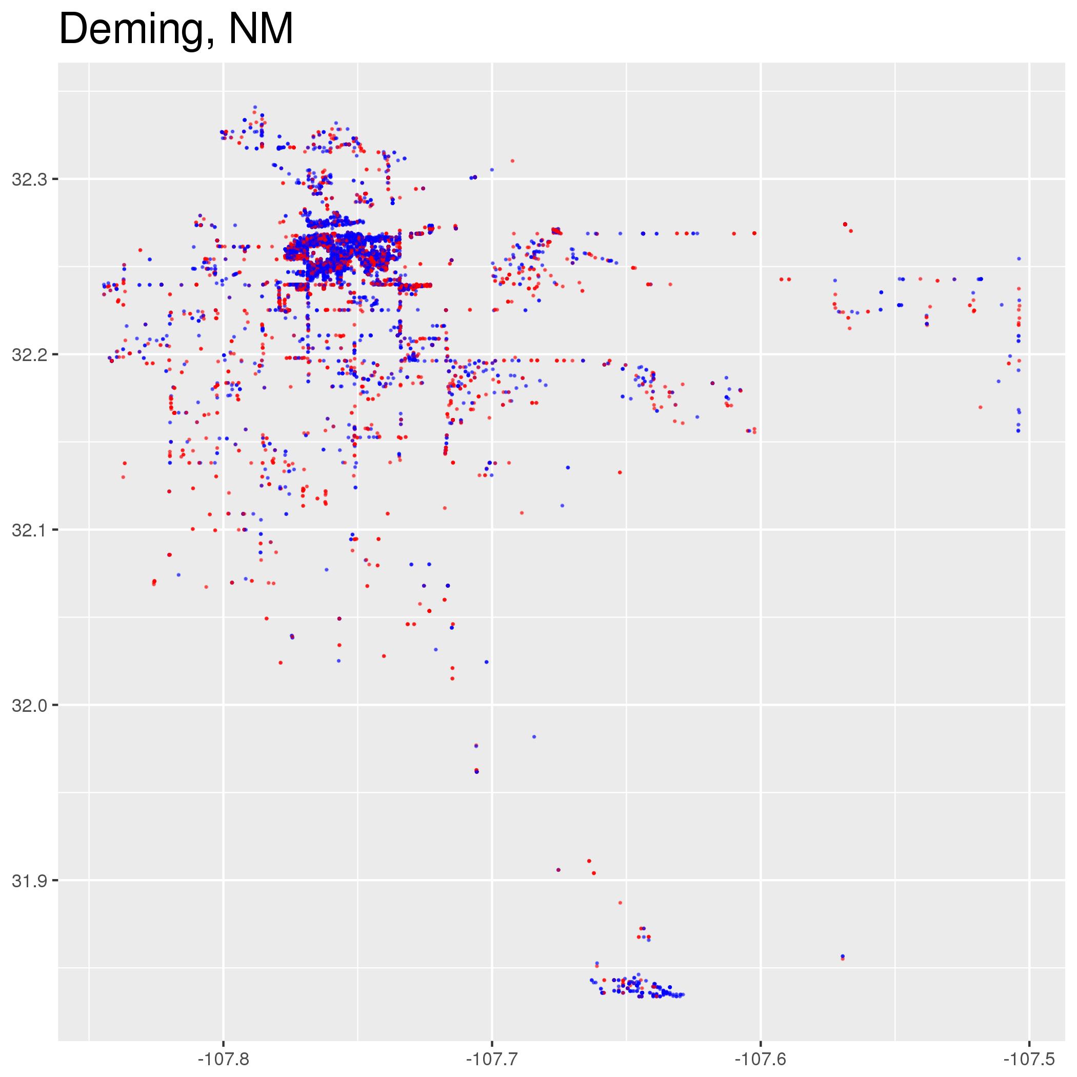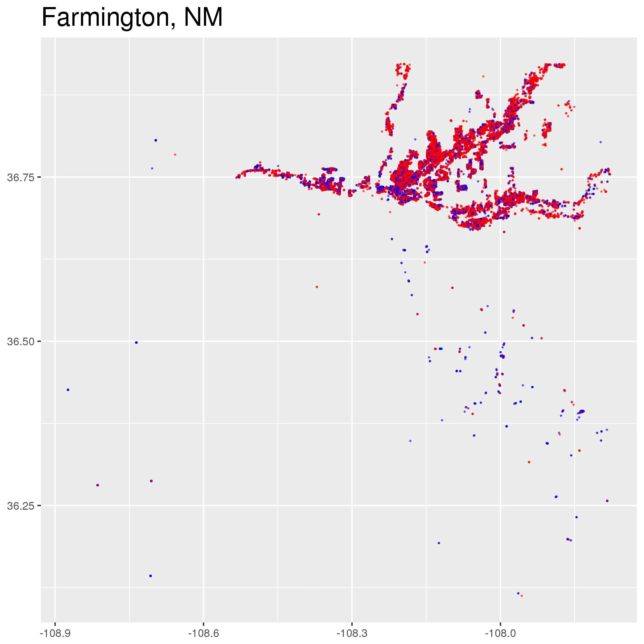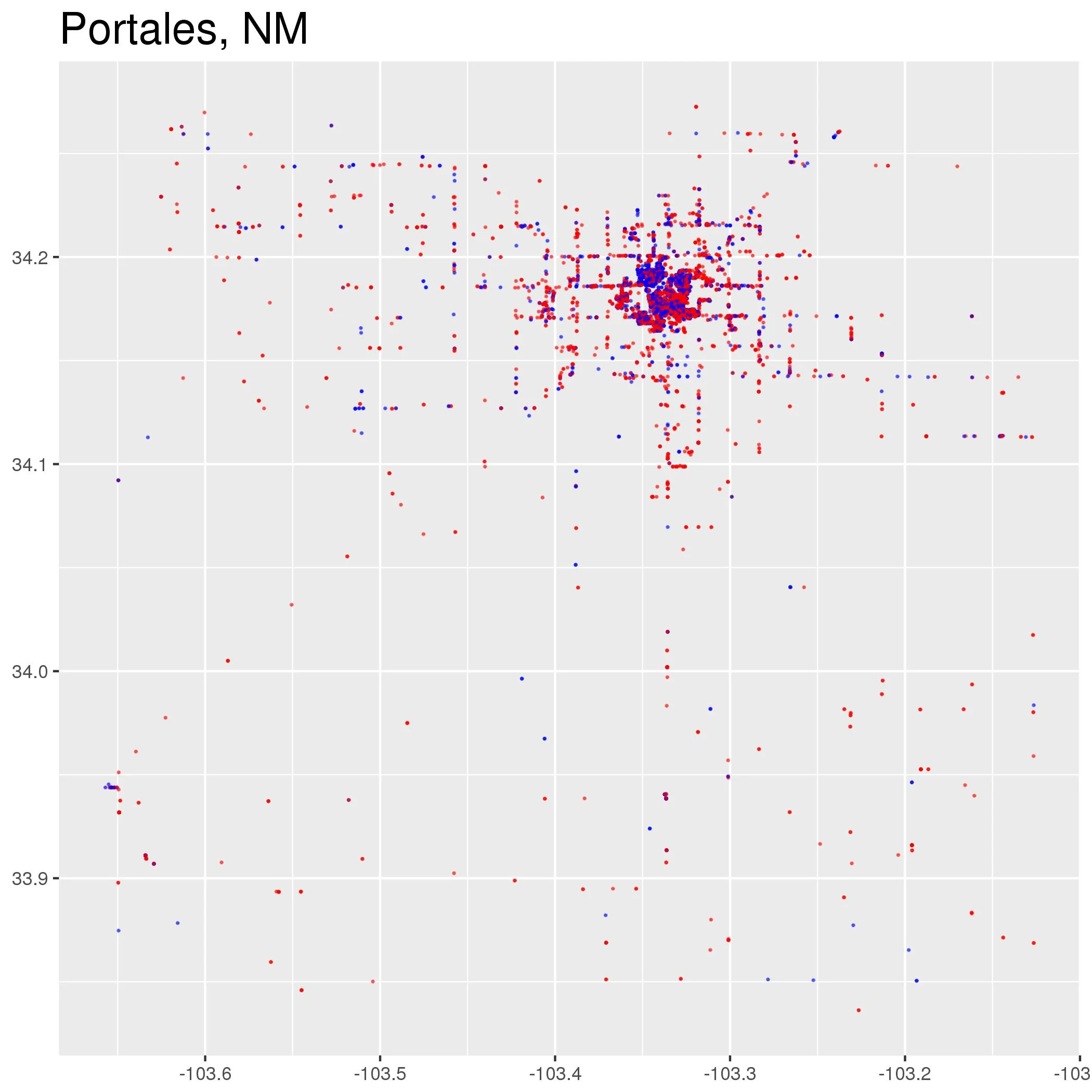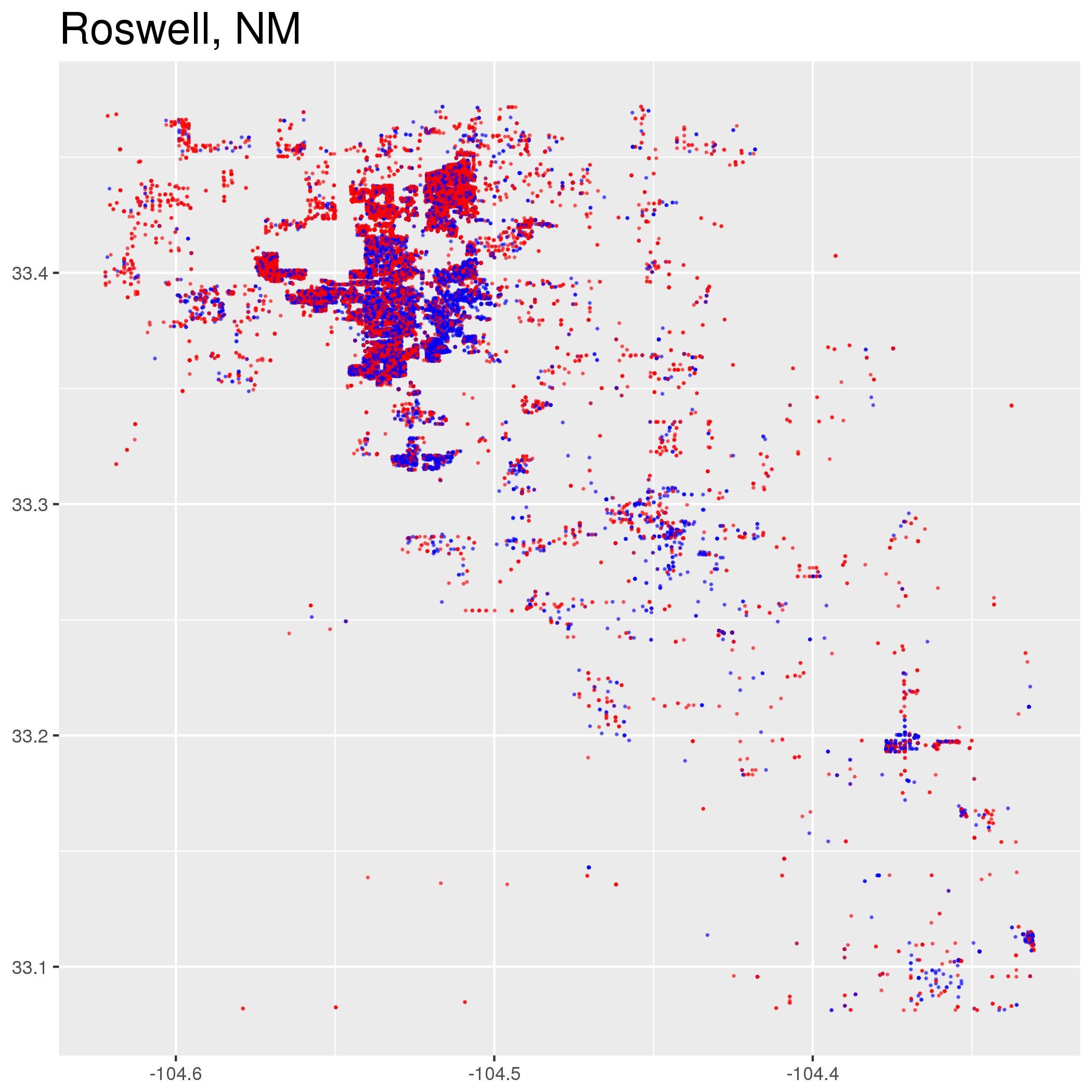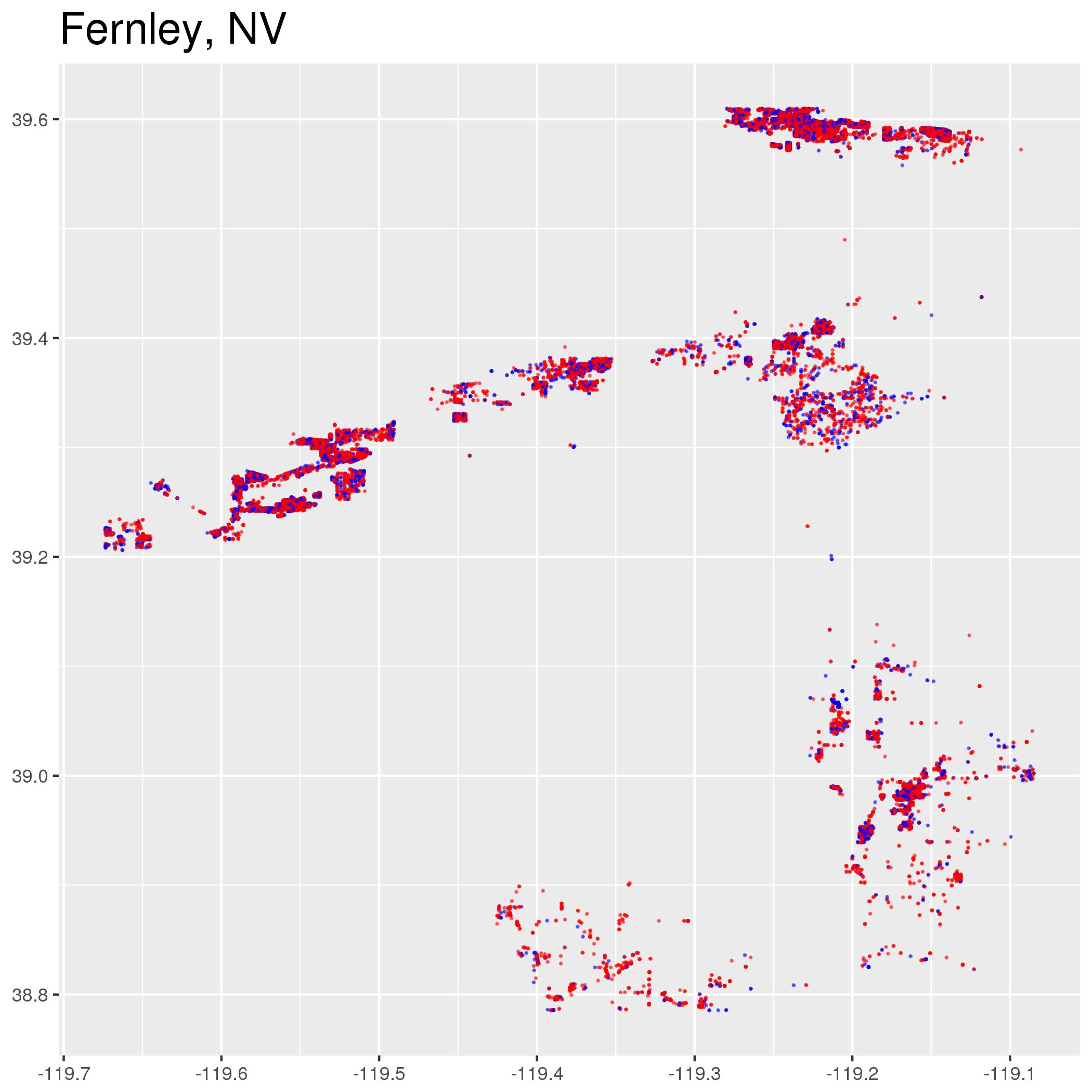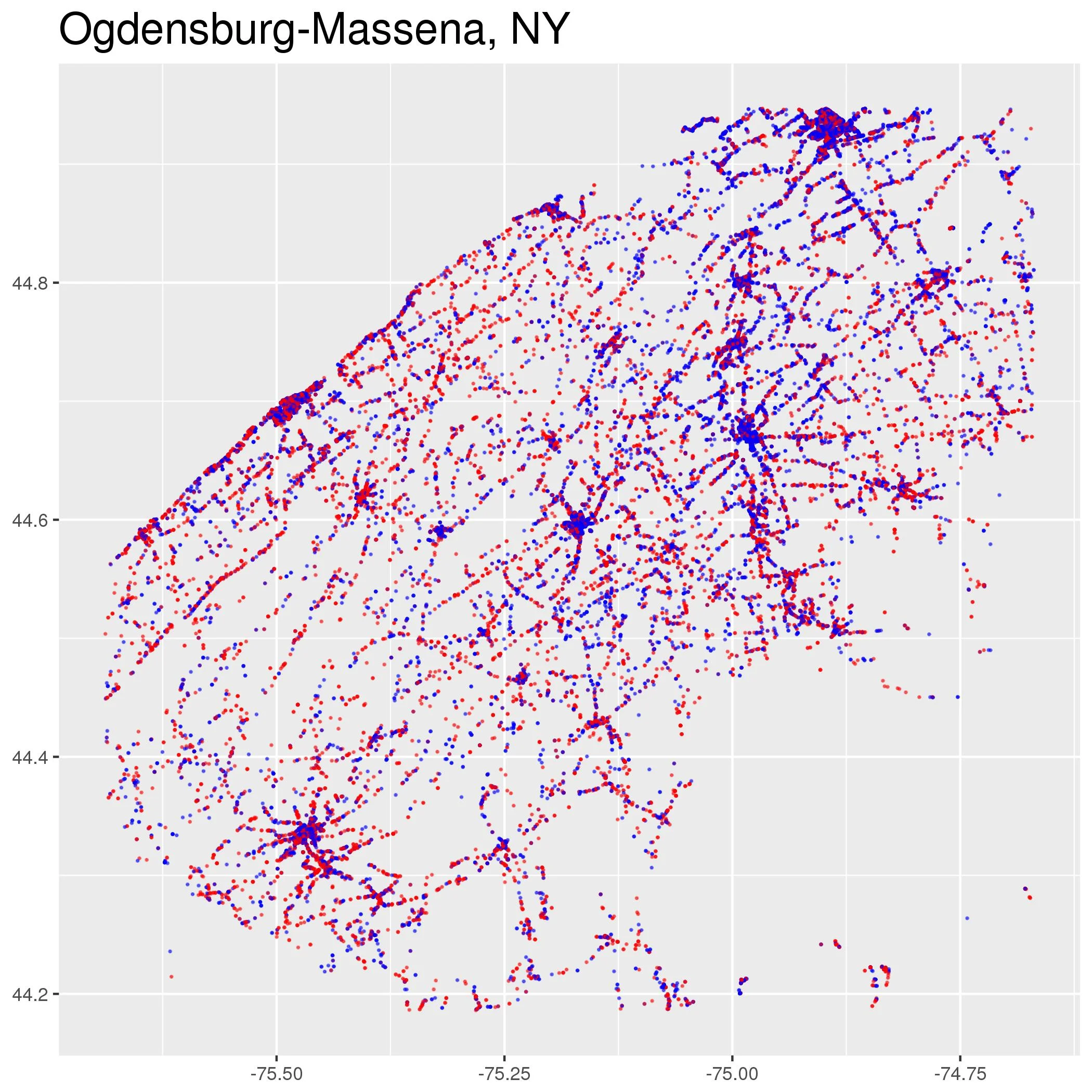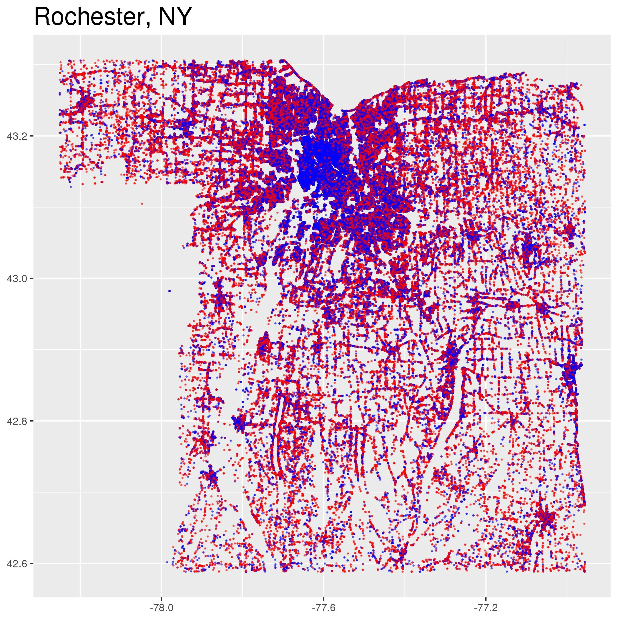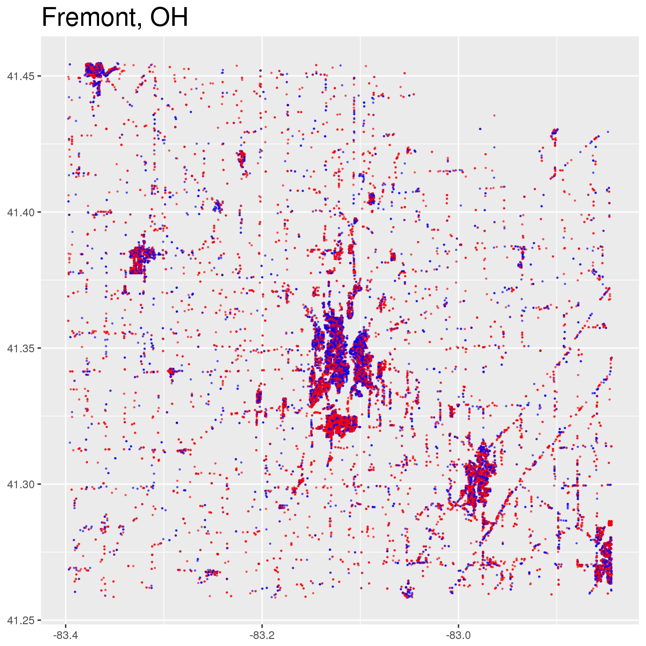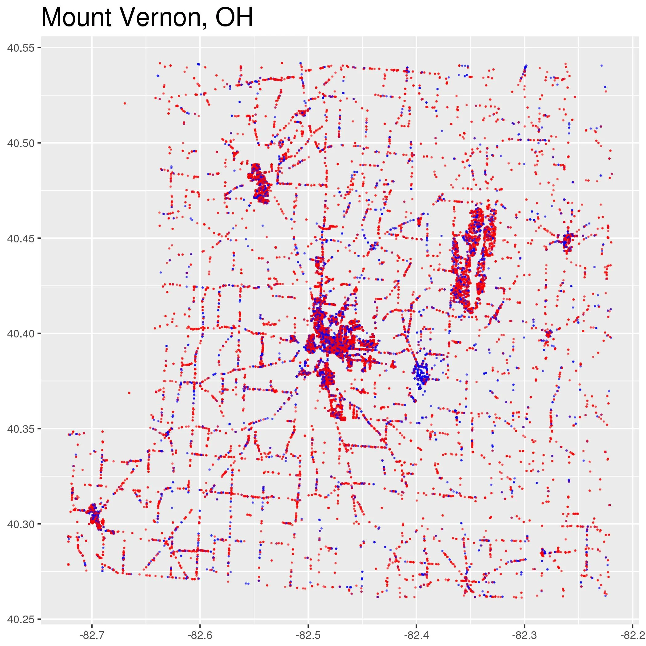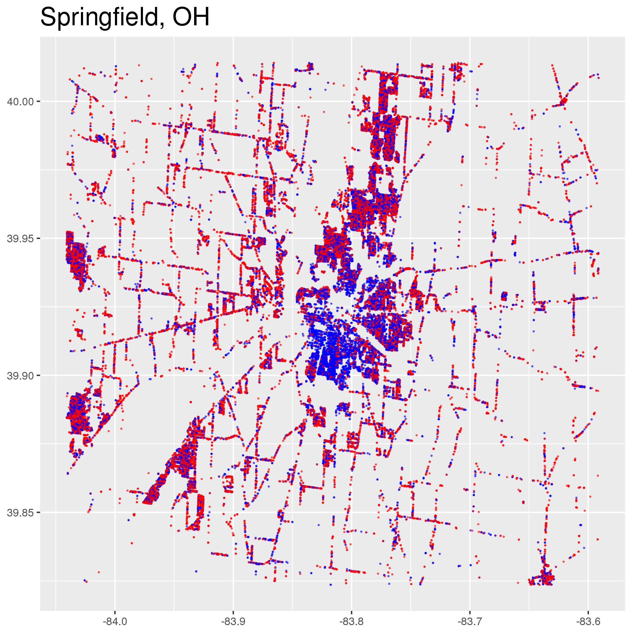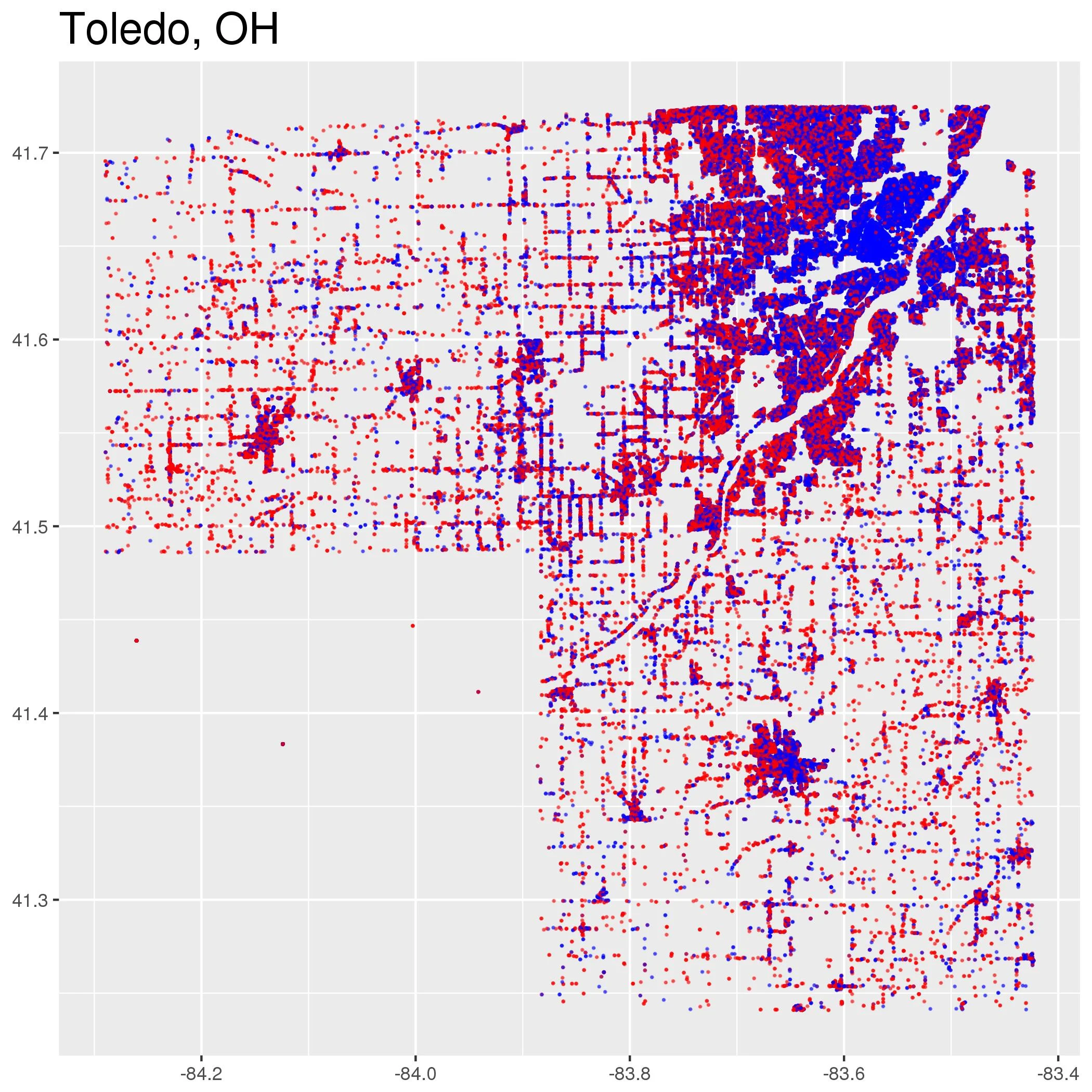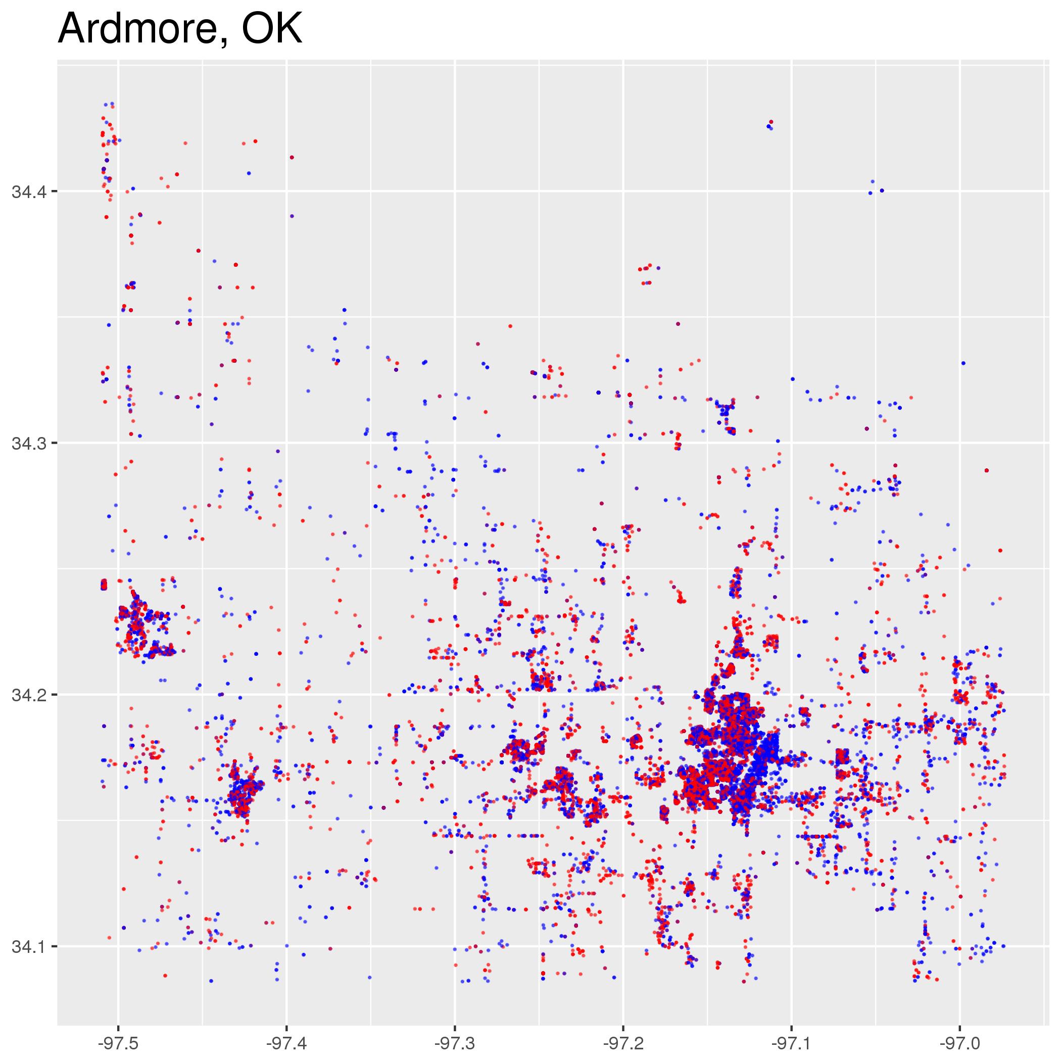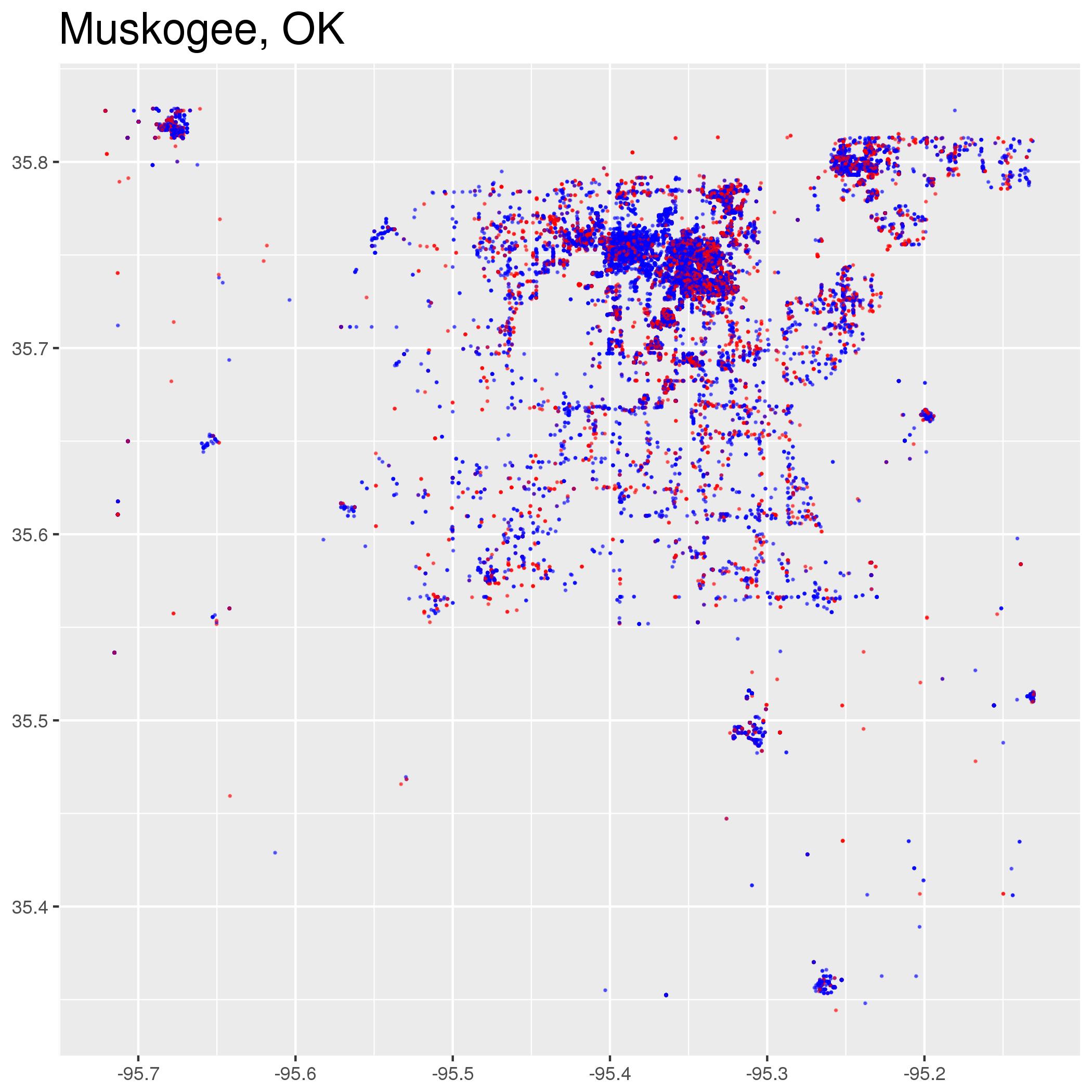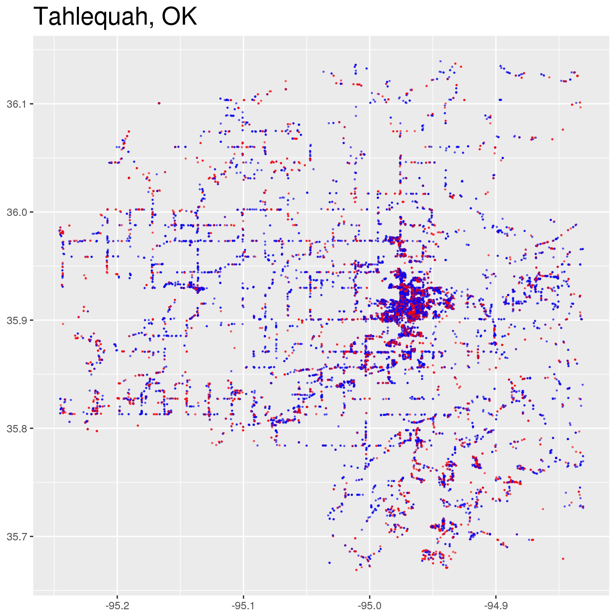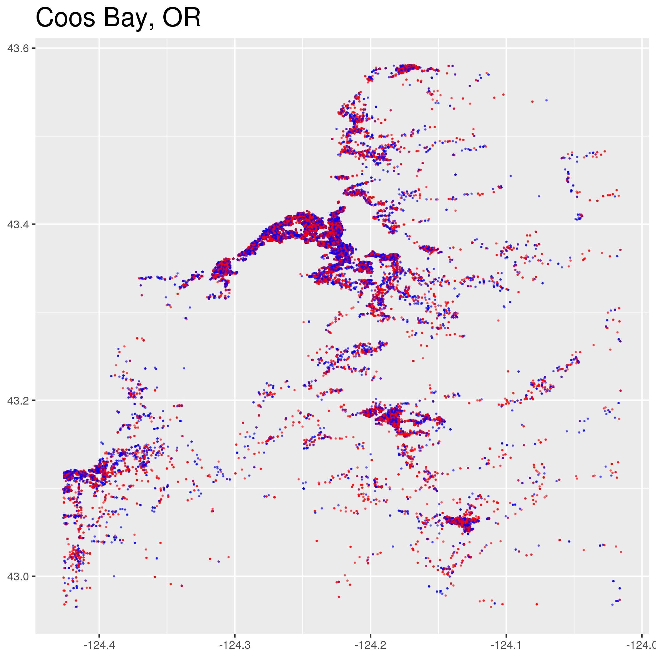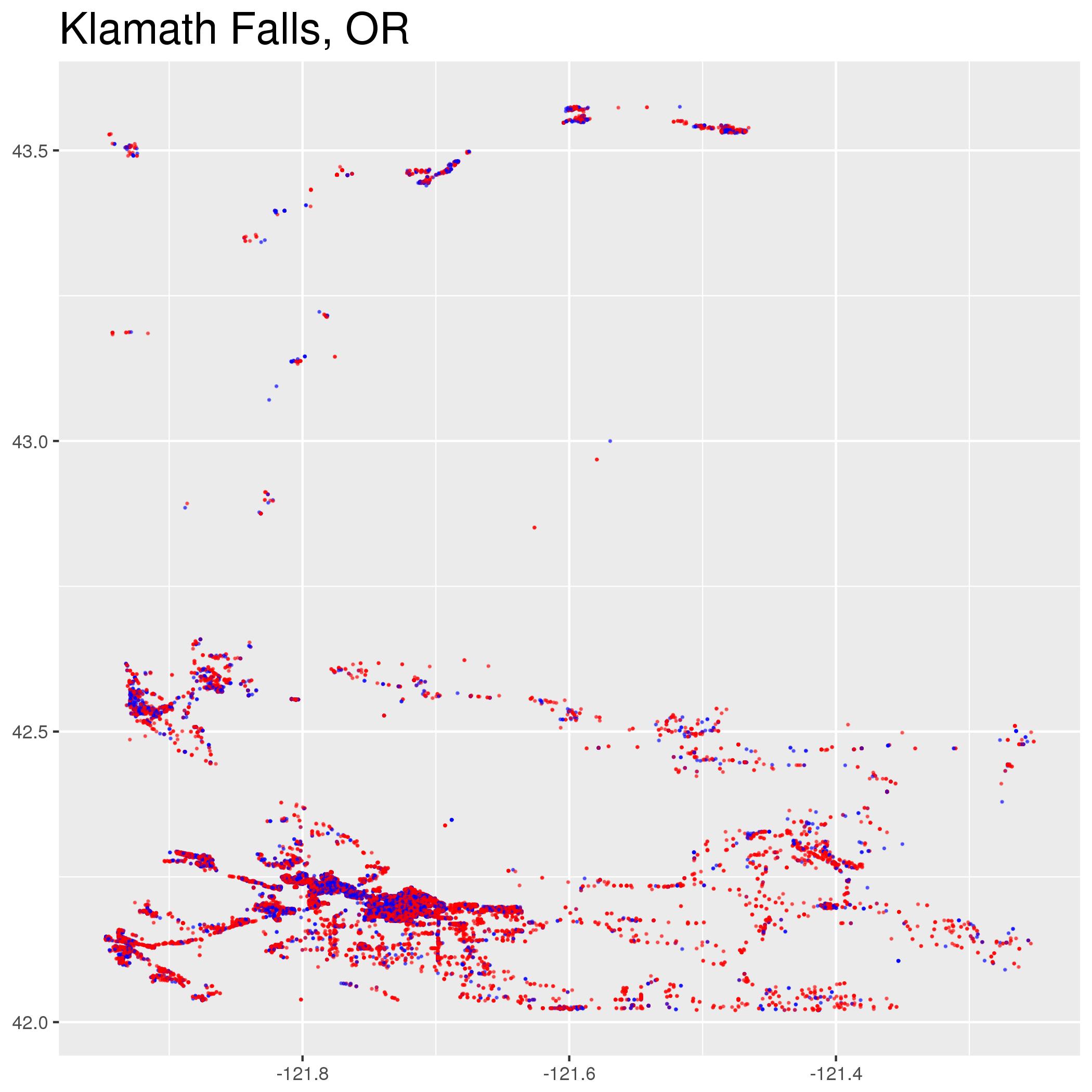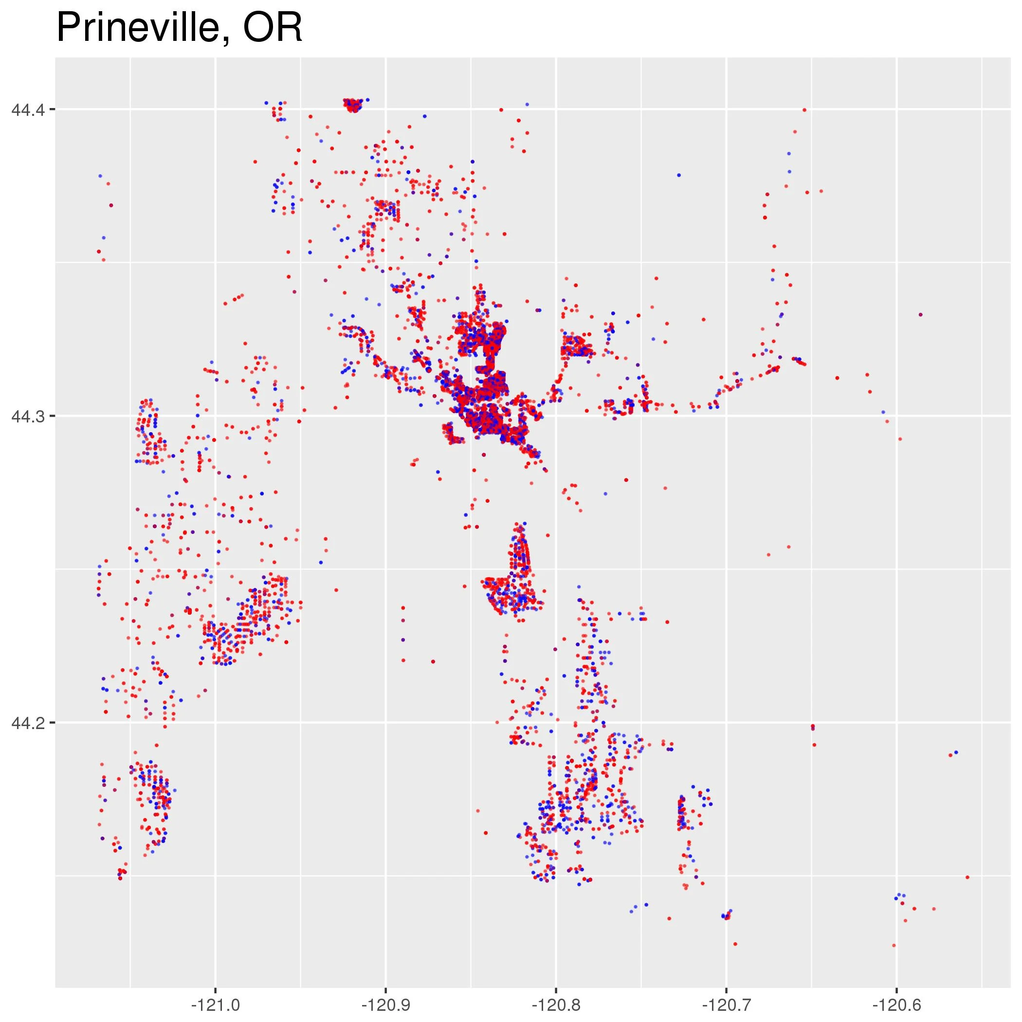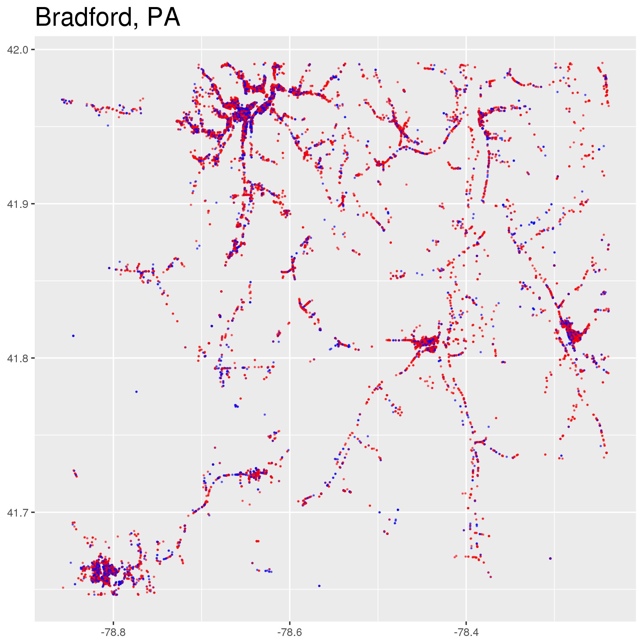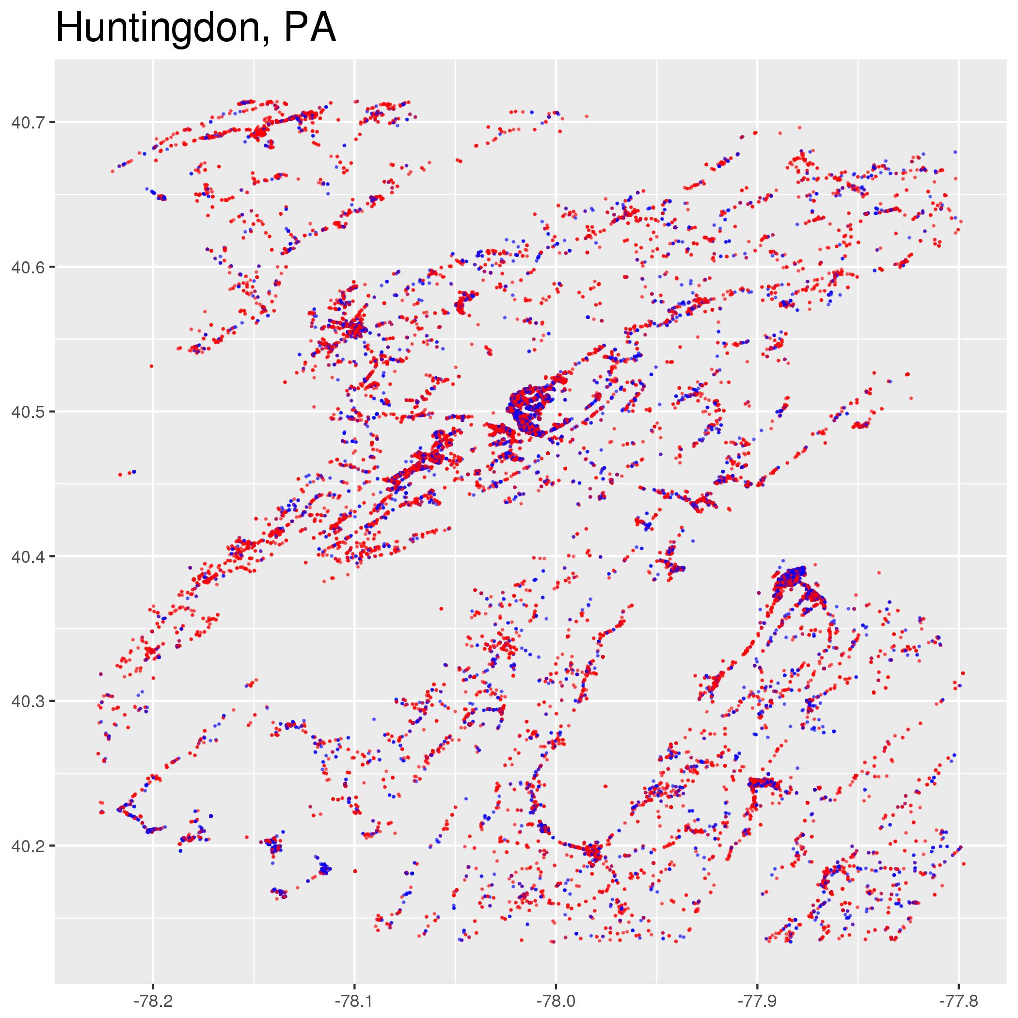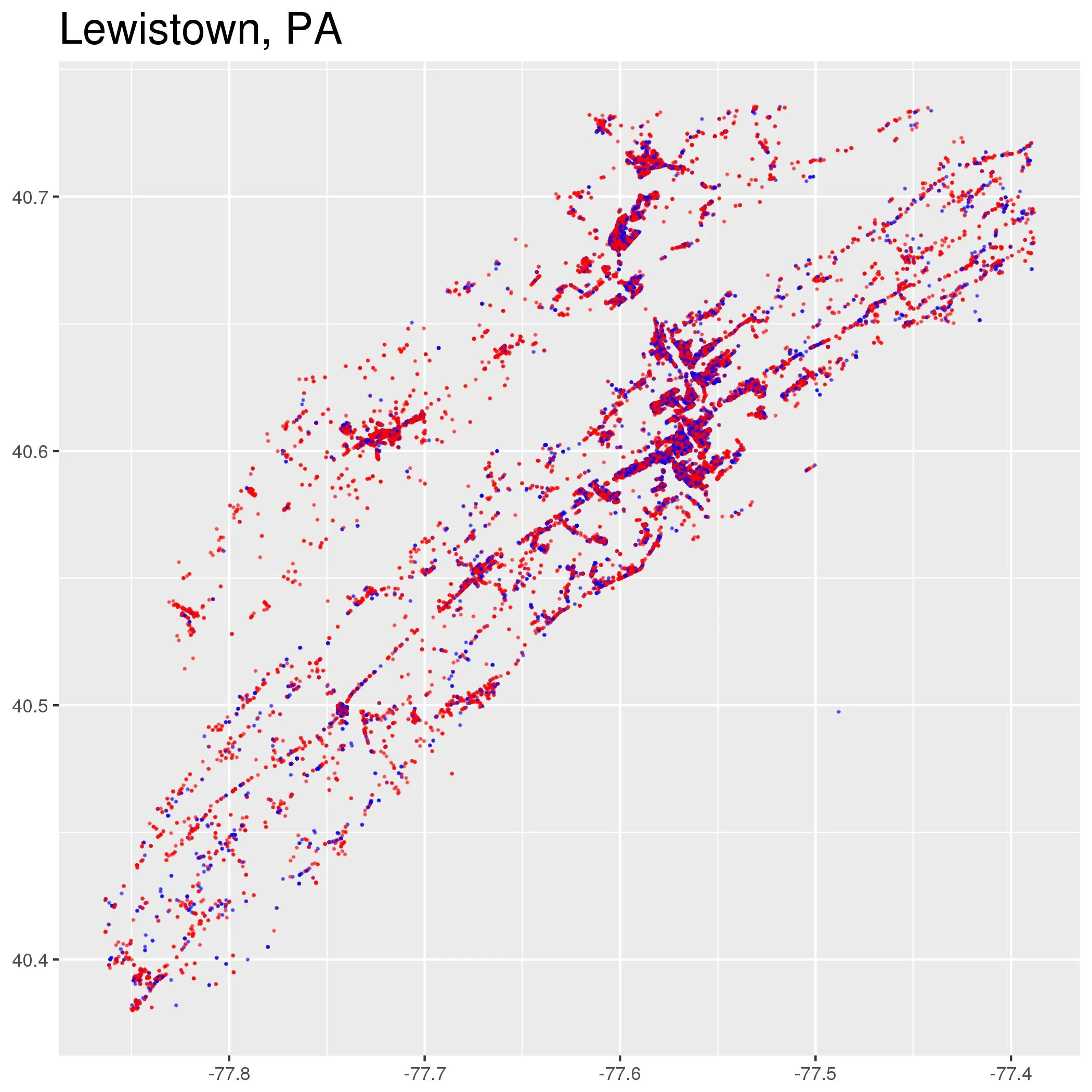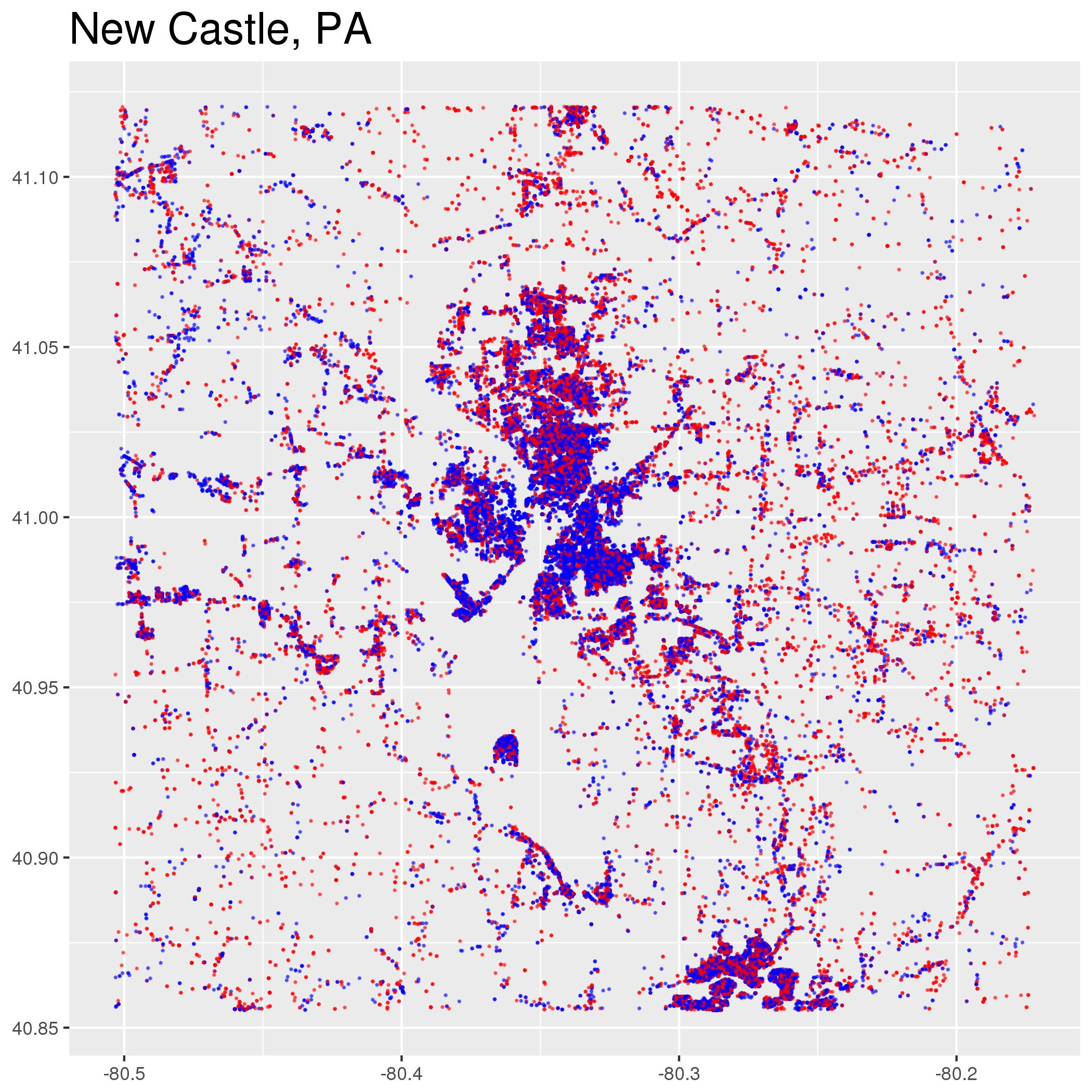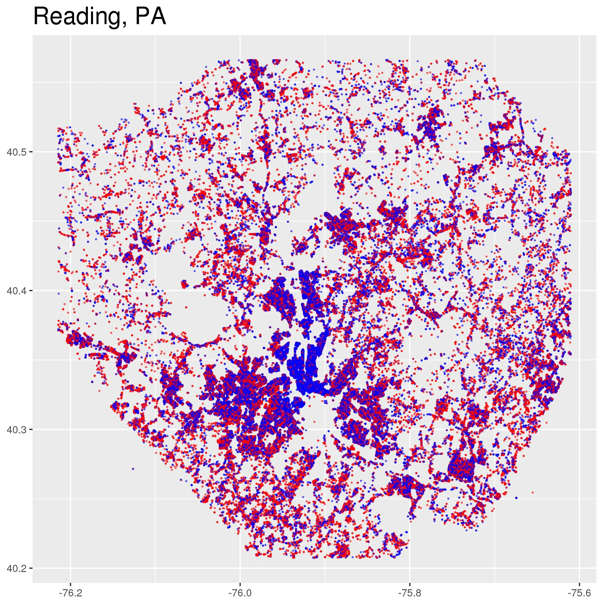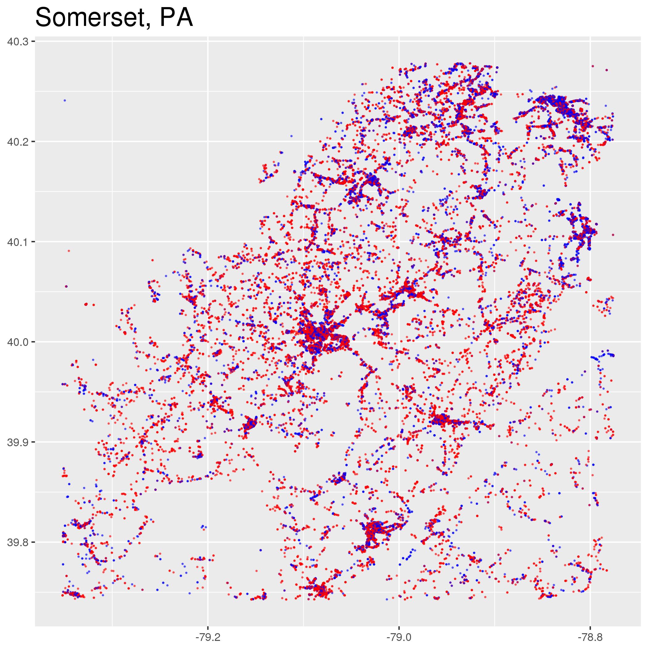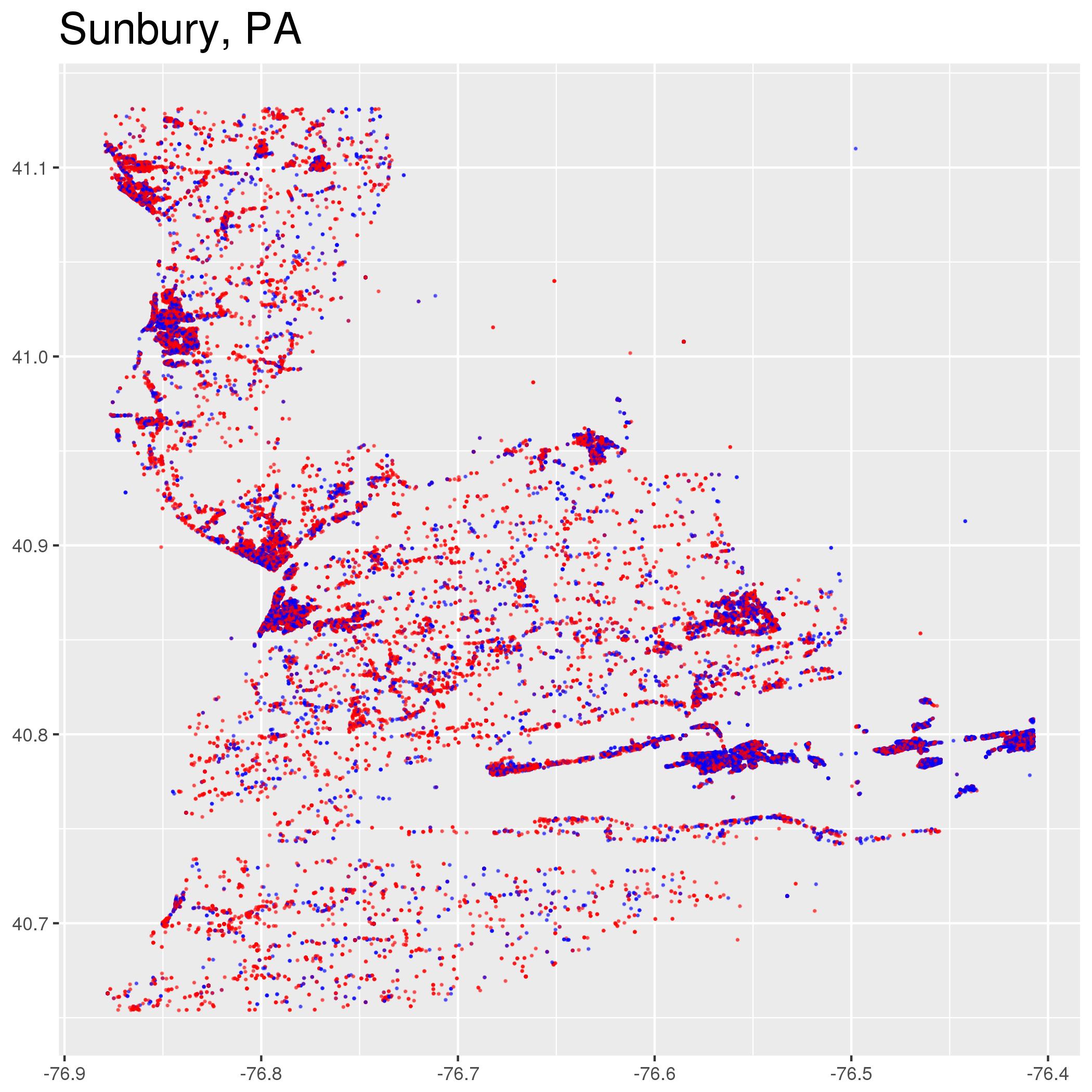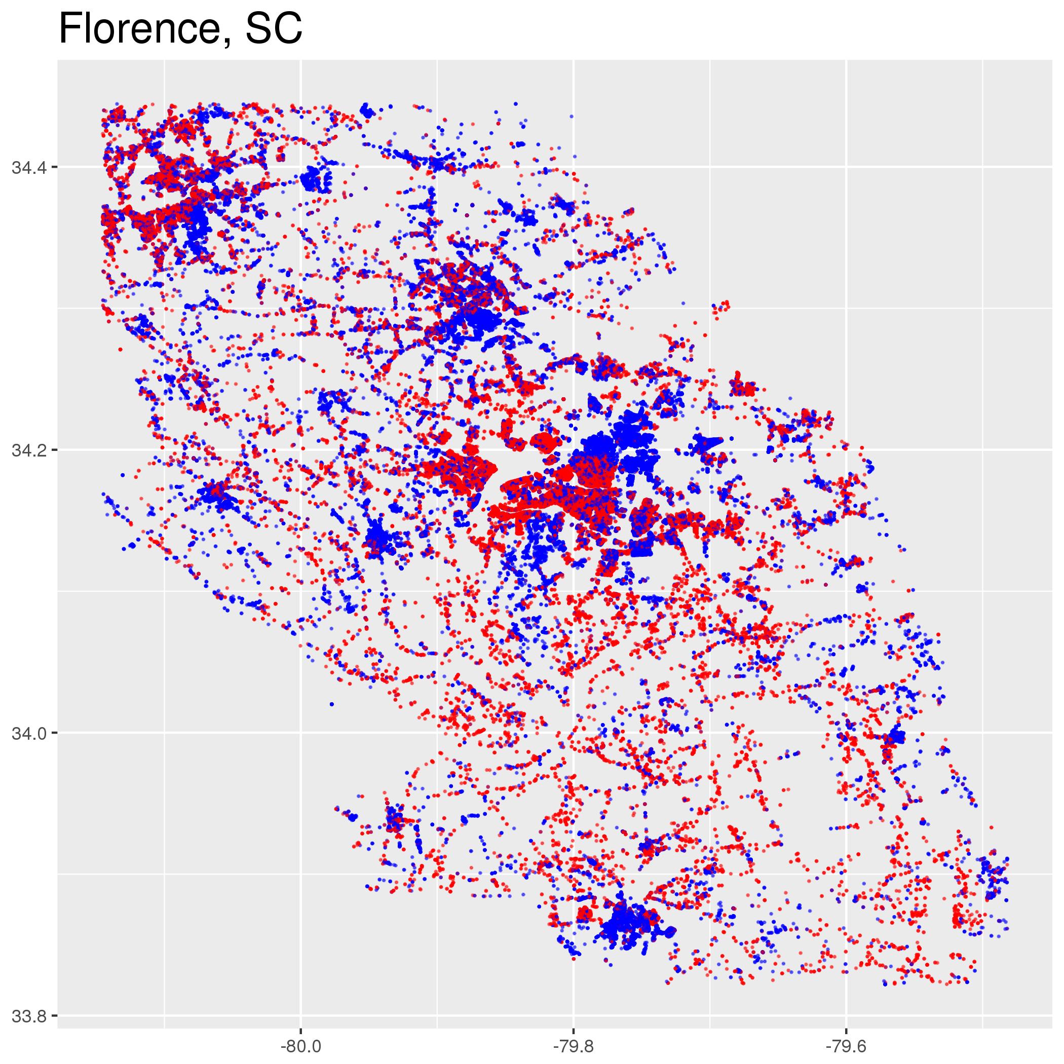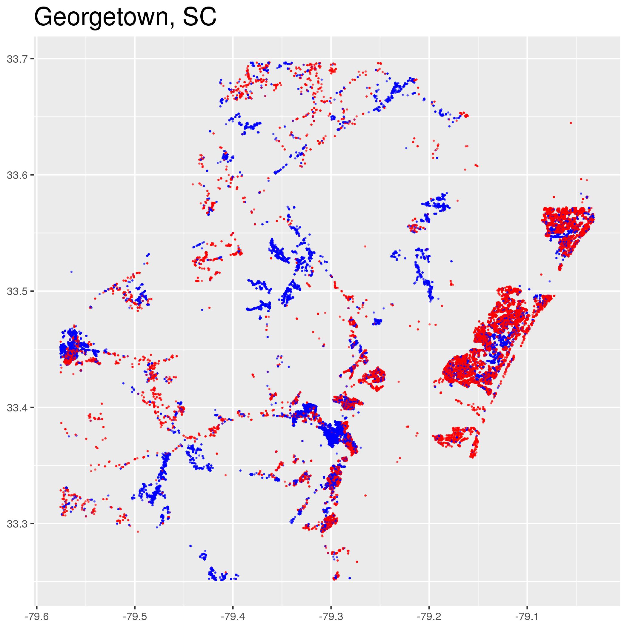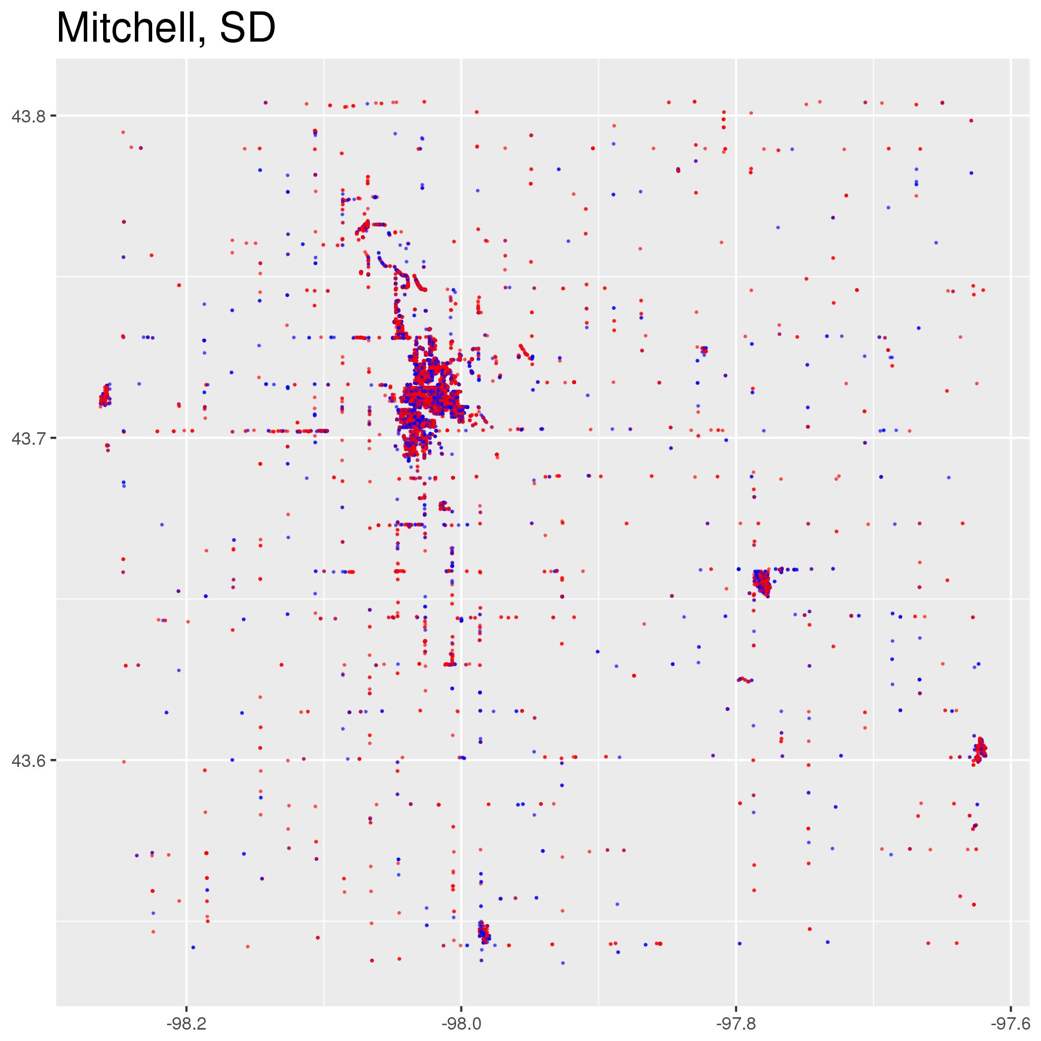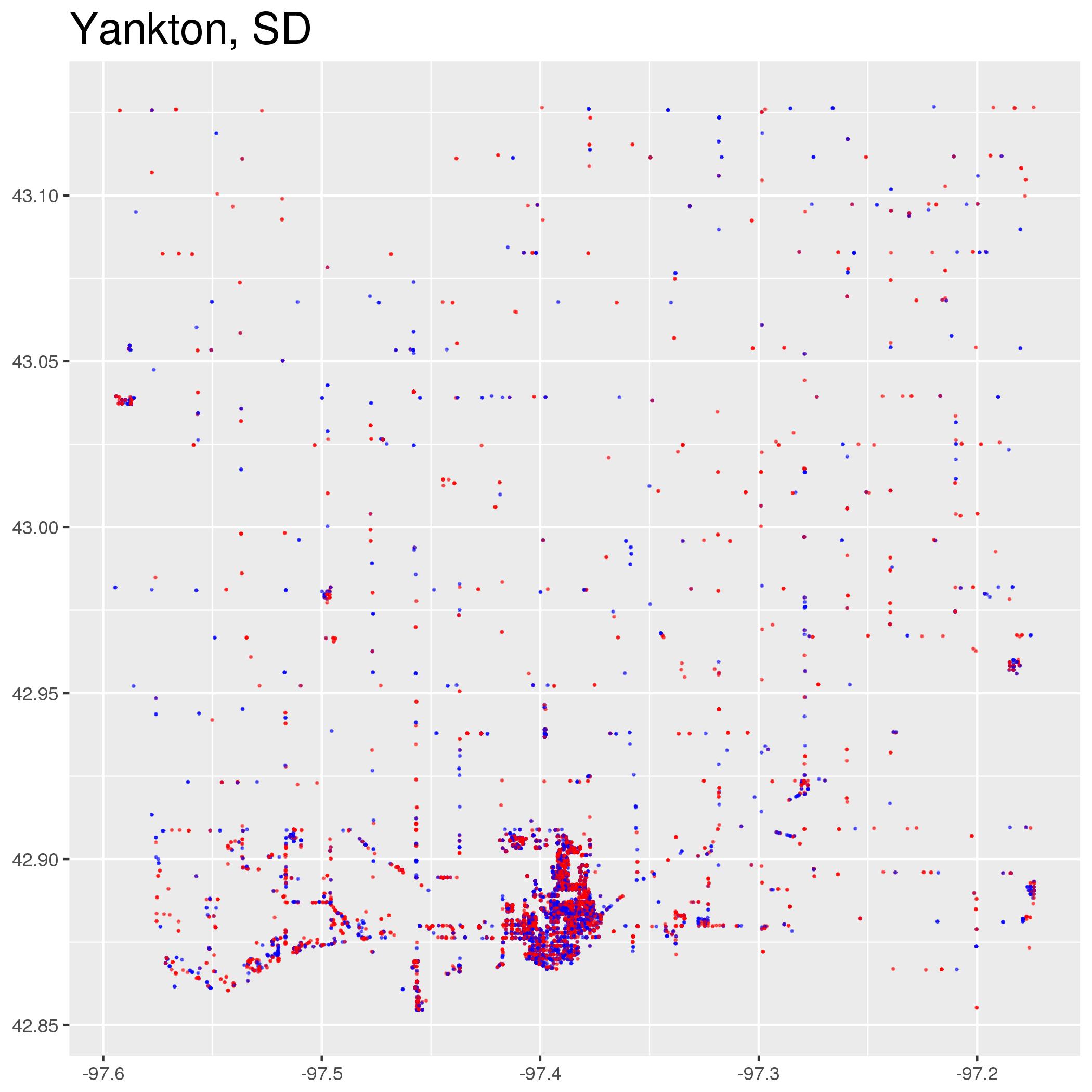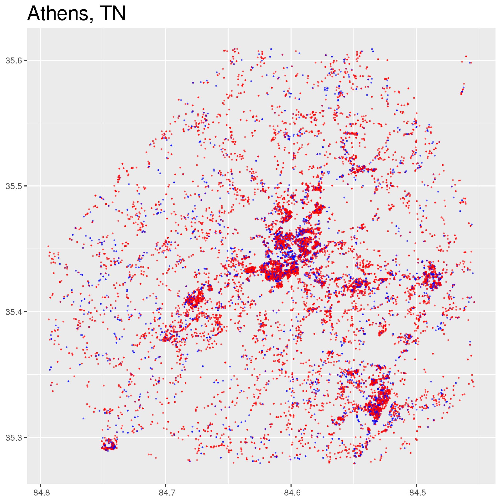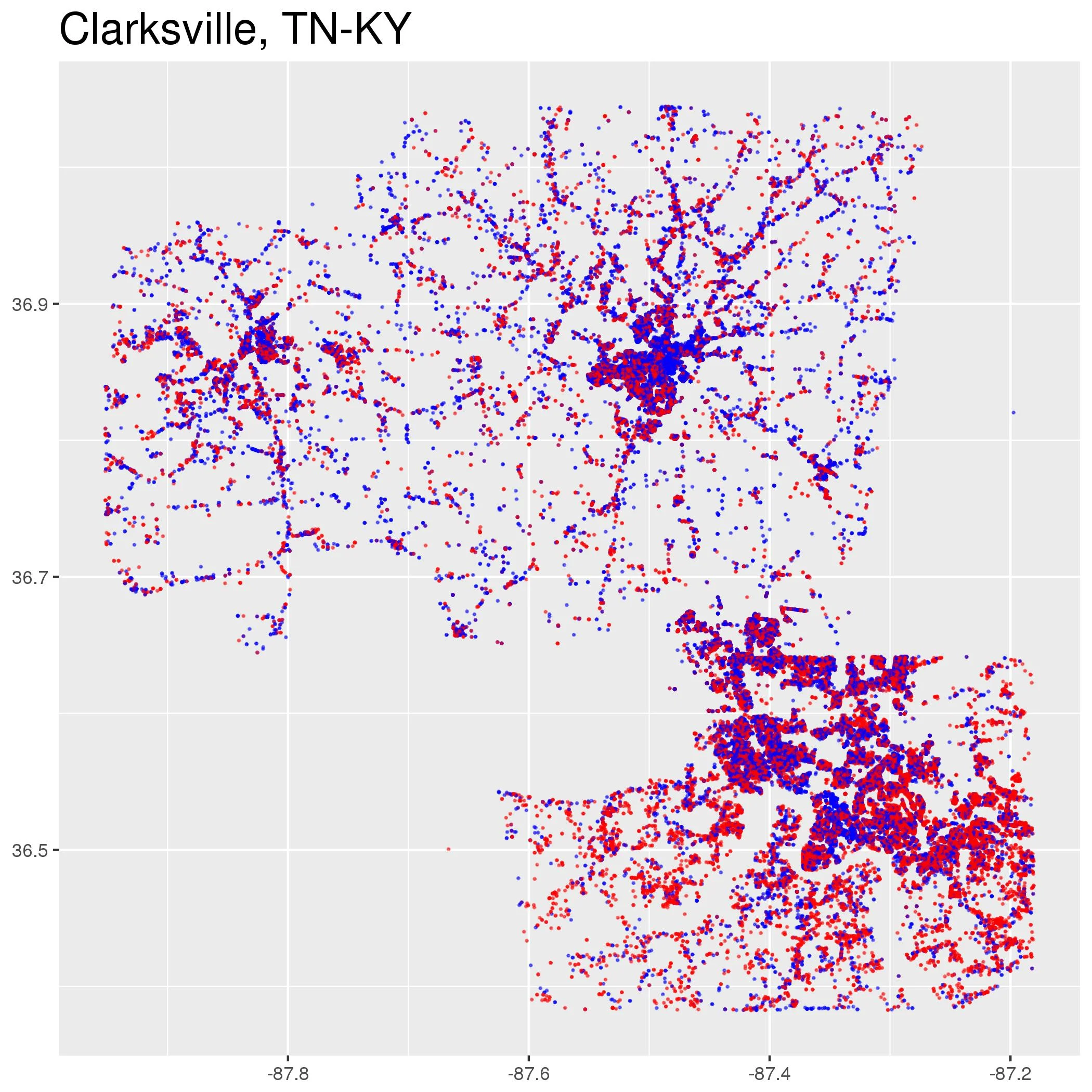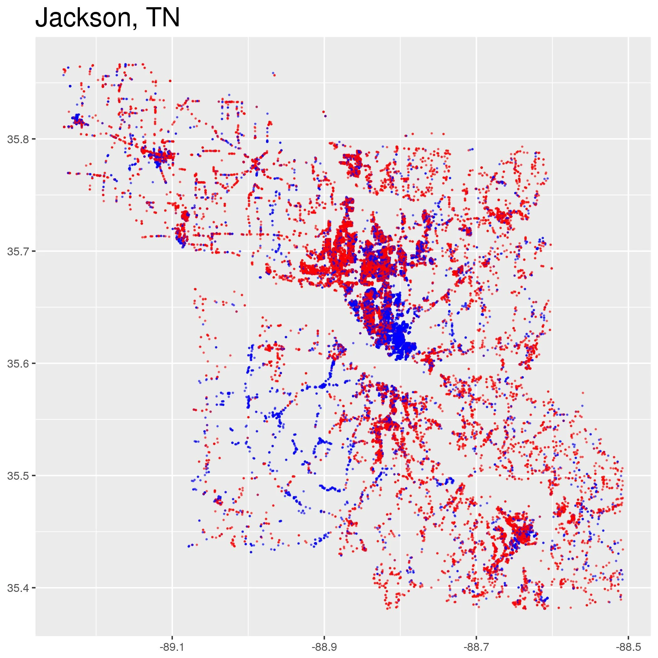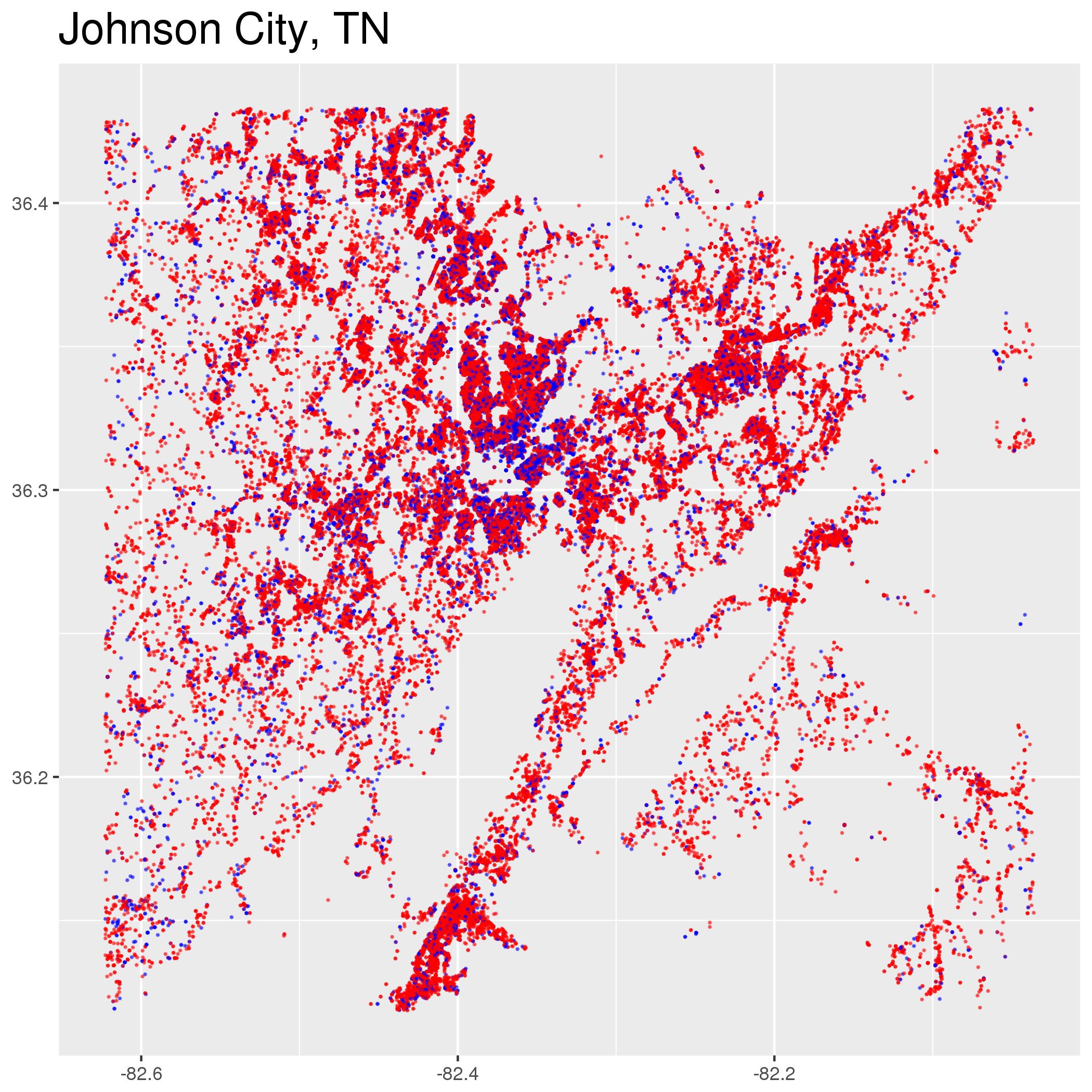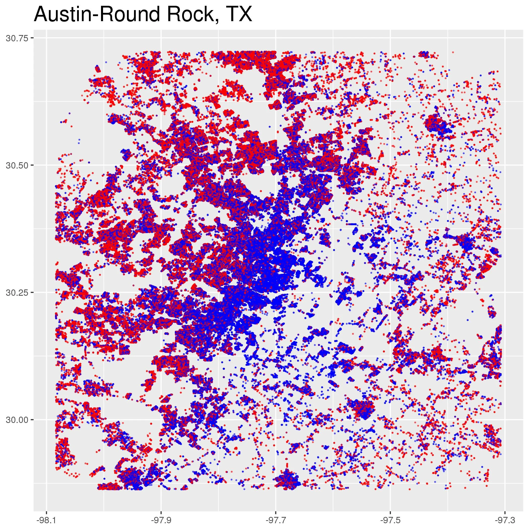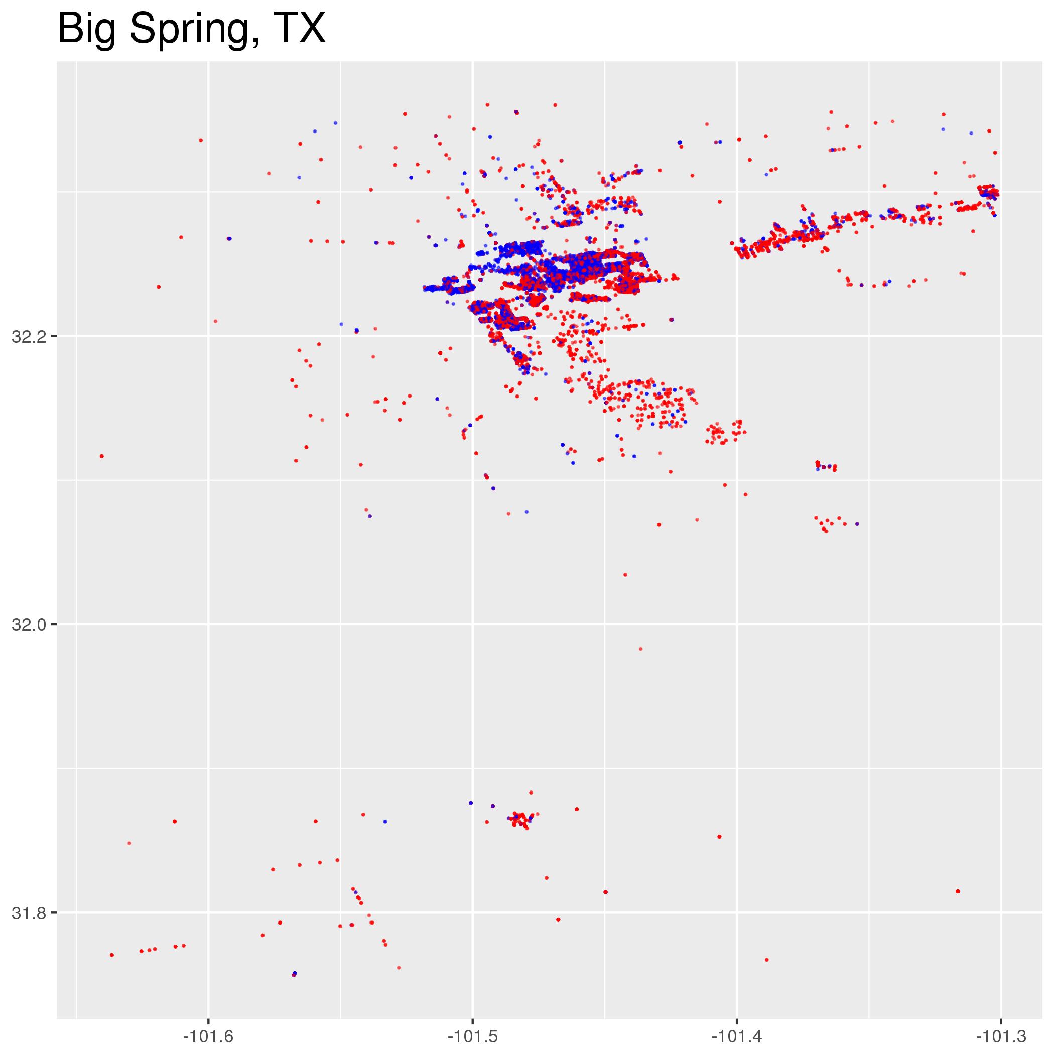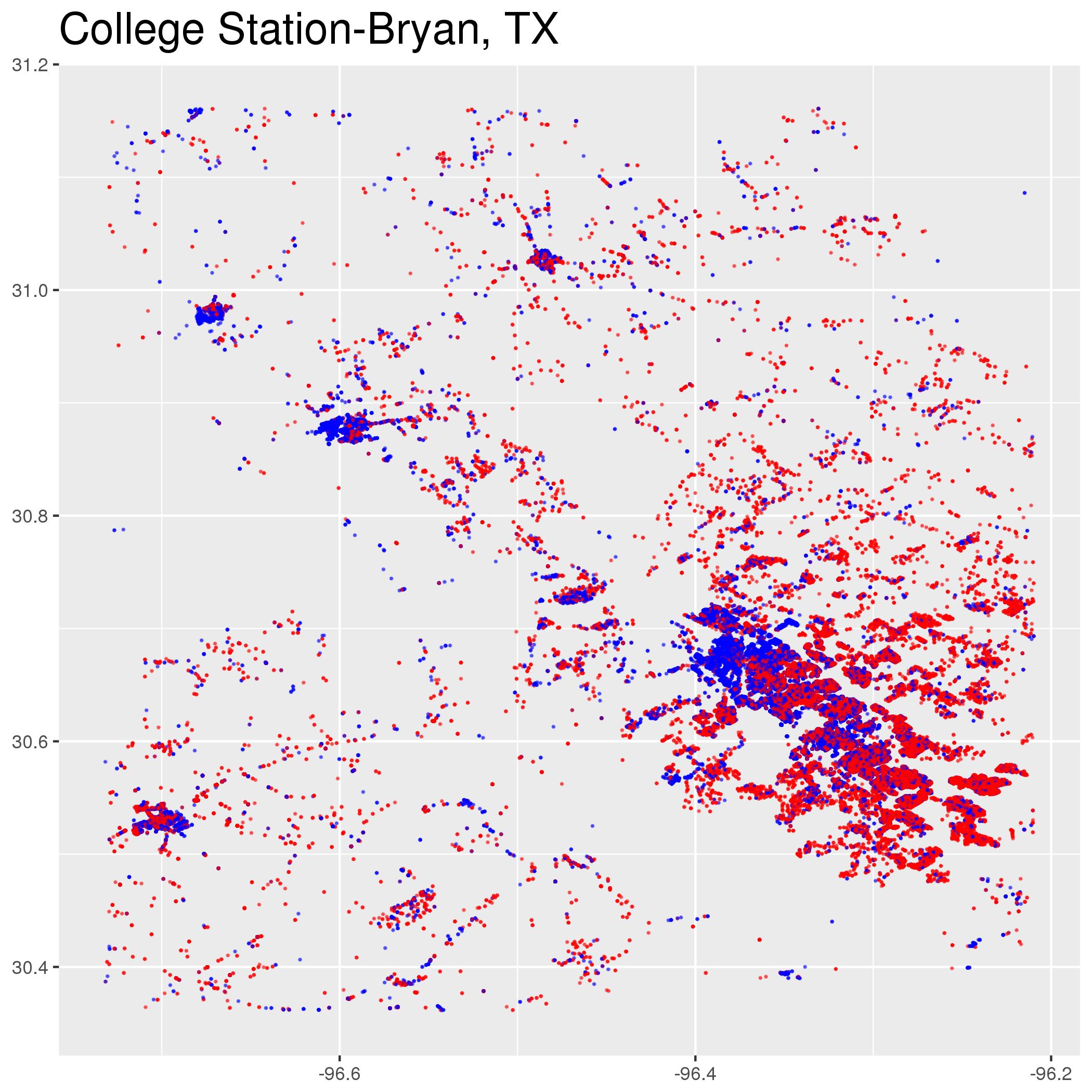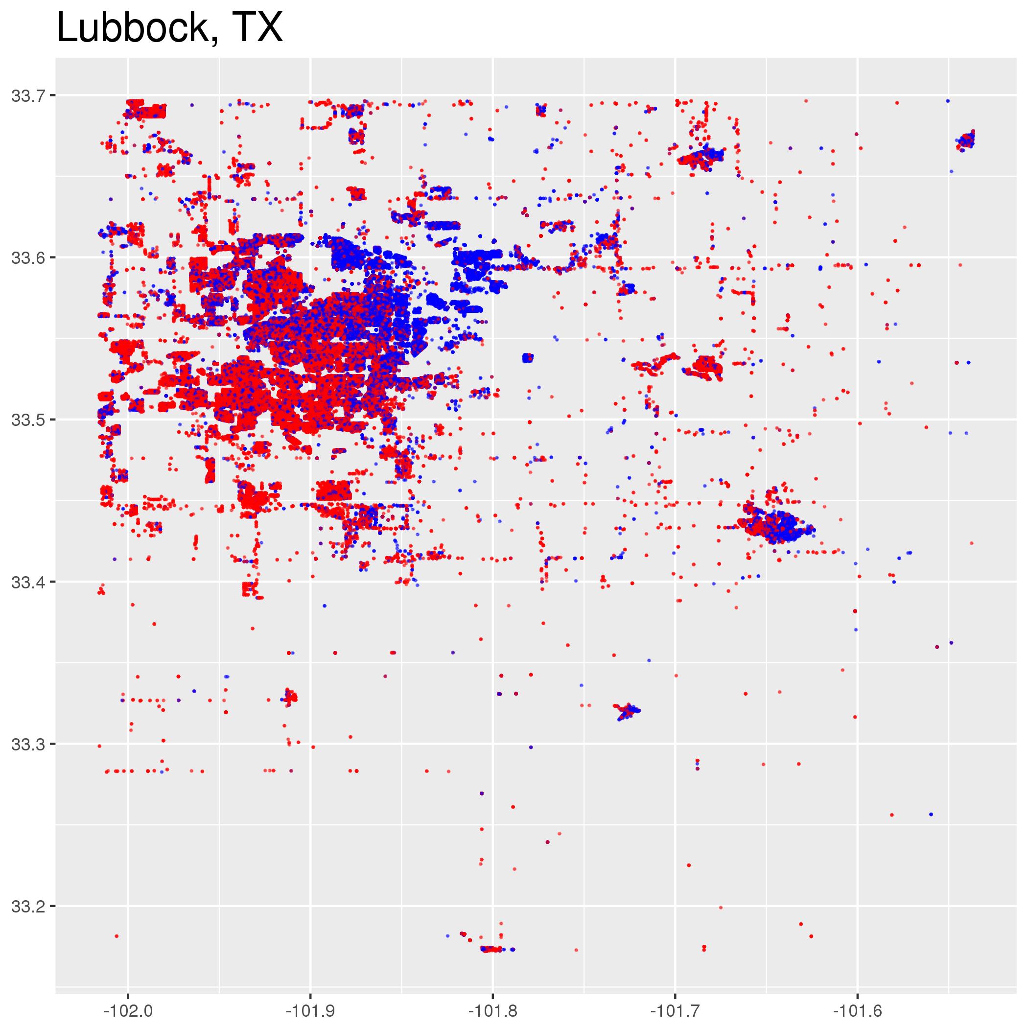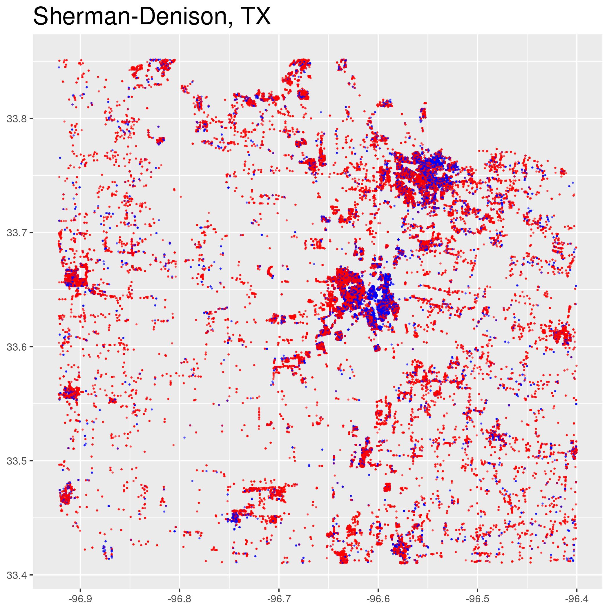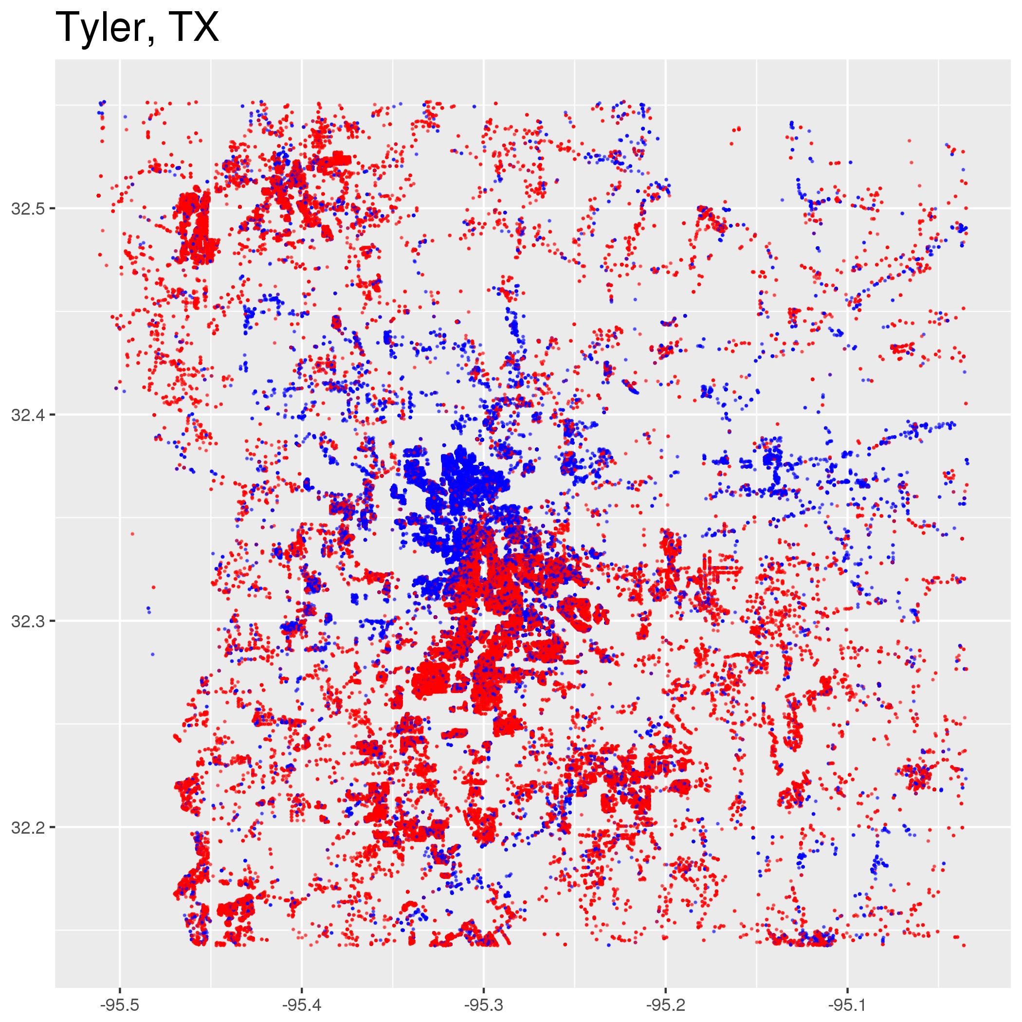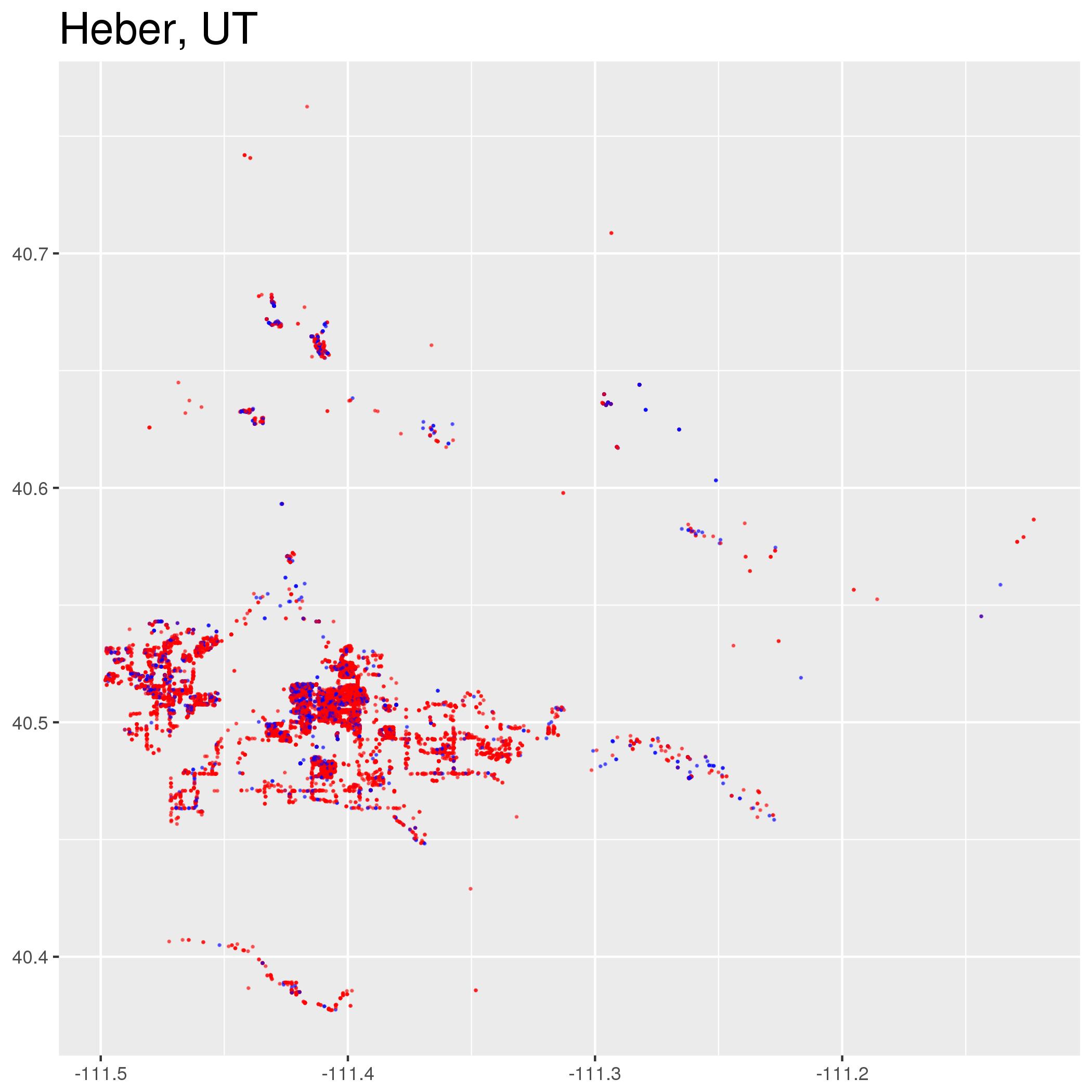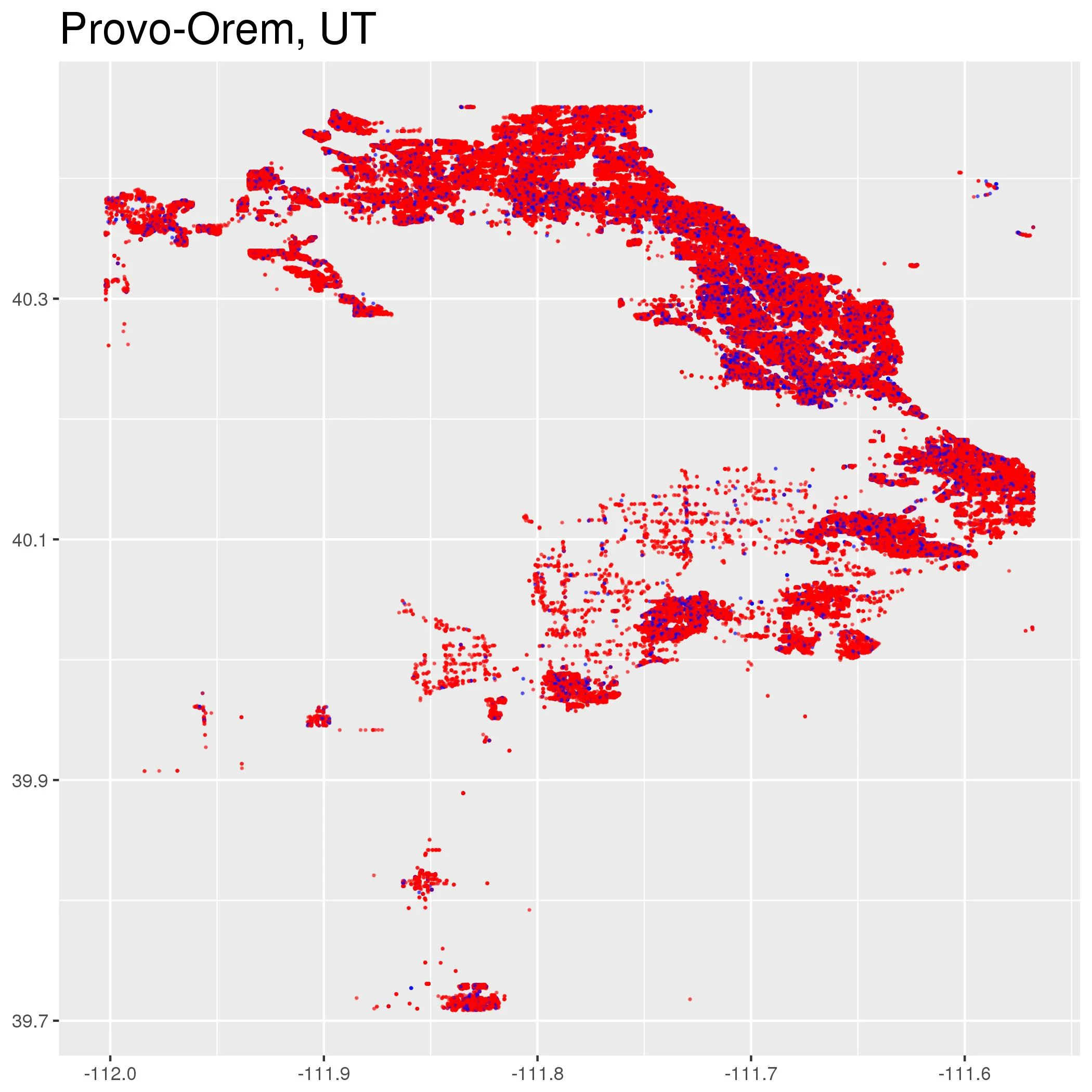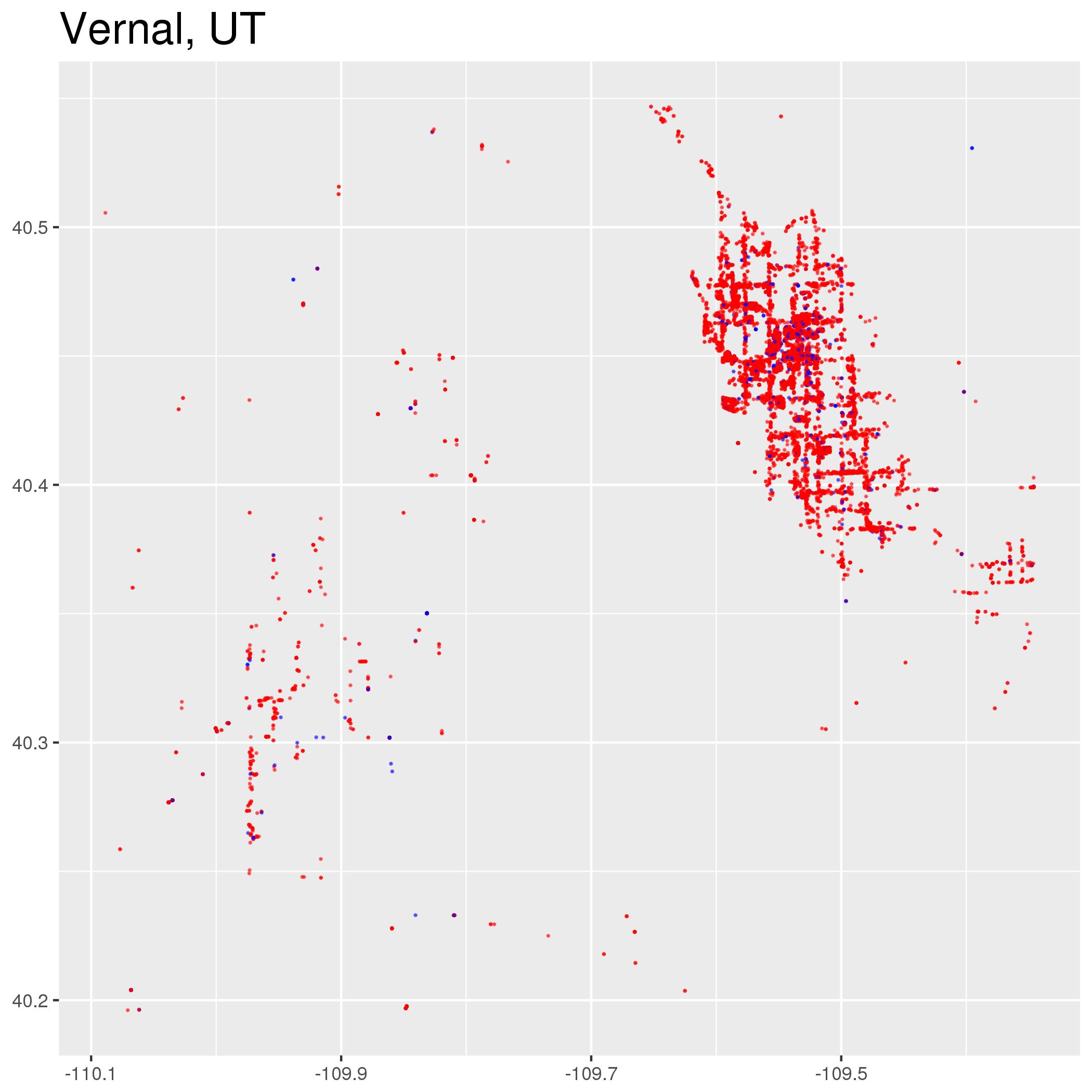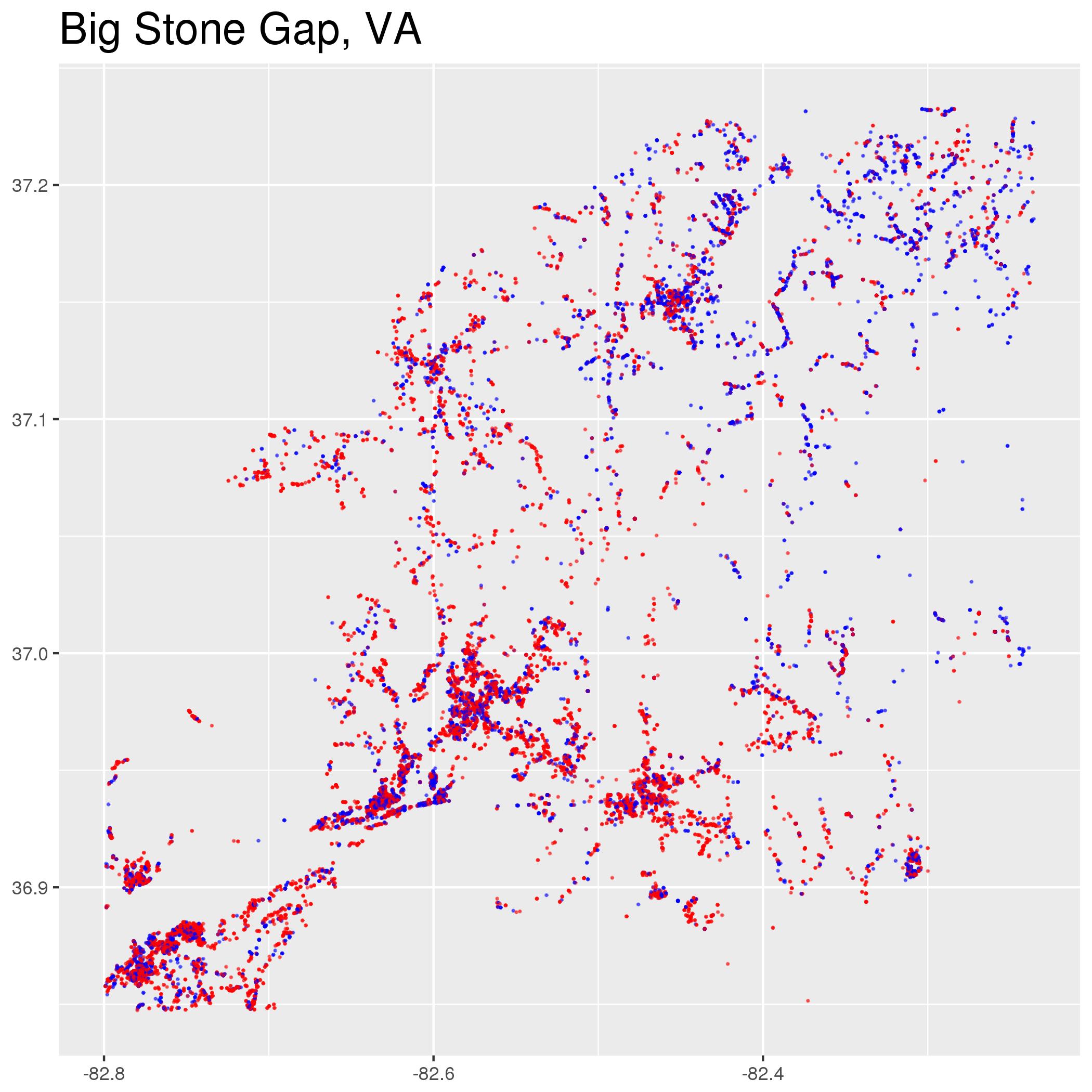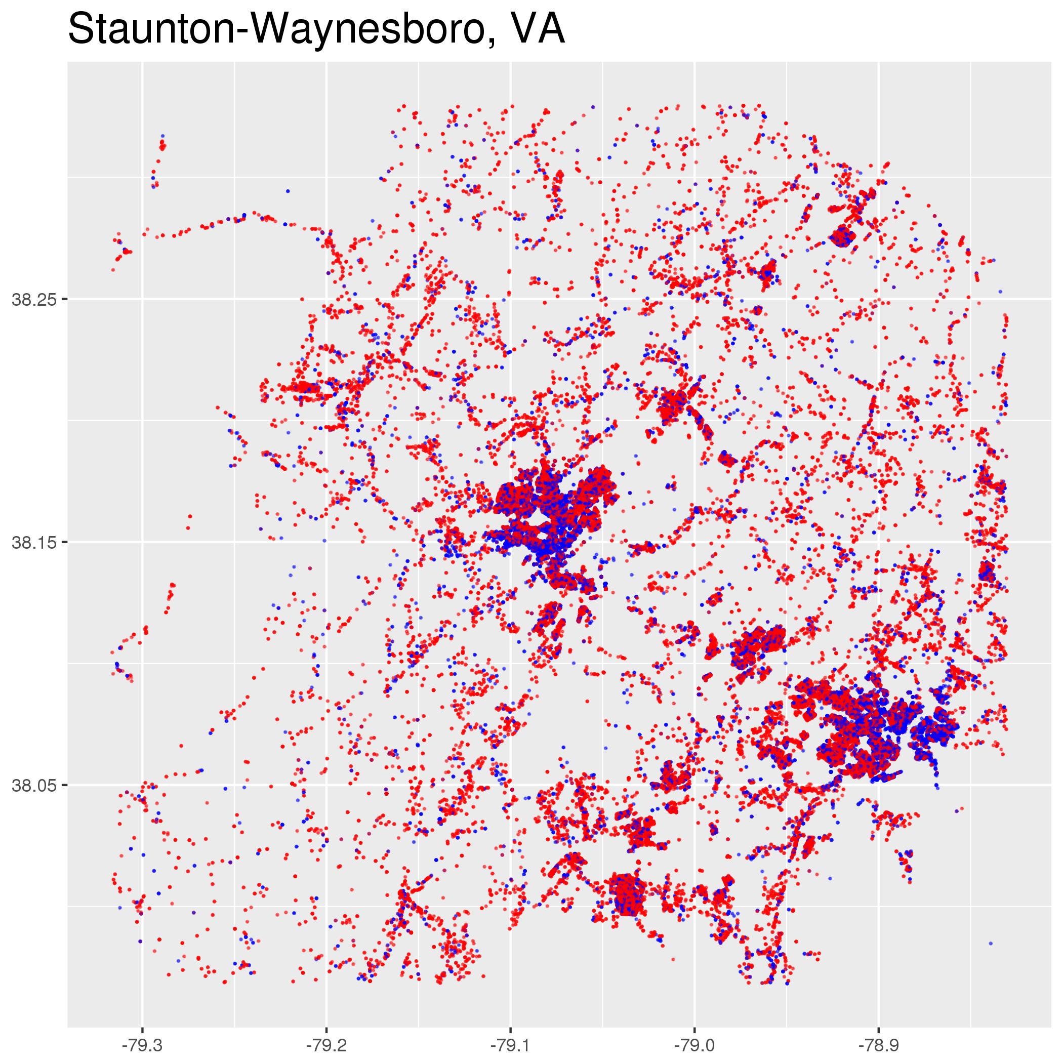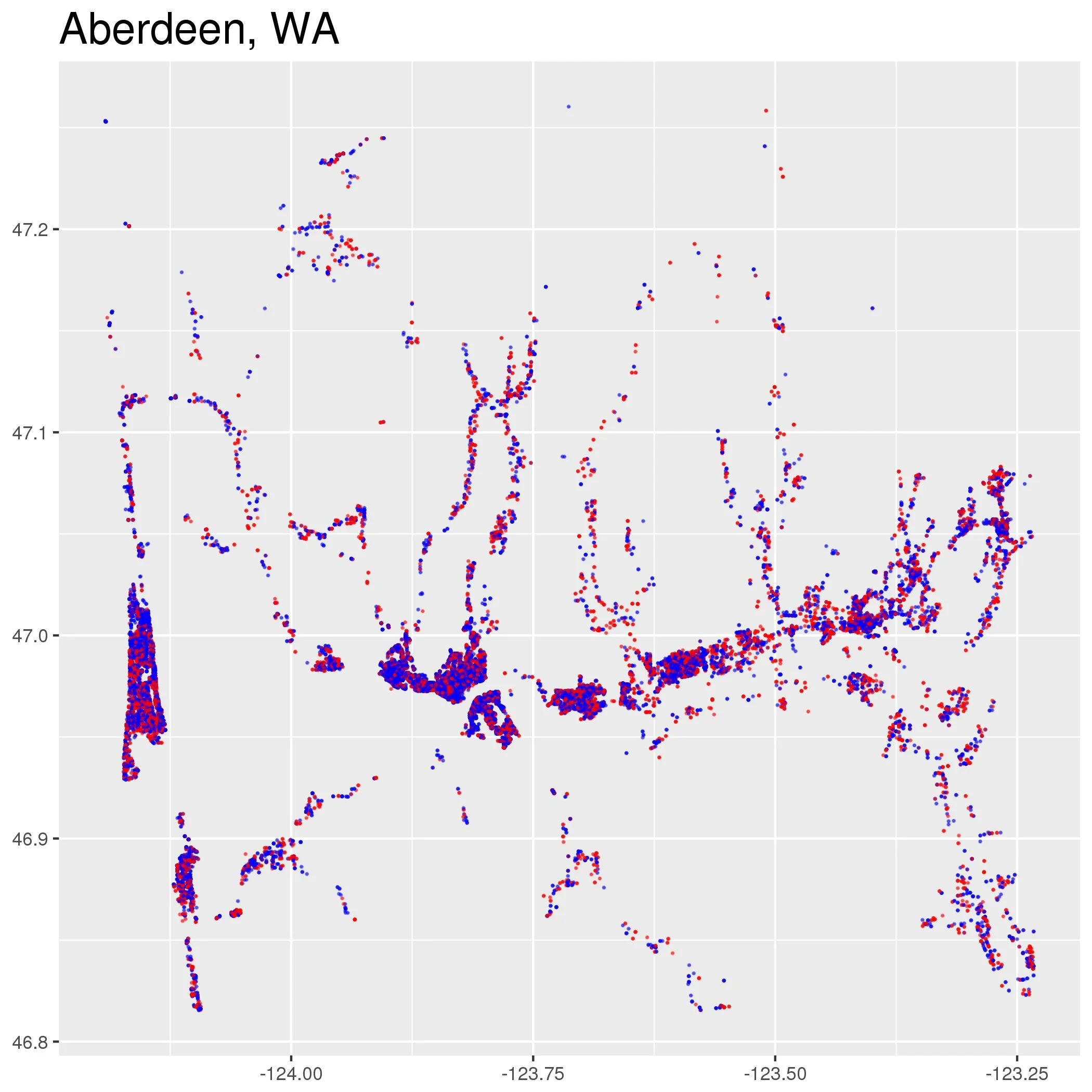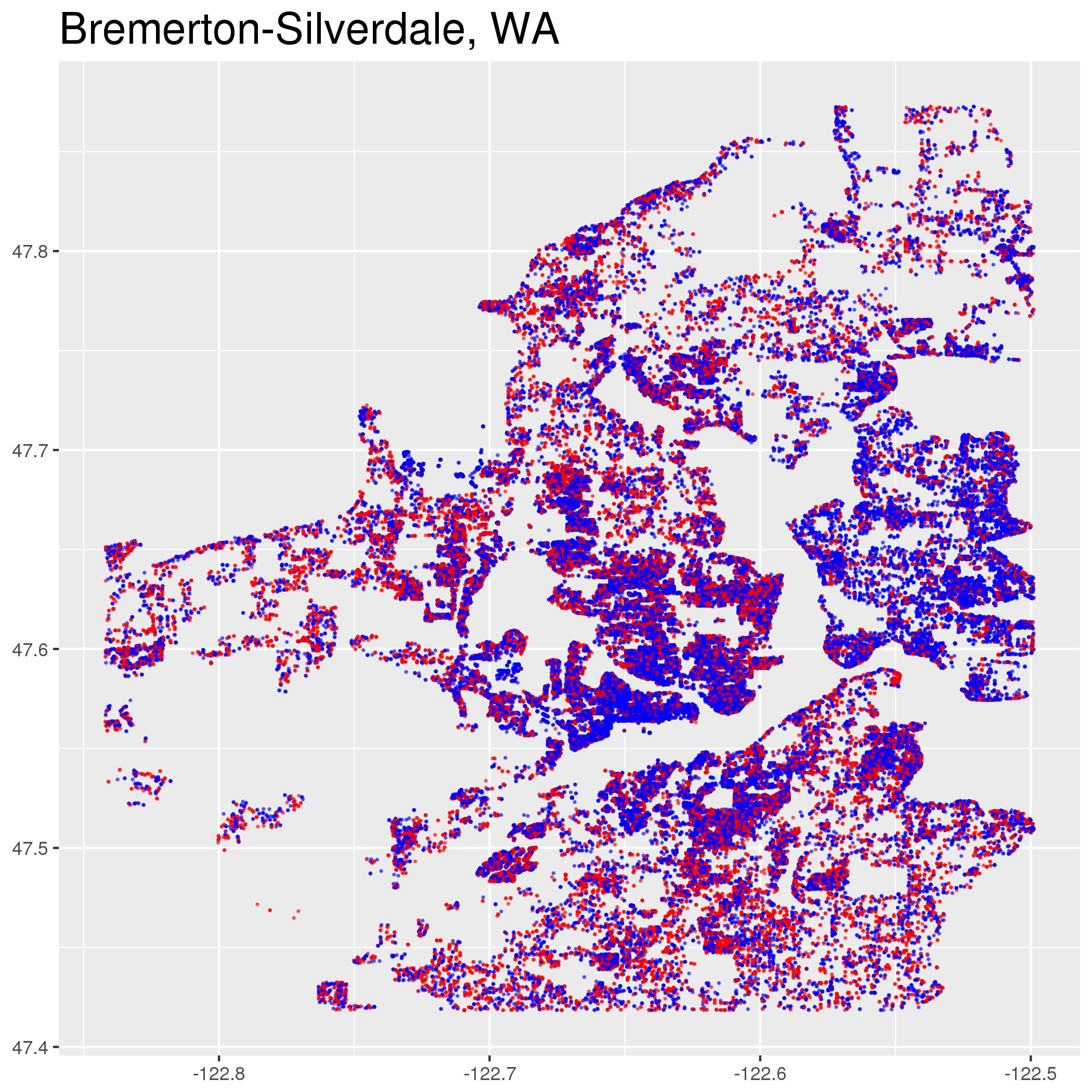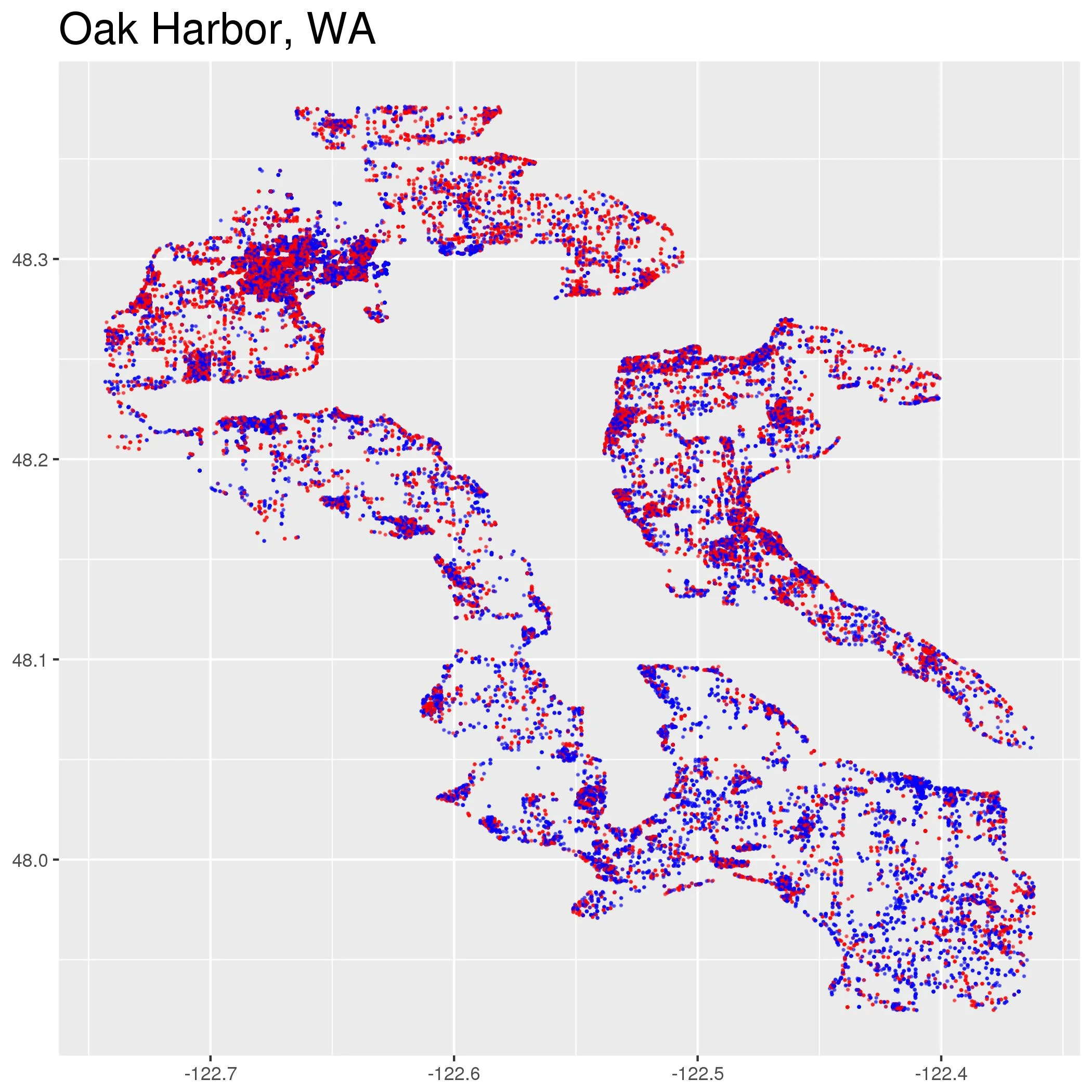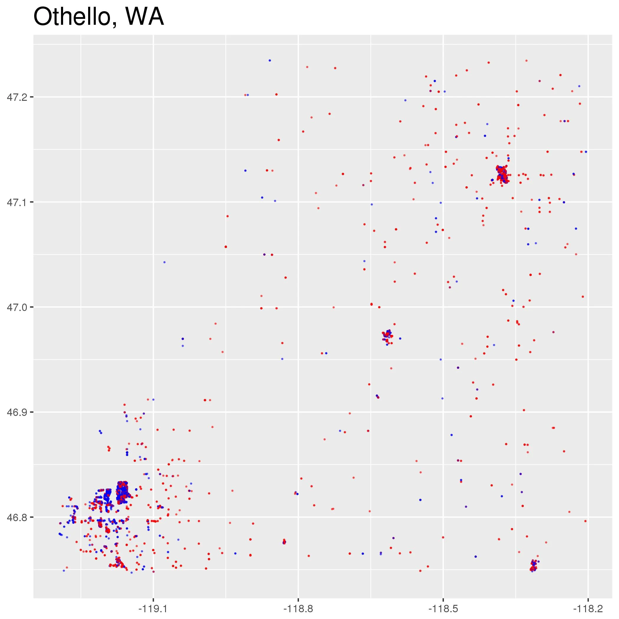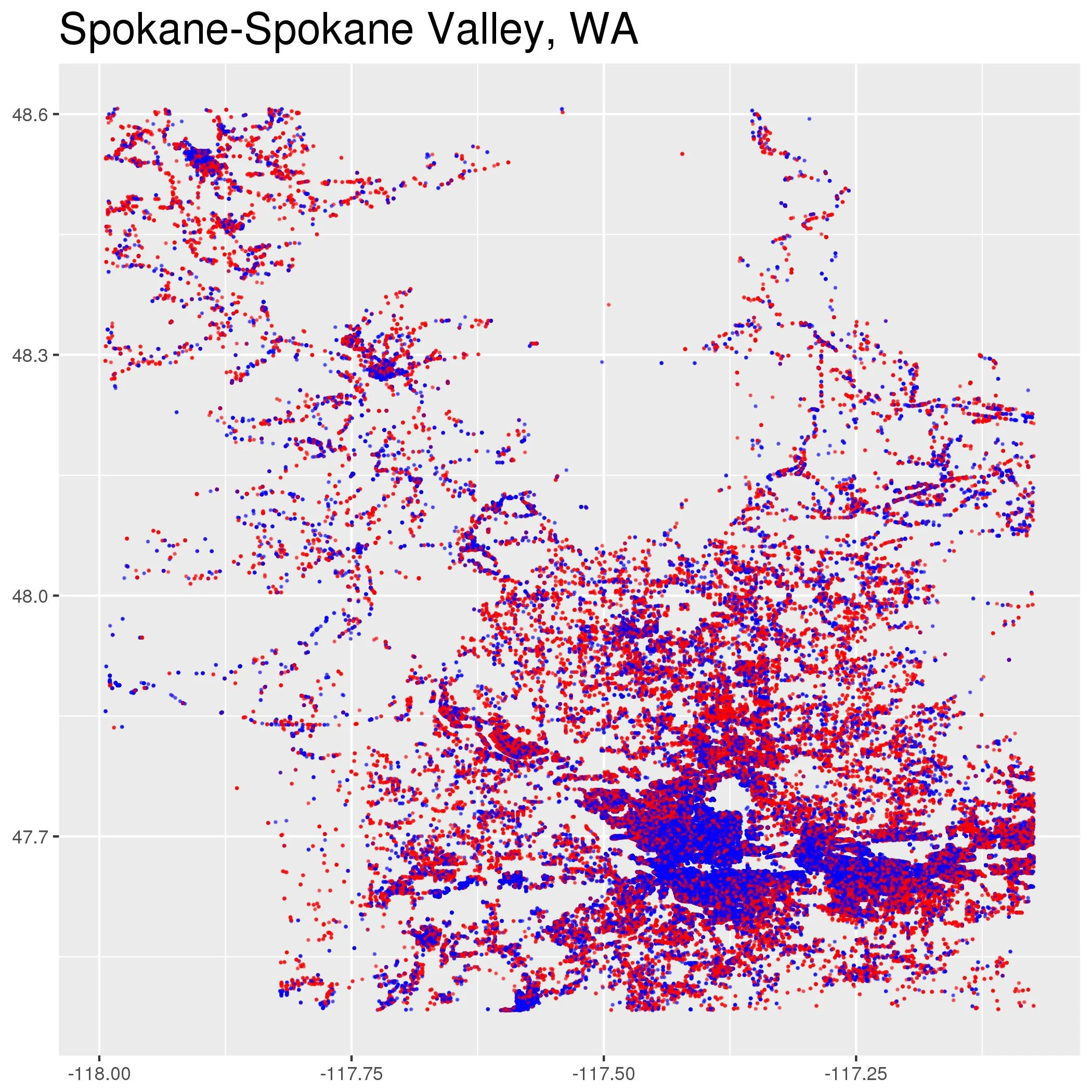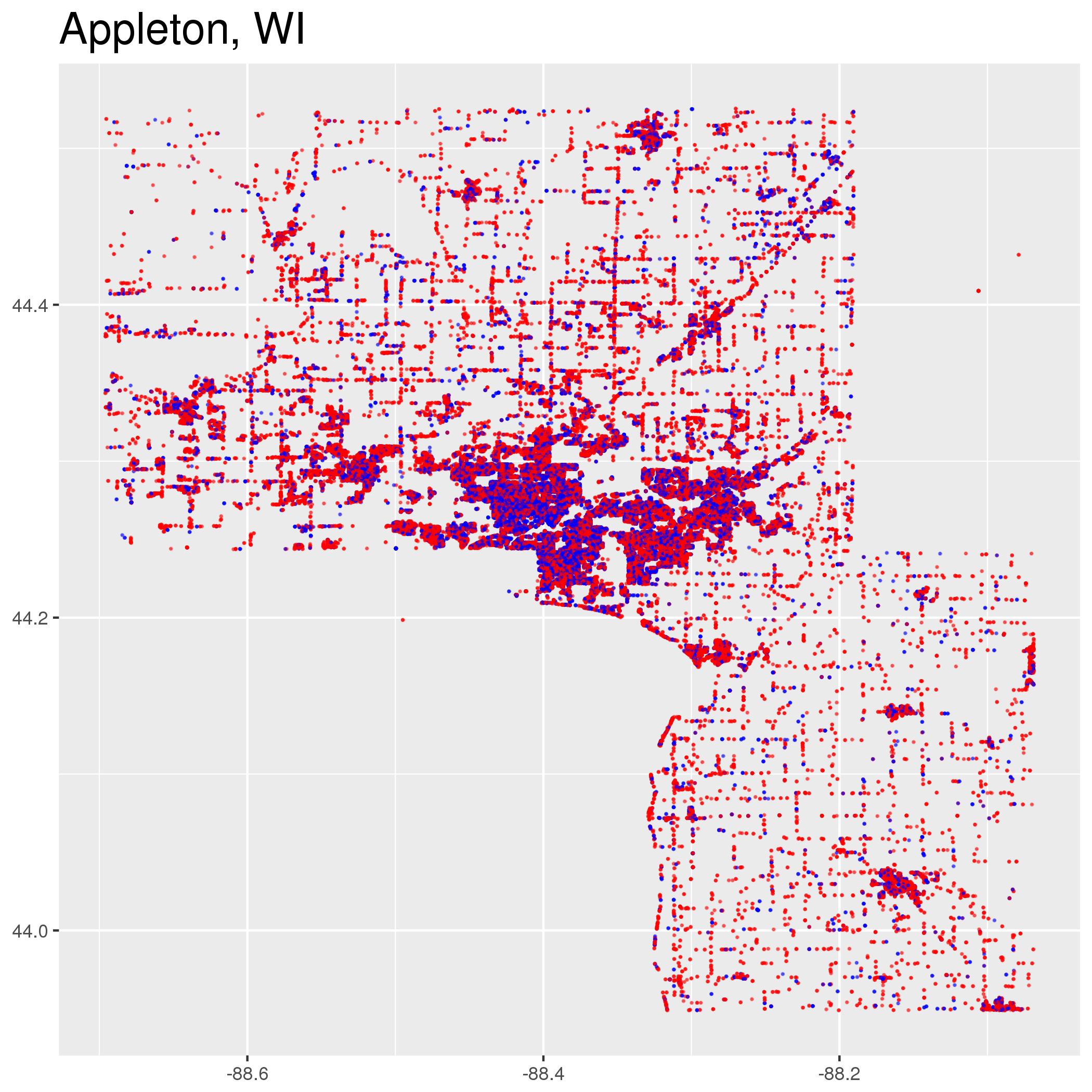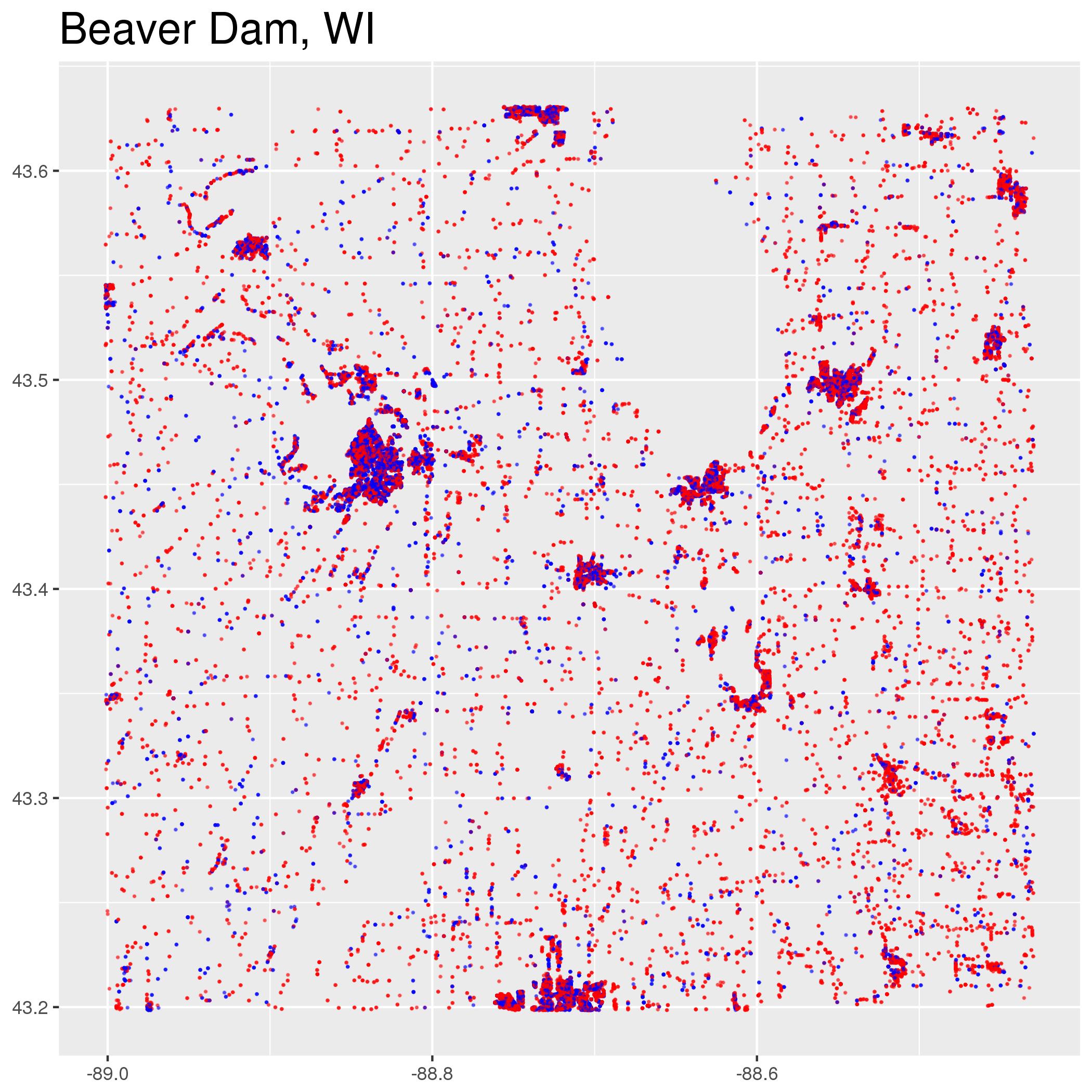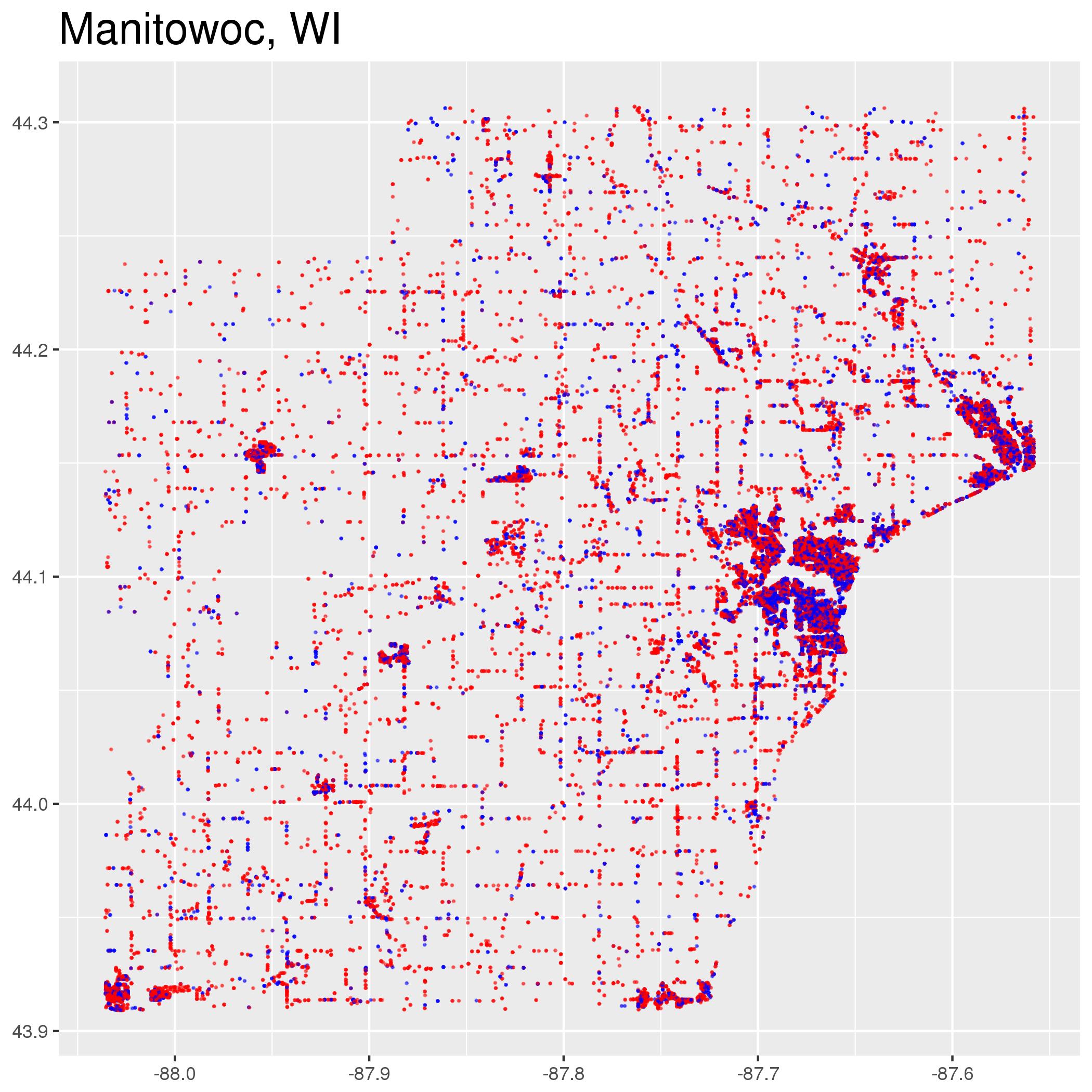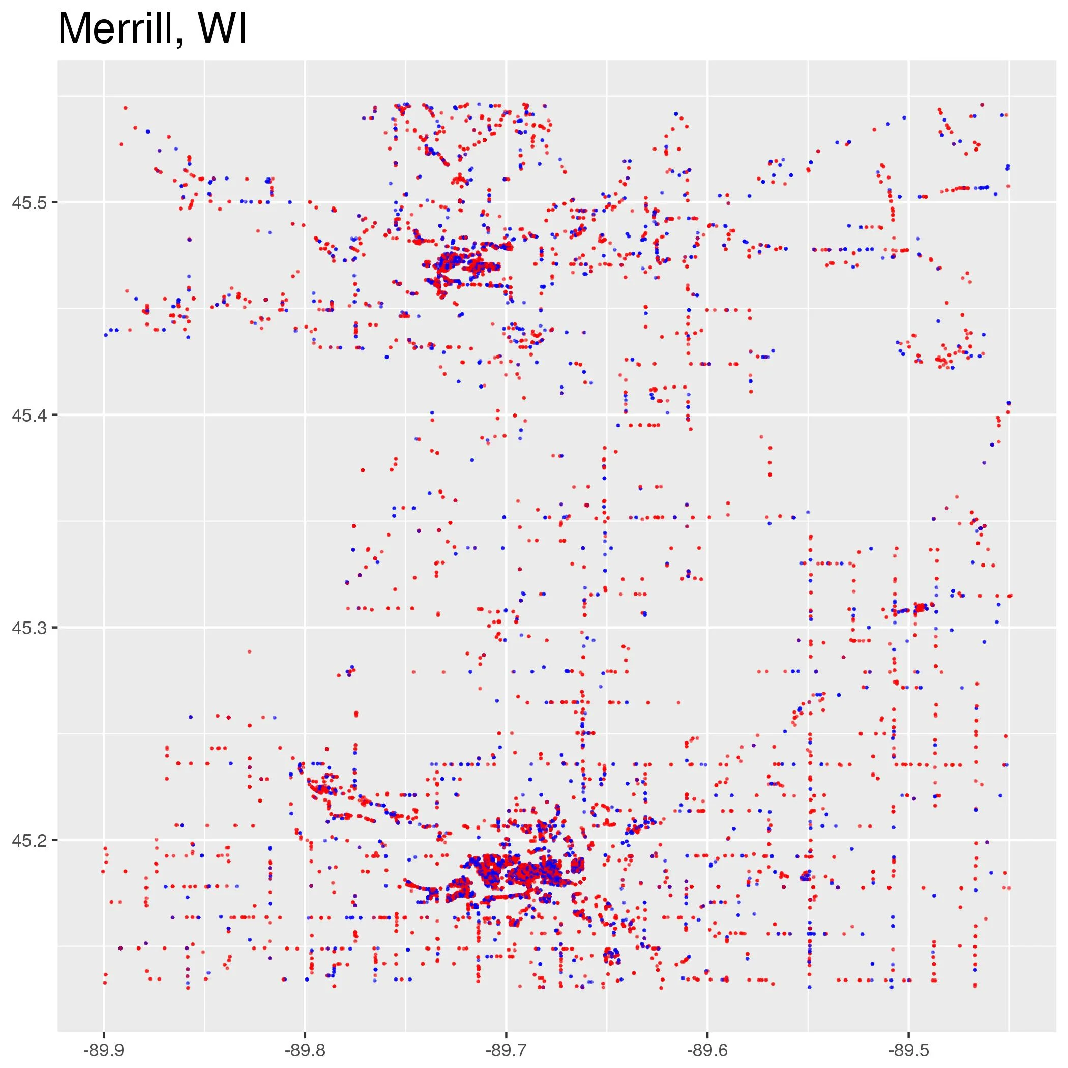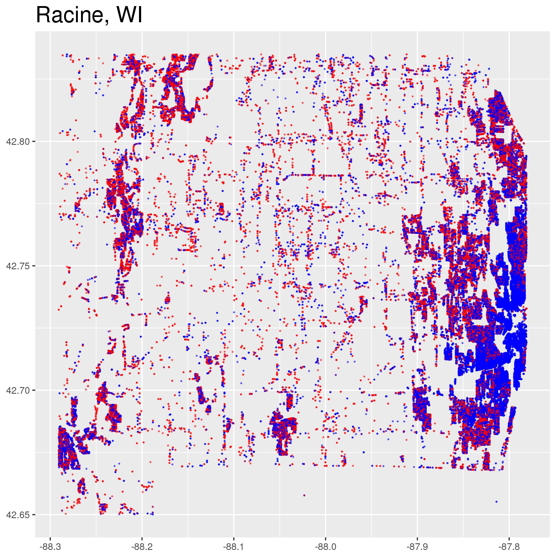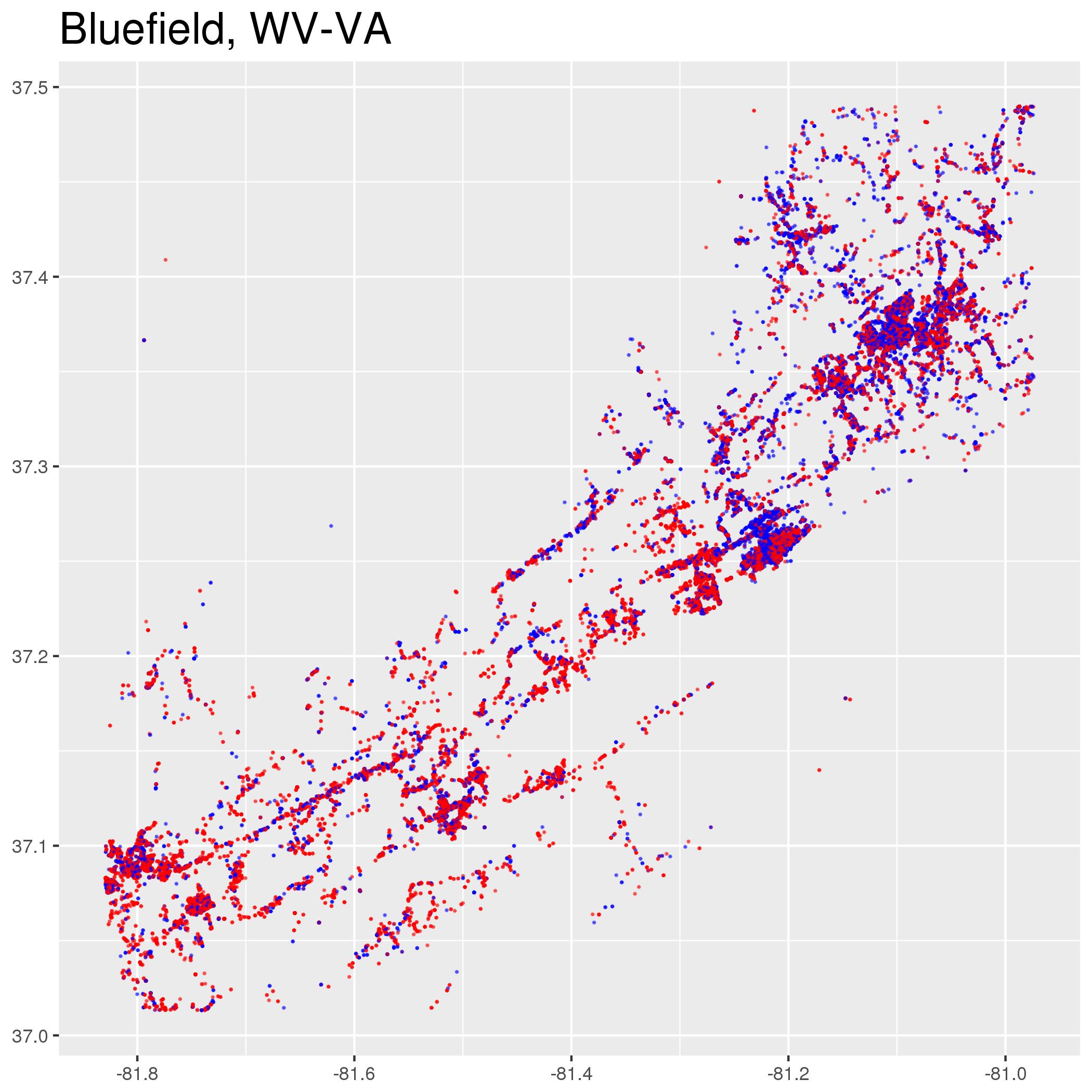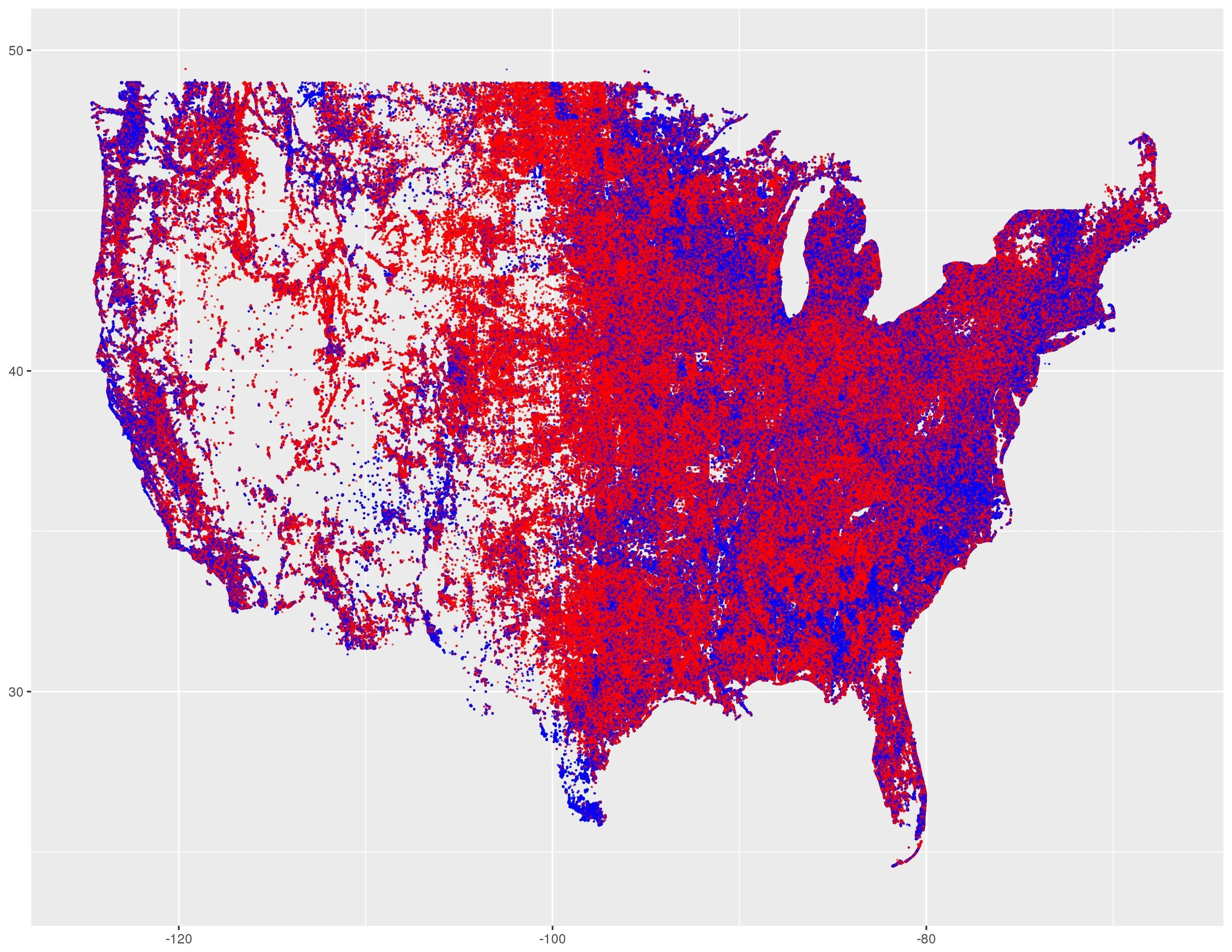
Metropolitan Partisan Segregation
Below are maps of the exact location of every registered Democrat and Republican in every metropolitan area in the United States. The maps were created by Ryan Enos and Jacob Brown using data from L2 as part of the Partisan Segregation Project (technical details).